15
Floristics of Ephemeral Ponds in East-central Texas
Barbara R. MacRoberts1,2, Michael H. MacRoberts1,2, D. Craig Rudolph3,*,
and David W. Peterson4
Abstract - Beginning in 2009, we surveyed the vegetation of ephemeral ponds in Sabine
and Nacogdoches counties in east-central Texas. These ponds are shallow and flat-bottomed,
with a small but distinct flora dominated by grasses (Poaceae) and sedges (Cyperaceae).
The floras of these ponds are most similar to those of flatwoods ponds located on the lower
coastal plain. Once more common on the landscape, ponds of this type have been altered
or destroyed by land-use changes and fire suppression, leading to massive encroachment
of woody vegetation. The pond we sampled in Nacogdoches County has been regularly
mowed for approximately 30 years to prevent woody encroachment. Currently, prescribed
burning in late summer and mechanical removal of encroaching woody vegetation are being
applied to better understand management options that will maintain and restore the ponds
we sampled and similar sites in east-central Texas. These and other natural ponds in the
West Gulf Coastal Plain have not been comprehensively studied.
Introduction
As part of a project to restore a damaged wetland in Sabine County, TX, we
used aerial photographs to locate other wetlands in the vicinity and determine what
the damaged site may have been like prior to disturbance. We found a number of
open, elliptically shaped, graminoid-dominated, flat-bottomed depressions (ponds)
associated with Quercus sp. (oak)-Pinus sp. (pine) forest stands on what appear
to be old river terraces of the Sabine River. The ponds typically fill in fall, winter,
and spring, and become dry in summer. Water depth varies through the year but
is generally less than 30 cm. The ponds range in size from 0.1 ha to about 0.8 ha.
We also located two similar ponds on the Stephen F. Austin Experimental Forest in
Nacogdoches County, TX.
Based on a survey of the literature, we concluded that the morphology and vegetation
of these wetlands had not been described. However, flatwoods ponds that
occur farther south in Texas and Louisiana share many features with the ponds in
our restoration project. Flatwoods ponds of the West Gulf Coastal Plain, while not
extensively studied, have received some attention from conservation organizations
such as the Louisiana Natural Heritage Program and The Nature Conservancy
(Bridges 1988, Bridges and Orzell 1989, Lester et al. 2005, NatureServe Explorer
2009, Pyne 2005). These ponds occur on the outer coastal plain in the Pinus
1Herbarium, Museum of Life Sciences, Louisiana State University in Shreveport, Shreveport,
LA 71115. 2Bog Research, 740 Columbia, Shreveport, LA 71104. 3USDA, Forest
Service, Southern Research Station, 506 Hayter Street, Nacogdoches, TX 75965. 4USDA,
Forest Service, National Forests and Grasslands in Texas, 2221 N. Raguet, Lufkin, TX
75904. *Corresponding author - crudolph01@fs.fed.us.
Manuscript Editor: Jerry Cook
Proceedings of the 5th Big Thicket Science Conference: Changing Landscapes and Changing Climate
2014 Southeastern Naturalist 13(Special Issue 5):15–25
Southeastern Naturalist
B.R. MacRoberts, M.H. MacRoberts, D.C. Rudolph, and D.W. Peterson
2014
16
Vol. 13, Special Issue 5
palustris Mill. (Longleaf Pine) savanna wetland ecosystem on Quaternary terraces
from Evangeline Parish in southwestern Louisiana to Liberty and Polk counties in
southeastern Texas. Flatwoods ponds appear to occur in swales and depressions in
and adjacent to ancient Pleistocene stream channels. Individual ponds may be as
large as 20 ha but generally are 0.5–2.0 ha in extent. They are graminoid-dominated,
circular or elliptical, and are shallow (0.3 to 1.6 m deep). Some are flat-bottomed,
but the majority have a depth gradient and become deeper toward the middle and
show distinct vegetational zonation.
True flatwoods ponds are highly variable floristically and tend to support relatively
few species. Surrounded by Longleaf Pine savanna wetlands, the shallow
ponds, in particular, support many plant species characteristic of that community.
Conditions caused by fluctuations in water level at these sites seem to favor predominantly
rhizomatous, stoloniferous, and densely cespitose herbaceous species
(Bridges 1988). Vegetation can become very dense, leading to accumulation of
high fuel loads (Bridges 1988). The ponds are filled by precipitation and runoff
from very small watersheds, with no input from stream flow and little or no outflow
(Bridges 1988). A high water table and fire appear to be the predominant factors
that prevent encroachment by woody species (Bridges and Orzell 1989). Soils are
hydric, acidic, nutrient-poor sandy loams. Flatwoods ponds are very rare because
of fire exclusion, grazing, excavation and filling, and silvicultural impacts; very few
good examples remain (Bridges 1988, Bridges and Orzell 1989, Lester et al. 2005,
NatureServe Explorer 2009, Pyne 2005).
The ephemeral ponds in Sabine and Nacogdoches counties resemble flatwoods
ponds, but occur north of the known range of flatwoods ponds on a landscape with
more topographic relief. Having determined that these new sites had not been documented
or described, we decided to study them to determine how they compared
with flatwoods ponds. The results of our study can inform discussions of management
and restoration issues related to these ponds.
Study Sites
We studied the vascular flora of three ephemeral ponds in eastern Texas. The
Sabine Ponds site consists of two adjacent ≈0.8-ha ponds in Sabine County, on
the Sabine National Forest (31o25'39.8"N, 93 o45’55.9”W and 31o25'37.7"N, 93
o45'46.3" W; Fig. 1). These two ponds will be referred to as one site, Sabine Ponds,
throughout this paper. Their elevation is approximately 57 m. Geologically, the site
features Quaternary alluvium on Gallime-Guyton soils in depressions on stream
terraces (Griffith 2010). In Nacogdoches County, we located two ponds on the
Stephen F. Austin Experimental Forest within the Angelina National Forest, approximately
92 km northwest of the Sabine County ponds. The geology at this site
is characterized by Quaternary alluvium (Pleistocene terraces) on the Angelina
River over Sparta Sand (Mollville loam). The elevation is approximately 75 m.
Pond 1 (31º30'35.5"N; 94º46'02.9"W) is approximately 1.2 ha (Fig. 2) and Pond 2
(31º30'35.0"N; 94º45'40.4"W) is approximately 1.4 ha in area. Both Nacogdoches
County ponds have been fire-suppressed for several decades. In Pond 1, periodic
Southeastern Naturalist
17
B.R. MacRoberts, M.H. MacRoberts, D.C. Rudolph, and D.W. Peterson
2014 Vol. 13, Special Issue 5
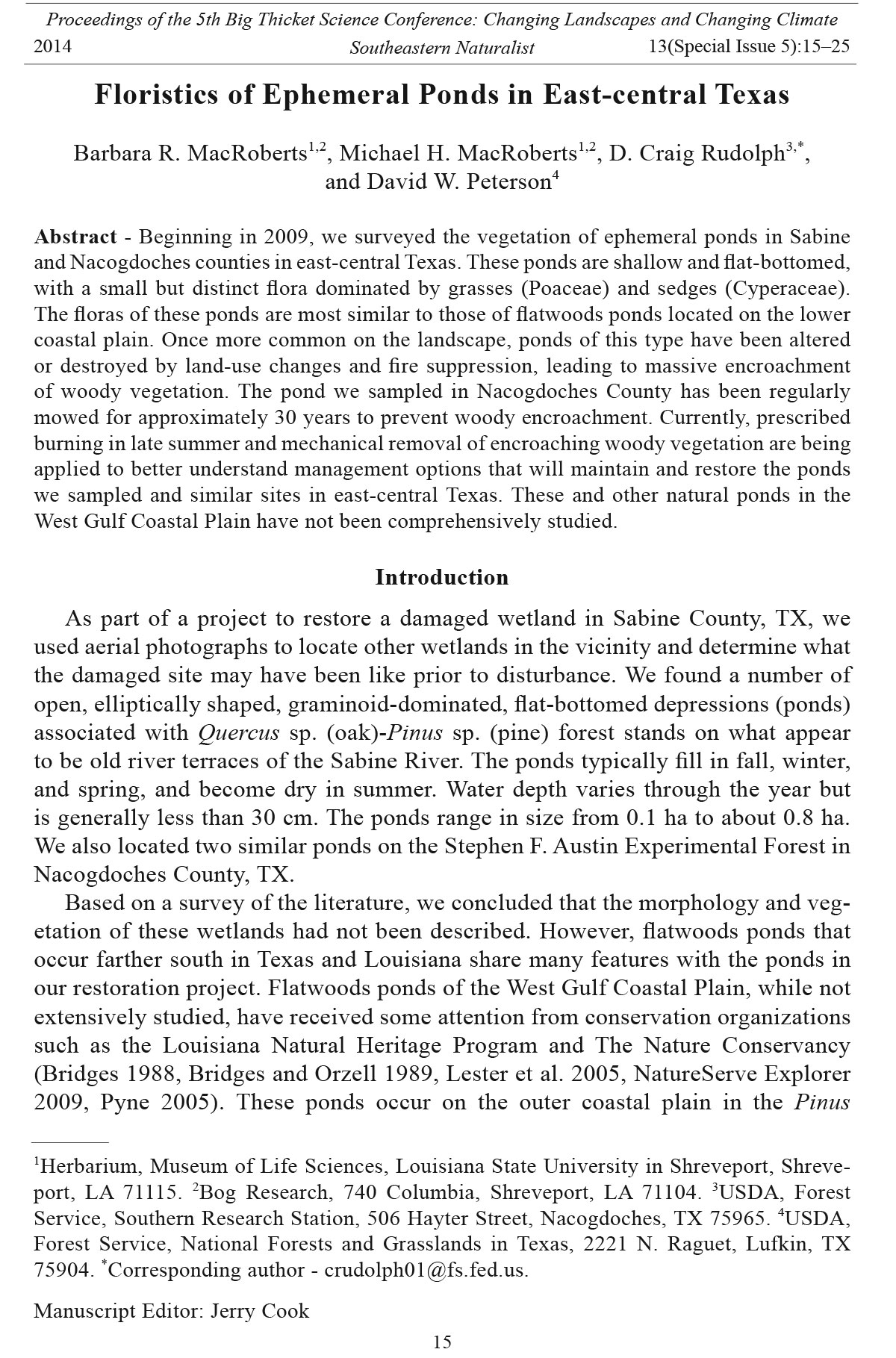
Figure 2. Study pond # 1 in Nacogdoches County, TX. Winter aspect.
Figure 1. Study pond in Sabine County, TX. Summer aspect.
Southeastern Naturalist
B.R. MacRoberts, M.H. MacRoberts, D.C. Rudolph, and D.W. Peterson
2014
18
Vol. 13, Special Issue 5
mowing over the last 30 yrs has prevented invasion by woody plants, and the pond
remains dominated by herbaceous species. Woody vegetation has significantly
encroached on Pond 2 during this same time period, and the pond now lacks most
herbaceous vegetation; it was not included in our floristic surv ey.
These ponds are typically filled from late fall until late spring by rainfall and runoff
from small local watersheds. Water levels fluctuate with local precipitation, and
there is considerable annual variation. In some years (i.e., 2010–2011) the ponds
remain empty. Sabine Ponds had a maximum water depth of 25 cm on 9 November
2009, and Nacogdoches Pond 1 had a maximum depth of 27 cm on 1 April 2010.
The general geology, topography, and climate of eastern Texas are described in
Diggs et al. (2006). Summers are hot and humid; winters are mild. Mean annual
temperatures are around 20 oC, and range from just below freezing in winter to
about 38 oC in summer. Average annual precipitation is 122–138 cm and occurs
relatively evenly throughout the year.
Our examination of topographic maps and aerial photographs suggests that several
other ephemeral ponds occur in the area of the Sabine Ponds, but apparently,
they are the only ponds of this type present in eastern Texas. Our examination of
soils maps and field observations suggest that other ponds like the Nacogdoches
Pond occurred in that region in the past, but these have all disappeared, likely due
to encroachment by woody vegetation.
The forest surrounding the Sabine Ponds has been cut and thinned several times.
In recent years, fire has become an important management tool used by the US
Forest Service. In the winter of 2009, the area surrounding the Sabine Ponds was
prescribe-burned, and we observed that due to high water levels the pond did not
burn. The Stephen F. Austin Experimental Forest, where the Nacogdoches County
ponds are located, is subject to periodic prescribed fire, typically in late winter or
early spring. During this time period, the ponds generally contain water and the
fires do not affect the pond vegetation.
Methods
Except for the winter months, we visited each pond monthly from May 2009
until July 2010 to collect plant samples. We collected specimens of most species in
the ponds and deposited them at the Botanical Research Institute of Texas (BRIT)
at the conclusion of our study. We collected soil samples from the center and upland
edges of each pond and sent them to the Louisiana State University Soil Testing and
Plant Analysis Laboratory, in Baton Rouge, LA for analysis. To determine species
richness, we established nine evenly spaced 10-m2 plots, each with a nested 1-m2
plot, on a transect set along the length of Nacogdoches Pond. We did not conduct
plot-sampling at the Sabine County ponds.
We listed the species in the plots, recorded vegetation height and percent cover
within the plots, and measured water depth at irregular intervals. We used Sorensen’s
index of similarity (Sorensen 1948) to compare communities following the
formula IS = (2C / [A + B]) x 100, where C is the number of species in common to
the two communities, A is the total number of species in community A, and B is the
total number of species in community B.
Southeastern Naturalist
19
B.R. MacRoberts, M.H. MacRoberts, D.C. Rudolph, and D.W. Peterson
2014 Vol. 13, Special Issue 5
Results
Appendix 1 lists the species we collected from ephemeral ponds in Sabine and
Nacogdoches counties. There were 40 species in the former (Sabine Ponds) and 32
species in the latter (Nacogdoches Pond 1); together, the ponds had a total of 55
species. There were 18 species in common between the two ponds, giving a Sorensen’s
index of similarity of 50, which indicates that while they are not identical,
the two ponds support the same plant community type. Triadica sebifera (Chinese
Tallow), which occurred in or on the periphery of each pond, was the only nonnative
species observed. The nine 1-m2 plots averaged 7.8 (range: 6–10) species per
plot, and the nine 10-m2 plots averaged 11.1 (range: 9–15) species per plot. Generally,
vegetation was dense and tall (up to about 90 cm; Figs. 1, 2), with nearly 100%
ground cover except where disturbed. Rhynchospora sp. (beaksedge) and Panicum
hemitomon (Maidencane), both rhizomatous and colonial, often grew in dense pure
or near-pure stands. Cespitose species such as Saccharum giganteum (Sugarcane
Plumegrass) and Eleocharis quadrangulata (Squarestem Spikerush) also formed
monospecific clumps.
The ponds were surrounded by shrubs and woody vegetation (Figs. 1, 2). Major
woody species surrounding the Nacogdoches County pond included Berchemia
scandens (Alabama Supplejack), Brunnichia ovata (American Buckwheat Vine),
Campsis radicans (Trumpet Creeper), Cephalanthus occidentalis (Buttonbush),
Crataegus opaca (Western Mayhaw), Diospyros virginiana (Common Persimmon),
Liquidambar styraciflua (Sweetgum), Pinus taeda (Loblolly Pine), Quercus
phellos (Willow Oak), Styrax americanus (American Snowbell), Smilax bona-nox
(Saw Greenbrier), and Chinese Tallow. Woody species surrounding the Sabine
Ponds included Buttonbush, Western Mayhaw, Common Persimmon, Sweetgum,
Nyssa biflora (Swamp Tupelo), Loblolly Pine, Willow Oak, and Chinese Tallow.
Water levels in the ponds varied throughout the year. We measured water depths
in the pools from June 2009–September 2010. Water began to accumulate in October
(2–8 cm), and the pond retained water in November (9–28 cm), February
(10–29 cm), March (17–22 cm), and April (10–20cm). There was no standing water
from late May through September. These figures would vary between years depending
on rainfall.
Table 1 shows the results of the soil analysis. The soils were classified as acidic,
nutrient poor, fine sandy loams.
Table 1. Soil analysis results for Sabine 3, Sabine 4, and Nacogdoches 1 ephemeral ponds. All numerical
values except pH are ppm. M = middle of pond, and E = edge of pond.
Sample pH Ca Cu Mg P K Na S Zn Soil texture
Sabine 3M 4.3 113.0 0.7 36.4 6.1 17.1 9.9 11.9 0.9 Fine sandy loam
Sabine 3E 4.3 61.9 0.4 29.1 2.9 12.3 6.6 9.7 0.5 Fine sandy loam
Sabine 4M 4.5 75.9 0.4 23.1 5.8 12.0 7.8 9.1 0.5 Fine sandy loam
Sabine 4E 4.5 65.1 0.5 29.6 3.5 11.9 6.5 9.2 0.6 Fine sandy loam
Nacog 1M 4.4 275.2 1.0 75.0 8.3 53.9 13.3 16.1 1.4 Loam
Nacog 1E 4.7 238.7 0.6 69.3 14.4 49.3 132.9 15.3 0.8 Fine sandy loam
Nacog 1E 4.2 87.4 0.4 34.8 8.9 16.2 8.0 9.2 0.8 Fine sandy loam
Southeastern Naturalist
B.R. MacRoberts, M.H. MacRoberts, D.C. Rudolph, and D.W. Peterson
2014
20
Vol. 13, Special Issue 5
Discussion
Superficially, the ephemeral ponds we studied resemble flatwoods ponds (see
descriptions in Lester et al. 2005, NatureServe Explorer 2009, Pyne 2005, Turner
1999, but especially Bridges and Orzell 1989).
We were unable to locate complete plant lists for any flatwoods ponds on the
West Gulf Coastal Plain to compare with our findings, but we found partial lists
based on surveys of many ponds. A comparison of the 51 species listed by Bridges
and Orzell (1989) for flatwoods ponds with our list of 55 species for ephemeral
ponds shows only 20 in common, giving a Sorensen’s index of similarity of 38,
which is below the value considered to signify the same community (threshol value
= 50; Sorensen 1948). Because the flatwoods ponds that have been surveyed all occur
in the wetland pine savanna region of southwestern Louisiana and southeastern
Texas and are thus embedded in the pine savanna ecosystem, which does not extend
into the areas where the ponds we studied occur, we do not consider the results of
this comparison definitive.
Virtually all commentators on flatwoods ponds have noted the high species variability
among ponds (Bridges 1988, Bridges and Orzell 1989, Lester et al. 2005,
NatureServe Explorer 2009, Pyne 2005). This variability is likely the result of differences
in surrounding community type, disturbance history, pond depth and hydroperiod,
the relative isolation of many of the ponds, and variations in fire regime.
Compared with other open habitats such as bogs, prairies, and pine savannas
that generally have about 25–30 species in a 10-m2 area, and 15–20 species in 1-m2
area (see MacRoberts and MacRoberts 2001, MacRoberts et al. 2007, 2009), the
Nacogdoches and Sabine ponds are not species-rich, an observation also made by
Bridges and Orzell (1989) for flatwoods ponds.
One taxon of particular interest in Sabine and Nacogdoches Ponds is beaksedge,
which is rhizomatous and colonial. The beaksedge we collected, which did not
key unequivocally to either Rhynchospora corniculata (Lam.) Gray (Shortbristle
Horned Beaksedge) or R. careyana Fern. (Broadfruit Horned Beaksedge), was
found to be very common in the Sabine and Nacogdoches ponds, and in all of the
ephemeral ponds we surveyed in the Sabine National Forest. Broadfruit Horned
Beaksedge, which differs from Shortbristle Horned Beaksedge by the presence
of rhizomes, is a species of the Gulf Coastal Plain east of the Mississippi River.
Therefore, further study is needed to determine the identity of the beaksedge species
present.
Jason Singhurst (Texas Parks and Wildlife Department, Austin, TX, pers.
comm.) has made observations on ephemeral ponds on Campbell Timber Corporation
land in Sabine County adjacent to the ponds we studied. His findings parallel
ours for most species, but he has also documented Eriocaulon compressum Lam.
(Flattened Pipewort), a new county record and a species characteristic of the more
southern flatwoods ponds.
Ephemeral ponds also support other organisms, notably amphibians. Studies of
amphibians in Nacogdoches County and on the Stephen F. Austin Experimental
Southeastern Naturalist
21
B.R. MacRoberts, M.H. MacRoberts, D.C. Rudolph, and D.W. Peterson
2014 Vol. 13, Special Issue 5
Forest, where Nacogdoches Pond is located, show that of the 25 amphibian species
that occur in the county, at least 16 (64%) and perhaps 18 (72%) of them breed in
Nacogdoches Pond (D. Saenz, USDA Forest Service, Southern Research Station,
Nacogdoches, TX, pers. comm.). These ponds support high amphibian diversity
because predaceous fish are not present, a point emphasized in studies of ephemeral
ponds in Florida (Means 2010).
The factors responsible for the creation of these wetland depressions remain
unclear. We suggest that the ponds may be old stream channels, the remains of
Castor canadensis Kuhl (Beaver) activity, swales paralleling old river channels,
or old ox-bow lakes. In any case, the ponds are subject to loss as erosional dissection
of the old river terraces proceeds. We assert that fire has been important in
the maintenance of herbaceous vegetation and the prevention of encroachment by
woody species.
Subsequent to the collection of floristic data reported herein, restoration and
management activities were initiated on the two ponds in Nacogdoches County.
Pond 1, last mowed in late summer 2008, was divided into three segments, each
approximately 0.4-ha in area. In September 2010, one segment was mowed, one
was prescribe-burned, and one was left untreated. Pond 2, heavily encroached
by trees, and with very little herbaceous vegetation remaining, was cleared using
mechanical means (mulchers, chainsaws) in October–December 2010. Periodic
mowing and/or prescribed fire are planned to prevent future woody encroachment.
Floristic surveys will continue in these two ponds to assess the efficacy of
current management protocols.
Clearly, study of the geomorphology and further floristic work are needed at all
of these ponds; we have been impressed by the paucity of information on them.
Ephemeral ponds are obvious on the landscape and clearly of conservation interest:
many conservation organizations have pointed out that these wetland communities
are increasingly rare (Smith 1996). Bridges and Orzell (1989) located fewer than
100 flatwoods ponds in their extensive survey, of which fewer than 20 were deemed
to be of high quality. The ponds we studied in Sabine and Nacogdoches counties
are on federal lands, are of high quality, and should be preserved. Further work is
needed to inventory and map additional ephemeral ponds in the region and assess
their quality and restoration potential.
Acknowledgments
We thank Jason Singhurst, Jim Neal, and two anonymous reviews for comments on an
earlier version of this manuscript. Jason Singhurst, Texas Parks and Wildlife Department,
shared information on ephemeral ponds and flatwoods ponds. Dan Saenz, USDA Forest
Service, Southern Research Station, provided information on amphibian occurrences. Chris
Reid, Louisiana Natural Heritage Program, shared his knowledge of flatwoods ponds in
Louisiana with us. William Godwin aided with the geological descriptions. Bob Kalinksy
aided with the identification of some of the aquatic species.
Southeastern Naturalist
B.R. MacRoberts, M.H. MacRoberts, D.C. Rudolph, and D.W. Peterson
2014
22
Vol. 13, Special Issue 5
Literature Cited
Bridges, E.L. 1988. A preliminary survey for potential natural areas in the pine flatwoods
region of southwestern Louisiana. Unpublished report. Louisiana Natural Heritage Program,
Baton Rouge, LA. 31 pp.
Bridges, E.L., and S.L. Orzell 1989. Longleaf Pine communities of the West Gulf Coastal
Plain. Natural Areas Journal 9:247–263.
Diggs, G.M., B.L. Lipscomb, M.D. Reed, and R.J. O’Kennon. 2006. Illustrated flora of East
Texas. Sida, Botanical Miscellany 26:1–1594.
Griffith, K. 2010. Soil survey of San Augustine and Sabine counties, TX, USDA, Natural
Resource Conservation Service. Available online at http://www.nrcs.usda.gov/Internet/
FSE_MANUSCRIPTS/texas/sanaugustine_sabineTX2010/San%20Augustine%20
and%20Sabine.pdf. Accessed 31 March 2014.
Lester, G.D., S.G. Sorensen, P.L. Faulkner, C.S. Reid, and I.E. Maxit. 2005. Louisiana comprehensive
wildlife conservation strategy. Unpublished report. Louisiana Department of
Wildlife and Fisheries, Baton Rouge, LA. 455 pp.
MacRoberts, M.H., and B.R. MacRoberts. 2001. Bog communities of the West Gulf Coastal
Plain: A profile. Bog Research Papers in Botany and Ecology 1:1–151.
MacRoberts, M.H., B.R. MacRoberts, and R.G. Kalinsky. 2007. Vascular plant species/area
relationships (species richness) in the West Gulf Coastal Plain: A first approximation.
Journal of the Botanical Research Institute of Texas 1:577–583.
MacRoberts, B.R., M.H. MacRoberts, C.S. Reid, and P.L. Faulkner. 2009. Vascular flora
of Morse clay prairies in northwestern Louisiana. Journal of the Botanical Research
Institute of Texas 3:355–366.
Means, R.P.M. 2010. Florida’s ephemeral ponds and pond-breeding amphibians. Available
online at http://www.coastalplains.org. Accessed 17 June 2010.
NatureServe Explorer. 2009. West Gulf Coastal Plain flatwoods pond. Available online at
http://www.natureserve.org/explorer. Accessed 26 June 2009.
Pyne, M. 2005. West Gulf Coastal Plain flatwoods pond ecological system. Unpublished
report. Available from NatureServe, Durham, NC. 31 pp.
Smith, L. 1996. The rare and sensitive natural wetland plant communities of interior Louisiana.
Unpublished report. Available from Louisiana Natural Heritage Program, Baton
Rouge, LA. 10 pp.
Sorensen, T. 1948. A method of establishing groups of equal amplitude in plant sociology
based on similarity of species content. Pp. 234–249, In R.P. McIntosh (Ed.). Phytosociology:
Benchmark Papers in Ecology. Dowden, Hutchinson, and Ross, Stroudsburg,
PA. 376 pp.
Turner, R.L., J.E. Van Kley, L.S. Smith, and R.E. Evans. 1999. Ecological classification
system for the national forests and adjacent areas of the West Gulf Coastal Plain. The
Nature Conservancy, Nacogdoches, TX.
Southeastern Naturalist
23
B.R. MacRoberts, M.H. MacRoberts, D.C. Rudolph, and D.W. Peterson
2014 Vol. 13, Special Issue 5
Appendix 1. Checklist of vascular plants of Sabine and Nacogdoches ponds. (S) = Sabine
Ponds, (N) = Nacogdoches pond 1, MM = B.R. and M.H. MacRoberts; CR = D.C. Rudolph.
Unless otherwise indicated, the species were common in the pond. The vouchers numbers
are for specimens deposited at BRIT.
Acanthaceae
Justicia ovata (Walt.) (Lindau) (Looseflower Water-mallow) (S) MM 8390, 8438
Aceraceae
Acer saccharum L. (Sugar Maple) (N) MM 8487
Alismataceae
Sagittaria graminea Michx. (Grassy Arrowhead) (N) MM 8512; (S) MM 8395, 8503
Sagittaria lancifolia L. (Bulltongue Arrowhead) (S) MM 8428
Amaryllidaceae
Hymenocallis liriosme (Raf.) Shinners (Spring Spiderlily) (S) MM 8499, 8502
Apocynaceae
Amsonia tabernaemontana Walt. (Eastern Bluestar) (N) CR 09-2, MM 8484; (S) MM
8396, 8423
Araceae
Sabal minor (Jacq.) Pers. (Dwarf Palmetto) (S) MM 8424, 8441 (uncommon)
Asteraceae
Boltonia diffusa Elliot (Smallhead Doll’s Daisy) (N) MM 8464, 8486
Eupatorium semiserratum DC. (Smallflower Throughwort) (S) MM 8432, 8478
Pluchea foetida (L.) DC. (Stinking Camphorweed) (S) MM 8421, 8439
Symphyotrichum dumosum (L.) Nesom (Rice Button Aster) (N) MM 8481, 8483
Callitrichaceae
Callitriche heterophylla Persh (Twoheaded Water-starwort) (N) MM 8511
Cyperaceae
Carex joorii Bailey (Cypress Swamp Sedge) (N) MM 8508, 8515, 8622; (S) MM 8434,
8452 (uncommon in S, abundant in N)
Eleocharis quadrangulata (Michx.) Roem. & Schult. (Squarestem Spikerush) (S) MM
8403 (uncommon)
Eleocharis tuberculosa (Michx.) Roem. & Schult. (Conecup Spikerush) (S) MM 8446,
8447, 8613
Fuirena breviseta (Coville) Coville (Saltmarsh Umbrella-sedge) (S) MM 8413, 8436
Rhynchospora sp. (see text) (beaksedge) (N) CR 09-1, MM 8666, 8668; (S) MM 8410,
8415, 8451, 8453, 8454, 8455, 8457, 8459
Rhynchospora filifolia Gray (Threadleaf Beaksedge) (S) MM 8405, 8406, 8407, 8435,
8429b
Rhynchospora globularis (Chapm.) Small (Globe Beaksedge) (N) CR 09-17; (S) MM
8399, 8402, 8429a
Rhynchospora rariflora (Michx.) Ell. (Fewflower Beaksedge) (S) MM 8400
Scleria baldwinii (Torr.) Steud. (Baldwin’s Nutrush) ( S) MM 8391, 8408, 861 1
Ebenaceae
Diospyros virginiana L. (Common Persimmon) (N) CR 09-24; (S) MM 8444
Southeastern Naturalist
B.R. MacRoberts, M.H. MacRoberts, D.C. Rudolph, and D.W. Peterson
2014
24
Vol. 13, Special Issue 5
Euphorbiaceae
Triadica sebifera (L.) Small (Chinese Tallow) (N) CR 09-19, MM 8482; (S) not collected
(uncommon).
Haloragaceae
Myriophyllum sp. (water millfoil) (N) MM 8510
Myriophyllum pinnatum (Walt.) B.S.P. (Cutleaf Watermilfoil) (S) MM 8501
Proserpinaca palustris L. (Marsh Mermaidweed) (S) MM 8392a, 8409
Proserpinaca pectinata Lam. (Combleaf Mermaidweed) (N) not collected; (S) MM 8392b,
8404, 8612
Hamamelidaceae
Liquidambar styraciflua L. (Sweetgum) (S) MM 8477 (uncommon)
Hydrophyllaceae
Hydrolea ovata Nutt. (Ovate False Fiddleleaf) (N) CR 09-22; (S) MM 8412, 8450
Juncaceae
Juncus effusus L. (Common Rush) (N) CR 09-9; MM 8466, 8626 (uncommon)
Juncus nodatus Coville (Stout Rush) (N) MM 8625 (uncommon)
Juncus repens Michx. (Lesser Creeping Rush) (N) CR 09-6 (uncommon)
Lamiaceae
Lycopus americanus Muhl. ex Bart. (American Water Horehound) (S) MM 8471 (uncommon)
Lentibulariaceae
Utricularia radiata Small (Little Floating Bladderwort) (N) MM 8513
Loganiaceae
Mitreola petiolata (Geml.) Torr. & Gray (Lax Hornpod) (N) CR 09-7
Malvaceae
Hibiscus moscheutos L. (Crimsoneyed Rosemallow) (S) MM 8393, 8421
Melastomataceae
Rhexia mariana L. (Maryland Meadowbeauty) (N) CR 09-3; (S) MM 8398, 8417
Onagraceae
Ludwigia peploides (Kunth) P.H. Raven (Floating Primrose-willow) (N) MM 8494, 8509;
(S) MM 8500
Ludwigia pilosa Walt (Hairy Primrose-willow) (N) not collected; (S) MM 8431
Pinaceae
Pinus taeda L. (Loblolly Pine) (S) MM 8443 (uncommon)
Poaceae
Andropogon virginicus L. (Broomsedge Bluestem) (S) MM 8473, 8476
Coelorachis rugosa (Nutt.) Nash (Wrinkled Jointtail Grass) (S) MM 8445
Dichanthelium dichotomum (L.) Gould (Cypress Panicgrass) (N) CR 09-4, 09-13; MM
8620, 8621; (S) MM 8427, 8418, 8430, 8440, 8610
Panicum hemitomon Schult. (Maidencane) (N) MM 8463, 8619
Panicum virgatum L. (Switchgrass) (S) MM 8472 (uncommon)
Paspalum praecox Walt. (Early Paspalum) (S) MM 8411, 8389, 8608
Saccharum giganteum (Walt.) Pers. (Sugarcane Plumegrass) (N) CR 09-23; MM 8485,
8492
Southeastern Naturalist
25
B.R. MacRoberts, M.H. MacRoberts, D.C. Rudolph, and D.W. Peterson
2014 Vol. 13, Special Issue 5
Polygonaceae
Brunnichia ovata (Walt.) Shinners (American Buckwheat Vine) (N) MM 8465
Polygonum hydropiperoides Michx. (Swamp Smartweed) (N) CR 09-5, 09-12; (S) MM
8449
Ranunculaceae
Ranunculus laxicaulis (T. & G.) Darby (Mississippi Buttercup) (N) MM 8624 (uncommon)
Rosaceae
Crataegus opaca Hook. & Arm. (Western Mayhaw) (N) CR 09-21, MM 8514, 8516; (S)
MM 8424; 8470, 8469, 8497, 8498 (uncommon)
Rubiaceae
Cephalanthus occidentalis L. (Buttonbush) (N) CR 09-11, 09-18; (S) MM 8425
Scrophulariaceae
Gratiola brevifolia Raf., (Sticky Hedgehyssop) (N) CR 09-14, 09-16; (S) MM 8397, 8414,
8416
Styracaceae
Styrax americanus Lam. (American Snowbell) (N) CR 09-8, 09-15; MM 8479
Xyridaceae
Xyris laxifolia (Chapm.) Kral (Laxleaf Yelloweyed-grass) (S) MM 8388, 8401, 8437,
8461, 8468


 The Southeastern Naturalist is a peer-reviewed journal that covers all aspects of natural history within the southeastern United States. We welcome research articles, summary review papers, and observational notes.