Southeastern Naturalist
J. Smith, S.A. Welsh, J.T. Anderson, and R.H. Fortney
2015 Vol. 14, Special Issue 7
103
Canaan Valley & Environs
2015 Southeastern Naturalist 14(Special Issue 7):103–111
Water Quality Trends in the Blackwater River Watershed,
West Virginia
Jessica Smith1, Stuart A. Welsh2,*, James T. Anderson1, and Ronald H. Fortney3
Abstract - An understanding of historic and current water quality is needed to manage
and improve aquatic communities within the Blackwater River watershed, WV. The
Blackwater River, which historically offered an excellent Salvelinus fontinalis (Brook
Trout) fishery, has been affected by logging, coal mining, use of off-road vehicles, and
land development. Using information-theoretic methods, we examined trends in water
quality at 12 sites in the watershed for the 14 years of 1980–1993. Except for Beaver
Creek, downward trends in acidity and upward trends in alkalinity, conductivity, and
hardness were consistent with decreases in hydrogen ion concentration. Water-quality
trends for Beaver Creek were inconsistent with the other sites and reflect ongoing
coal-mining influences. Dissolved oxygen trended downward, possibly due to natural
conditions, but remained above thresholds that would be detrimental to aquatic life.
Water quality changed only slightly within the watershed from 1980–1993, possibly reflecting
few changes in development and land uses during this time. These data serve as
a baseline for future water-quality studies and may help to inform management planning.
Introduction
The watershed of the Blackwater River (hereafter, the River) has experienced
large changes over the last 140 years. According to a pre-settlement account by
Kennedy (1853), the basin supported an excellent Salvelinus fontinalis Mitchill
(Brook Trout) fishery. However, logging and repeated burning during the late
1800s through early 1900s (Michael 2002) caused more siltation which resulted
in wider and shallower stream channels, higher summer water temperatures,
lower watershed storage capacity, and a loss of acid-base buffering capacity
(Zurbuch 1963). Coal mining during the first half of the 20th century led to acid
mine drainage (AMD) and degraded water quality in both Beaver Creek and the
River below the mouth of Beaver Creek (Phares 1971, USEPA 1971).
More recently, recreation has increased within the watershed. Canaan Valley
(hereafter, the Valley), located in the upper part of the River’s watershed, attracts
over one million visitors each year (Hudgins 1992). The use of off-road vehicles
(ORVs), although banned from many areas within the watershed, commonly occurs.
During 1975–1993, the Blackwater 100 Cross-country Motorcross Race, an
ORV event, damaged native vegetation and raised the levels of sediment and fecal
coliform bacteria in the River (Hudgins 1992, USEPA 1994). Other common
1Division of Forestry and Natural Resources, West Virginia University, PO Box 6125,
Morgantown, WV 26506. 2US Geological Survey, West Virginia Cooperative Fish and
Wildlife Research Unit, PO Box 6125, Morgantown, WV 26506. 3Department of Civil
and Environmental Engineering, West Virginia University, PO Box 6103, Morgantown,
WV 26506 (deceased). *Corresponding author - swelsh@wvu.edu.
Southeastern Naturalist
J. Smith, S.A. Welsh, J.T. Anderson, and R.H. Fortney
2015 Vol. 14, Special Issue 7
104
recreational activities have included bird watching, camping, fishing, golfing,
horseback riding, hunting, hiking, mountain biking, and snow skiing (Hudgins
1992, Waldron and Wiley 1996). Most of these recreational activities have caused
minimal environmental impacts, but continued visitation at current or increased
rates will likely cause cumulative effects
There are no centralized wastewater-treatment facilities within the River’s
watershed, so septic systems and small package plants that treat domestic wastes
discharge directly into the River and its tributaries (McCabe 1998, Waldron and
Wiley 1996). The water quality of rivers, as indicated by the concentration of
fecal coliform bacteria, is degraded by sewage effluent. Further development
within the watershed is likely to increase sewage-effluent input and cause lower
levels of dissolved oxygen in the River. Additionally, given the watershed’s large
populations of Odocoileus virginianus Zimmermann (White-tailed Deer) and
Branta canadensis L. (Canada Goose), fecal effluents from wildlife may further
degrade the River’s water quality (Waldron and Wiley 1996).
Land development for tourism and residential purposes in the Valley increased
dramatically during the 1970s, slowed in the 1980s, and decreased even more
during the early 1990s, particularly during the economic recession of 1989–1993.
Land development and previous land-use practices have undoubted ly influenced
the River’s water quality. Our 1980–1993 data set, however, was captured after
the major developments of the 1970s, and before the accelerated development of
recent years. Our overall objective was to examine monthly water-quality data at
12 sites for trends during 1980–1993.
The River begins on Canaan Mountain, flows through the Monongahela National
Forest, the Canaan Valley National Wildlife Refuge, and Blackwater Falls
State Park. The Valley, the highest basin of its size east of the Rocky Mountains
(McCabe 1998), holds the River’s headwaters and the largest freshwater wetland
(7083 ac [2833 ha]; USEPA 1994) in the central and southern Appalachians
(Hudgins 1992). The River flows 28 miles (47 km), drops 1508 feet (457 m), and
joins the Dry Fork at Hendricks (Phares 1971). The dark reddish-brown of the
River’s water reflects its high level of tannic acid, acquired from flowing through
wetland vegetation and sedimentary deposits rich in iron oxide (WVDNR 2000).
The River’s water is generally soft and low in both alkalinity and dissolved solids
(Waldron and Wiley 1996), in part because of its parent rocks, such as the
Conemaugh, Greenbrier, Mauch Chunk, Pocono, and Pottsville formations (Fig.
1; Waldron and Wiley 1996).
Methods
During 1978–1993, the Allegheny Power Company collected water-quality
data from the following mainstem and tributary sites within the River’s watershed
(Fig. 1) as a baseline for a proposed hydropower dam: (1) Blackwater River
near Davis WV at the US Geological Survey’s gauging station; (2) Blackwater
River at a point 3300 feet (1000 m) downstream from the mouth of Yellow Creek;
(3) Blackwater River at Camp 70, a site that is 1.8 river miles (3 river kilometers
Southeastern Naturalist
J. Smith, S.A. Welsh, J.T. Anderson, and R.H. Fortney
2015 Vol. 14, Special Issue 7
105
[rkm]) downstream from mouth of the Little Blackwater River; (4) Blackwater
River 0.82 river miles (1.4 rkm) upstream from mouth of Little Blackwater River;
(5) Beaver Creek at bridge on Camp 70 Road, sited 396 feet (120 m) upstream
from the confluence of Beaver Creek and Blackwater River; (6) Yellow Creek
at a culvert located 297 feet (90 m) upstream from the Creek’s mouth; (7) Little
Blackwater River near Camp 72, approximately 6.1 miles (9.8 km) ENE of Davis,
WV; (8) Glade Run, 1.4 river miles (2.3 rkm) upstream from its mouth; (9) Sand
Run at a bridge located 0.68 river mile (1.13 rkm) upstream from its mouth;
(10) Blackwater River at a bridge that is 462 feet (140 m) downstream from the
mouth of Yoakum Run; (11) North Branch of Blackwater River at Cortland, WV,
approximately 820 ft (250 m) downstream from the mouth of Flat Run; and (12) an
unnamed tributary of the North Branch sited south of Mirror Lake along Route 32.
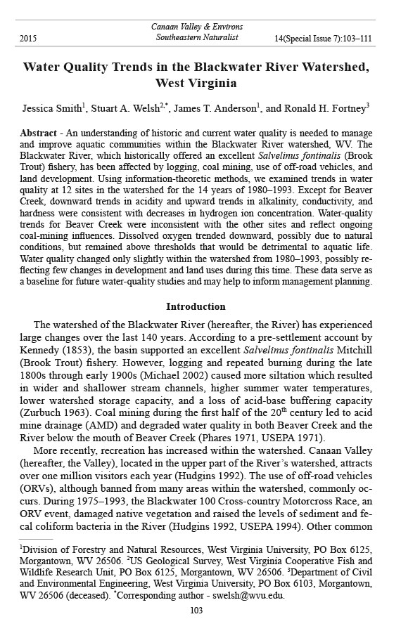
Figure 1. Bedrocks and locations of 12 study sites within the upper Blackwater River
watershed. Paths of the major streams and rivers shown in upper left.
Southeastern Naturalist
J. Smith, S.A. Welsh, J.T. Anderson, and R.H. Fortney
2015 Vol. 14, Special Issue 7
106
To detect water-quality trends, we examined the following 10 indicators:
acidity, alkalinity, conductivity, dissolved oxygen (DO), dissolved solids, fecal
coliform bacteria, hardness, iron, pH, and sulfate. We measured flow, pH, and
conductivity in the field, and determined values for the other variables in the
laboratory. We excluded 1978 and 1979 data from the time series because of differences
in methods used during those years.
We reduced the effects of seasonal variation in our data by conducting separate
analyses of two seasonal periods. The first set of analyses included a time series
of data from summer months (July, August, and September), and the second set
included spring months (March, April, and May). To further reduce variation in
water-quality variables, we fit linear, log-linear, inverse, and quadratic models
to determine relationships between stream flow and the water-quality variables
(Crawford et al. 1983). The correlation (r) values of the quadratic and log-linear
models were comparable and higher than other models, but only indicated a
significant (P < 0.05) relationship with flow for four parameters, namely conductivity,
hardness, dissolved solids, and alkalinity. Except for sites 4, 7, and 8,
which lacked flow data, we based flow-adjustments for these four constituents on
the log-linear model. We did not flow-adjust the other water -quality data.
We analyzed the data by using Kullback-Leibler information and likelihood
theory (Burnham and Anderson 2002) and a multiple working-hypotheses approach
(Chamberlin 1965). Based on the land-use changes in and anthropogenic
impacts to the Valley during 1980 through 1993, we chose a priori a set of three
candidate models. The first hypothesis, hereafter called the land-use model, reflects
a positive or negative trend in water-quality constituents from 1980 to 1989
and no trend for the remainder of the time series (1990–1993). This model, based
on land-use history, reflects an increase in development during the first part of the
time series followed by decreased development. The second hypothesis, called
the monotonic trend model, reflects a positive or negative trend throughout the
time series from 1980 to 1993. The final hypothesis, the no trend model, indicates
relatively no change across the time series, i.e., a regression model with a slope
of zero.
We fit the three candidate models, which represented three alternative hypotheses,
to the data using SAS (PROC REG; Littell et al. 2002). The best
approximating model was selected based on the second-order (small sample size)
adjustment to Akaike’s information criterion for the least squares case (AICc;
Burnham and Anderson 2002). The model with the lowest AICc value is the
best approximating model, and represents the alternative hypothesis that is best
supported by the data (Burnham and Anderson 2002). The AICc values for each
model were computed as follows:
AICc = n log (σ̂
2) + 2K + (2K [K + 1]) / (n - K - 1),
where log (ℓ[θ ̂ ] ) = -½(n) log(σ ̂
2), σ̂
2 = RSS/n (RSS = residual sum of squares),
K = number of model parameters, n = sample size, and log (ℓ[θ̂ ]) is the natural
logarithm of the likelihood function. The sign (+ or -) of the regression slope
Southeastern Naturalist
J. Smith, S.A. Welsh, J.T. Anderson, and R.H. Fortney
2015 Vol. 14, Special Issue 7
107
indicated trend direction, whereas the likelihood of the trend was determined by
comparing Akaike model weights (as described below). The AICc values were
rescaled as simple differences, where
Δ i = AICci - minAICc .
A model is supported by the data when its Δi value, also known as ΔAICc , is ≤ 2.0.
Then the Δi value is used to estimate the likelihood of model i, given the data, as
ℓ(Mi|x
̅
) = exp(-½Δi)
and normalized to sum to 1, as
R
wi = exp(-½Δi) / Σexp(-½Δi).
r =1
The wi values, also known as AICc weights, can be interpreted as probabilities
(i.e., evidence ratios), where the relative likelihood of model i versus model j is
wi/wj. For example, given model weights of 0.9 for the monotonic trend model
and 0.1 for the no-trend model, then the former is nine times more likely than
the latter.
Results
To identify temporal trends,we examined a total of 240 time series, comprised
of 10 water-quality variables at 12 sites for spring and summer series. We provide
evidence ratios of water quality trends for 118 time series, where 104 fit the trend
model, three fit the land-use model, and 11 supported both the trend and land-use
models. In general, from 1980 through 1993, negative trends occurred for acidity,
DO, iron, pH, and sulfate, whereas positive trends occurred for alkalinity,
conductivity, and hardness. Based on evidence ratios, support for trends differed
between spring and summer seasons for several water-quality constituents
(Table 1). Among the summer time series, strongest support occurred primarily
for negative trends in acidity, DO, and iron. Negative trends in pH typically
received strongest support for spring data. We did not observe seasonal patterns
among sites for trends of alkalinity, conductivity, hardness, and sulfate.
For the mine-impacted Beaver Creek watershed, trends of conductivity, dissolved
solids, and hardness were inconsistent with the other sites. Negative
trends of conductivity occurred for Beaver Creek’s summer data. Spring data
from Beaver Creek supported a negative trend of hardness. Trends in dissolved
solids received strong support only for Beaver Creek. Negative trends of conductivity,
hardness, and dissolved solids for Beaver Creek were not reflected in the
River data below the mouth of Beaver Creek at Davis.
Discussion
We could not attribute water-quality trends to specific influences or landuse
changes in the watershed during 1980–1993; rather, the trends may reflect
Southeastern Naturalist
J. Smith, S.A. Welsh, J.T. Anderson, and R.H. Fortney
2015 Vol. 14, Special Issue 7
108
Table 1. Evidence ratios supporting models of monotonic (T) or land-use (L) trends (with trend direction of + or -) of 10 water quality parameters in the
Blackwater River watershed, WV. Abbreviations: Acid = acidity, Alk = alkalinity, Cond = conductivity, DS = dissolved solids, DO = dissolved oxygen,
FC = fecal coliform bacteria, Hard = hardness, H+ = hydrogen ion concentration, and Sulf = Sulfate. Time series (1980–1993) were analyzed for 12 sites,
separated into spring (March–May = season 1) and summer (July–September = season 2). An evidence ratio of 10 indicates that the trend model is 10
times more likely than the no trend model. A blank space indicates no support for trend.
Site Season Acid Alk Cond DS DO FC Hard H+ Iron Sulf
1 1 120 (-T) 86 (+T) 449 (+T) 13 (-T) 41 (+T), 46 (+L) 5,287,532 (-L) 110,771 (-L) 4 (-T)
2 115 (-T) 8002 (-T) 1293 (+L) 563 (-T), 550 (-L) 6 (-T) 32 (-T)
2 1 6 (+T) 1370 (+T) 3 (+T) 6 (+T) 81 (-T), 58 (-L) 3 (-T)
2 87 (-T) 3 (+T) 26 (-T) 6 (-T) 115 (-T), 78 (-L)
3 1 824 (+T) 4 (-T) 6 (-T) 13 (-T) 34 (-T)
2 71 (-T), 67 (-L) 49 (+T) 21 (-T) 20 (+T), 18 (+L) 12 (-T) 81 (-T), 54 (-L)
4 1 8 (-T) 11 (-T)
2 4 (-T) 26 (-T) 9 (-T) 6891 (-T)
5 1 6056 (-T) 399 (-T) 5 (-T) 13.3 (-T) 757,576 (-T) 1.5 x 10⁸ (-T)
2 2,920,793 (-T) 75 (-T) 45 (-T) 17,990 (-T) 153,169 (-T) 1,411 (-T) 185 (-T)
6 1 8 (-T) 5 (-T) 25 (+T) 3 (+T) 1636 (-T) 33 (-T)
2 17 (-T) 4 (-T) 34 (+T) 3812 (-T) 2329 (-T)
7 1 10 (-T) 458 (-T)
2 29 (-T) 78 (-T) 15 (-T)
8 1 5 (-T) 19 (-T) 3 (-T)
2 4 (-T) 9 (-T) 187 (-T)
9 1 9 (-T) 11 (-T) 7 (+T)
2 70 (-T) 425 (+T) 30 (-T) 7 (-T) 4 (-T) 72 (-T)
10 1 2478 (+T) 7 (+T) 1.7 x 1028 (-T), 1.4 x 1028 (-L) 4 (-T)
2 423 (-T), 486 (-L) 104 (+T) 6 (+T) 124 (-T) 4 (-T) 145 (-T)
11 1 4 (+T) 1081 (+T) 4 (+T) 3 (-T) 3 (-T) 20 (+T) 23 (-T) 9 (-T)
2 39 (-T), 42 (-L) 68 (+T) 8834 (+T) 5 (+T) 31 (-T)
12 1 5 (-T) 28 (+T) 8 (-T) 413 (-T), 259 (-L) 5 (-T)
2 26 (-T) 12 (+T) 490 (-T) 4 (-T)
Southeastern Naturalist
J. Smith, S.A. Welsh, J.T. Anderson, and R.H. Fortney
2015 Vol. 14, Special Issue 7
109
pre-1980 impacts. For the 1980–1993 time series, we modeled a single land-use
impact that represented swift land development during 1980–1988 and slow
development during the recession years of 1989–1993. This land-use model,
however, was rarely supported by the data. We were unable to model impacts on
water quality that predated the 1980–1993 time series, such as timbering, mining,
acidic deposition, anthropogenic pollution, dams built by introduced Castor
canadensis Kuhl (American Beaver) (Bailey 1954), recreational uses, and development.
However, these pre-1980 changes may have singly or synergistically
influenced water quality within the Blackwater drainage during the 1980–1993
time series.
Bedrock influences water quality (Bricker and Rice 1989, Welsh and Perry
1997). The River’s watershed is underlain by various kinds of bedrock including
the Conemaugh, Greenbrier Limestone, Mauch Chunk, Pocono, and Pottsville formations.
We found positive trends in conductivity primarily in streams influenced
by Greenbrier Limestone. Support for positive trends in alkalinity and hardness
was also strongest at sites downstream of Greenbrier Limestone, but this support
was less than that found for conductivity. Pottsville bedrock in the Yellow Creek
watershed and upper Beaver Creek, which yields low buffering capacity (Welsh
and Perry 1997), likely influenced the negative trends in alkalinity of Yellow
Creek’s water. Multiple bedrock types influenced most sites, such as Little Blackwater,
Sand Run, Glade Run, and the River’s mainstem, thereby precluding further
inferences of geology-based trends.
Trends from Beaver Creek were often inconsistent with those of other sites,
possibly due to annual variation in its AMD production. In spring and summer,
negative trends in pH at the Beaver Creek site were supported by large evidence
ratios. In Beaver Creek, strong support for decreases in dissolved solids, sulfate,
and iron may be linked to a reduction in pH. Negative trends for conductivity at
Beaver Creek were likely associated with decreases of dissolved solids. Beaver
Creek is typically more affected by AMD, specifically during the low flows of
summer, because acid production is temporarily uniform (Phares 1971). The
decreasing trend in acidity received highest support for summer data, and likely
influenced decreasing trends of conductivity and sulfate.
The drop in pH during 1980–1993 was unexpected given the acid deposition
documented for the region (Baker et al. 1990), but this trend occurred within a
narrow range of pH values. Streams within the River’s drainage were limed to
increase their pH, but we are unaware of any mitigation efforts before or during
1980–1993. Because H+ concentration in streams typically increases following
snowmelt (Sharpe et al. 1984), and strongest support for negative trends in H+
occurred during the spring, we explored trends in precipitation and air temperature
within the time series during December–February. The data do not support
a trend for precipitation, but do support a slight upward trend in temperature.
Consequently, we hypothesize that lower winter temperatures and spring snowmelt
in the early part of the time series influenced negative trends in pH during
1980–1993.
Southeastern Naturalist
J. Smith, S.A. Welsh, J.T. Anderson, and R.H. Fortney
2015 Vol. 14, Special Issue 7
110
Negative trends of DO received highest support for the summer time series,
but all values were above levels serving as upper thresholds of biological degradation
for the region’s fauna. Negative trends of DO occurred in watersheds with
and without development, and likely resulted from annual changes in several natural
processes, such as increasing amounts of aquatic vegetation, decomposition
of wetland plants, canopy-cover influences on stream temperatures, and reduced
flow due to beaver dams. Untreated organic matter, sometimes indicated by high
levels of fecal coliform bacteria, can reduce DO during aerobic decomposition.
Increasing trends of fecal coliform bacteria, which could result from human or
wildlife sources, occurred at mainstem sites near Davis and Camp 70 but were
not observed at most sites. Given the likelihood of synergistic influences, we are
unable to speculate about the specific causes of the DO and fecal coliform trends.
Still, the DO and fecal coliform data were generally within narrow ranges and are
useful as baseline information for future studies.
Management Implications
Future development, growth of both human and wildlife populations, and
disturbances of mine-impacted areas are expected within the River’s watershed.
The results of our study increase understanding of the River’s water quality since
1980 and will be useful for the current and future aquatic resource management.
Most trends occurred within a narrow range of water-quality values and suggested
neither large improvement nor degradation of water quality during 1980–
1993. Because development and other land-use changes within the watershed
were relatively small during 1980–1993, the data reported herein have greatest
value as a baseline picture for future water-quality studies. A current assessment
of water quality within the River is needed, and we suggest long-term monitoring
at specific sites that are representative of the watershed such as sites 1,3,
and 5 from this study. Comparing more recent data with those from 1980–1993
will provide additional insights into changes of water quality within the River’s
watershed, and will allow natural resource managers to make informed decisions
based on optimal strategies.
Acknowledgments
The Canaan Valley Institute provided research funds. Many people assisted and
contributed to our efforts, including C.A. Anderson, D.B. Chambers, B.H. Collins, L.
Cooper, E.D. Michael, J.S. Rodd, B.S. Smith, P.K. Worden, and P.E. Zurbuch. This is
manuscript number 2800 of the West Virginia University Agricultural and Forestry Experiment
Station. The use of trade names or products does not constitute endorsement by
the US Government.
Literature Cited
Bailey, R.W. 1954. Status of Beaver in West Virginia. Journal of Wildlife Management
18:186–190.
Southeastern Naturalist
J. Smith, S.A. Welsh, J.T. Anderson, and R.H. Fortney
2015 Vol. 14, Special Issue 7
111
Baker, L.A., P.R. Kaufmann, A.T. Herlihy, and J.M. Eilers. 1990. Current status of surface-
water acid-base chemistry: State of Science and Technology, Volume II. National
Acid Precipitation Assessment Program, Washington DC. 367 pp.
Bricker, O.P., and K.C. Rice. 1989. Acidic deposition to streams: A geology-based method
predicts their sensitivity. Environmental Science and Technology 23:379–385.
Burnham, K.P., and D.R. Anderson. 2002. Model Selection and Multimodel Inference:
A Practical Information-theoretic Approach, 2nd Edition. Springer-Verlag, New York,
NY. 488 pp.
Chamberlin, T.C. 1965 (1890). The method of multiple working hypotheses (Reprint of
1890 paper in Science). Science 148:754–759.
Crawford, C.G., J.R. Slack, and R.M. Hirsch. 1983. Tests for trends in water-quality data
using the statistical analysis system. US Geological Survey Open-File Report 83-550.
93 pp.
Hudgins, J.E. 1992. Off-road use and impact in Canaan Valley, Tucker County, West Virginia.
Special Project Report 92-2. West Virginia Field Office, US Fish and Wildlife
Service, Elkins, WV. 17 pp.
Kennedy, P.P. 1853. The Blackwater Chronicle—A Narrative of an Expedition in to the
Land of Canaan in Randolph County, Virginia. Redfield Publishing, New York, NY.
Reprinted 1978, McClain Printing Co., Parsons, WV. 248 pp.
Littell, R.C., W.W. Stroup, and R.J. Freund. 2002. SAS for Linear Models, 4th Edition.
SAS Institute, Cary, NC. 496 pp.
McCabe, W.M. 1998. Total maximum daily load, upper Blackwater River, West Virginia.
Established by the US Environmental Protection Agency Region III and developed in
cooperation with the West Virginia Division of Environmental Protection. Philadelphia,
PA. 32 pp.
Michael, E.D. 2002. A Valley Called Canaan: 1885–2002. McClain Printing Co., Parsons,
WV. 232 pp.
Phares, D.P. 1971. Sources of AMD in the Blackwater River watershed with recommended
reclamation procedures. West Virginia Department of Natural Resources,
Division of Wildlife Resources, Elkins, WV. 23 pp.
Sharpe, W.E., D.R. DeWalle, R.T. Leibried, R.S. Dinicola, W.G. Kimmel, and L.S. Sherwin.
1984. Causes of acidification of four streams on Laurel Hill in southwestern
Pennsylvania. Journal of Environmental Quality 13:619–631.
United States Environmental Protection Agency (USEPA). 1971. Summary report:
Monongahela River mine drainage remedial project. Division of Field Investigations,
Cincinnati, OH. 146 pp.
USEPA. 1994. Short-term effects of off-road vehicle activity on the quality of the Blackwater
River above Davis, West Virginia. USEPA-Region III, Philadelphia, PA. 26 pp.
Waldron, M.C., and J.B. Wiley. 1996. Water quality and processes affecting dissolved
oxygen concentrations in the Blackwater River, Canaan Valley, West Virginia. Water-
Resources Investigations Report 95-4142. US Geological Survey, Charleston, WV.
91 pp.
Welsh, S.A., and S.A. Perry. 1997. Acidification and fish occurrence in the Upper Cheat
River drainage, West Virginia. Journal of the American Water Resources Association
33:423–429.
Zurbuch, P.E. 1963. Notes on the Blackwater River fishery and water quality. West Virginia
Department of Natural Resources, Division of Game and Fish, Elkins, WV. 8 pp.


 The Southeastern Naturalist is a peer-reviewed journal that covers all aspects of natural history within the southeastern United States. We welcome research articles, summary review papers, and observational notes.