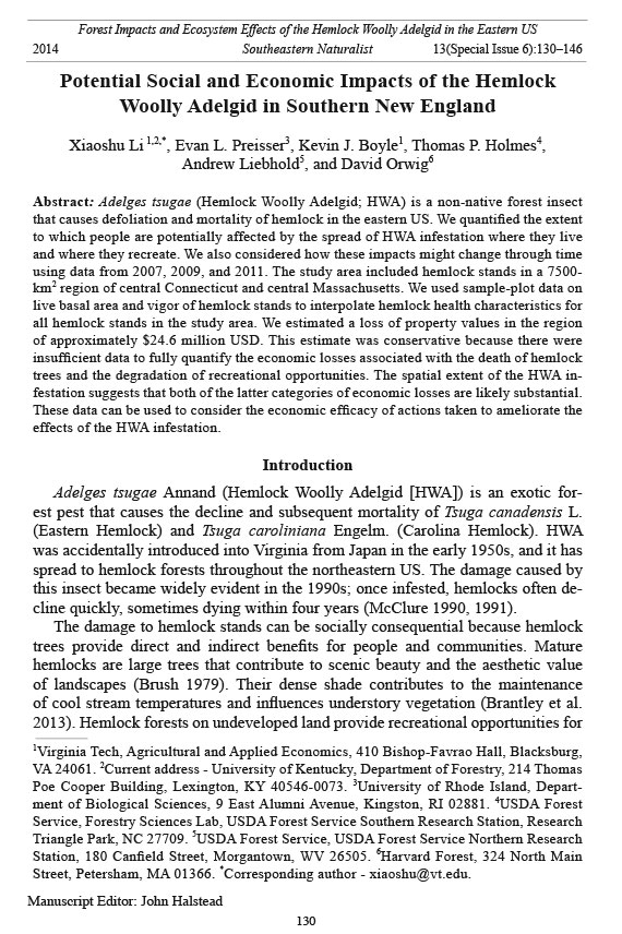
Southeastern Naturalist
X. Li, E.L. Preisser, K.J. Boyle, T.P. Holmes, A. Liebhold, and D. Orwig
2014
130
Vol. 13, Special Issue 6
Potential Social and Economic Impacts of the Hemlock
Woolly Adelgid in Southern New England
Xiaoshu Li 1,2,*, Evan L. Preisser3, Kevin J. Boyle1, Thomas P. Holmes4,
Andrew Liebhold5, and David Orwig6
Abstract: Adelges tsugae (Hemlock Woolly Adelgid; HWA) is a non-native forest insect
that causes defoliation and mortality of hemlock in the eastern US. We quantified the extent
to which people are potentially affected by the spread of HWA infestation where they live
and where they recreate. We also considered how these impacts might change through time
using data from 2007, 2009, and 2011. The study area included hemlock stands in a 7500-
km2 region of central Connecticut and central Massachusetts. We used sample-plot data on
live basal area and vigor of hemlock stands to interpolate hemlock health characteristics for
all hemlock stands in the study area. We estimated a loss of property values in the region
of approximately $24.6 million USD. This estimate was conservative because there were
insufficient data to fully quantify the economic losses associated with the death of hemlock
trees and the degradation of recreational opportunities. The spatial extent of the HWA infestation
suggests that both of the latter categories of economic losses are likely substantial.
These data can be used to consider the economic efficacy of actions taken to ameliorate the
effects of the HWA infestation.
Introduction
Adelges tsugae Annand (Hemlock Woolly Adelgid [HWA]) is an exotic forest
pest that causes the decline and subsequent mortality of Tsuga canadensis L.
(Eastern Hemlock) and Tsuga caroliniana Engelm. (Carolina Hemlock). HWA
was accidentally introduced into Virginia from Japan in the early 1950s, and it has
spread to hemlock forests throughout the northeastern US. The damage caused by
this insect became widely evident in the 1990s; once infested, hemlocks often decline
quickly, sometimes dying within four years (McClure 1990, 1991).
The damage to hemlock stands can be socially consequential because hemlock
trees provide direct and indirect benefits for people and communities. Mature
hemlocks are large trees that contribute to scenic beauty and the aesthetic value
of landscapes (Brush 1979). Their dense shade contributes to the maintenance
of cool stream temperatures and influences understory vegetation (Brantley et al.
2013). Hemlock forests on undeveloped land provide recreational opportunities for
1Virginia Tech, Agricultural and Applied Economics, 410 Bishop-Favrao Hall, Blacksburg,
VA 24061. 2Current address - University of Kentucky, Department of Forestry, 214 Thomas
Poe Cooper Building, Lexington, KY 40546-0073. 3University of Rhode Island, Department
of Biological Sciences, 9 East Alumni Avenue, Kingston, RI 02881. 4USDA Forest
Service, Forestry Sciences Lab, USDA Forest Service Southern Research Station, Research
Triangle Park, NC 27709. 5USDA Forest Service, USDA Forest Service Northern Research
Station, 180 Canfield Street, Morgantown, WV 26505. 6Harvard Forest, 324 North Main
Street, Petersham, MA 01366. *Corresponding author - xiaoshu@vt.edu.
Manuscript Editor: John Halstead
Forest Impacts and Ecosystem Effects of the Hemlock Woolly Adelgid in the Eastern US
2014 Southeastern Naturalist 13(Special Issue 6):130–146
Southeastern Naturalist
131
X. Li, E.L. Preisser, K.J. Boyle, T.P. Holmes, A. Liebhold, and D. Orwig
2014 Vol. 13, Special Issue 6
residents in nearby communities and non-residents who visit the forests (McConnell
and Walls 2005).
Because hemlock stands provide these social benefits, the economic consequences
of HWA invasion extend beyond the loss of harvestable timber. Holmes et
al. (2010a) found that severely defoliated hemlocks in northern New Jersey reduced
the value of residential parcels with HWA damage and reduced the value of properties
located up to 0.5 km away from infestations. The economic losses were roughly
1–1.6% of the parcels’ sales price. Such losses in property values also reduce annual
property tax revenues and may cause communities to increase property-tax mill
rates in order to maintain services. Moore et al. (2011) employed contingent valuation
to examine the public’s value of a program to control the HWA infestation in
the southern Appalachian Mountains. They found that residents of North Carolina
were willing to make a one-time payment of $122 per person to protect hemlock
stands in western North Carolina public forests from HWA. This value was a measure
of the loss to the public if the hemlock stands were not protected from HWA
and were instead allowed to decline.
Managers face the challenge of determining how to interpret results of sitespecific
studies, predict infestation patterns and speed of spread, and consider
management as it relates to regional economic consequences of HWA infestations.
Holmes et al. (2010b) did an early extrapolation in which they predicted the intersection
of hemlock forests and residential areas as HWA infestation spread spatially
and temporally. These authors found that the largest economic losses due to hemlock
defoliation were likely to occur in western Connecticut and Massachusetts,
and southeastern New Hampshire.
In this study, we present a more refined approach to estimate the potential
social impacts of HWA infestation. Using data on hemlock health from sampled
stands in central Connecticut and Massachusetts, we scaled the damage to a
regional area based on satellite imagery. We used kriging to interpolate HWA
sample data on hemlock defoliation and live basal area to all hemlock stands in
central Connecticut and Massachusetts. We then overlaid this HWA-damage data
with GIS layers on human population, publicly and privately owned undeveloped
land, and median home prices to identify HWA infestation intersections with
places where people live and work (population) and places where people might
recreate (undeveloped land), and to estimate losses in residential property values.
Our results indicated dramatic losses of healthy hemlock stands in the study area
over time and space, with the infestation moving in a northeasterly direction. We
found that the impact of HWA on people increased dramatically during the 5-year
study period (2007–2011), during which the number of people living in close proximity
to HWA-infested trees increased and, consequentially, there was a substantial
accompanying decline in property values of as much as $105 million in the study
area alone.
The effects of trees on property values
Previous hedonic studies have shown that healthy trees and forests could provide
scenic and recreation value to residential properties (Anderson and Cordell
Southeastern Naturalist
X. Li, E.L. Preisser, K.J. Boyle, T.P. Holmes, A. Liebhold, and D. Orwig
2014
132
Vol. 13, Special Issue 6
1985, Dombrow et al. 2000, Netusil et al. 2010, Tyrvainen and Miettinen 2000). For
example, Dombrow et al. (2000) determined that sale prices of single-family homes
increased by 2% when mature trees occurred on properties. This economic benefit
of healthy forests indicates the potential significant loss from forest disturbances
including forest fires and forest-pest outbreaks.
Forest-pest outbreaks are important factors that have negative effects on forestecosystem
services (Holmes et al. 2009, Huggett 2008, Rosenberger et al. 2012).
Dendroctinus ponderosae Hopkins (Mountain Pine Beetle), Choristoneura fumiferana
(Clemens) (Spruce Budworm), Lymantria dispar dispar (L.) (Gypsy Moth),
and HWA are all major forest pests that have caused significant damage to the forests
in the eastern US. However, only a few studies have evaluated the economic
impacts on property values from such forest pest outbreaks.
Kovacs et al. (2011) investigated the economic losses from Phytophthora ramorum
Werres, de Cock, & Man in’t Veld (Sudden Oak Death) in Marin County, CA,
and found that property values decreased 3–6% as a result of oak mortality. Price
et al. (2010) conducted research to investigate the relationship between the number
of trees killed by Mountain Pine Beetle and property prices in Grand County, CO.
They estimated that property values decreased by $648, $43, and $17 for every dead
tree within a 0.1-, 0.5-, and 1.0-km buffer, respectively. However, these studies and
others such as Holmes et al. (2010a) have focused on specific areas and forest pests.
Thus, there is a need for further investigation as to how these price effects vary with
infestation organism and region of the country.
In this study, we focused on the social impact of HWA infestation in central Connecticut
and central Massachusetts. We also considered methods that could be used
to scale-up the results from site-specific studies to lar ger geographic areas.
Study Area
Ecologists at the Harvard Forest (Petersham, MA) identified, mapped, and characterized
Eastern Hemlock stands within a 7500-km2 rectangular area extending
from Long Island Sound in Connecticut north to the Massachusetts–Vermont border
(Fig. 1; Orwig et al. 2002). They identified all stands of Eastern Hemlock greater
than 1.3 ha in size using high-resolution aerial photographs that they then scanned
and digitally transferred into a GIS overlay; a total of 6126 Eastern Hemlock stands
were identified. Orwig et al. (2012) ground-truthed more than 300 stands across the
study area and determined that they had correctly classified 93.5% of the visited
sites in their aerial photograph interpretation.
Orwig et al. (2002) conducted field sampling in 1997–1998 to characterize Eastern
Hemlock forest conditions in Connecticut (Orwig et al. 2002), the first New
England state invaded by HWA, and continued their work in 2002–2004 to assess
conditions in Massachusetts (Orwig et al. 2012). They included 142 Eastern Hemlock
stands in their field surveys (Fig. 1).
Southeastern Naturalist
133
X. Li, E.L. Preisser, K.J. Boyle, T.P. Holmes, A. Liebhold, and D. Orwig
2014 Vol. 13, Special Issue 6
Methods
For our analyses, we used Eastern Hemlock-health data collected by Preisser et
al. (2011) when they revisited Orwig et al.’s (2002) stands in 2007, 2009, and 2011.
We focused our analyses on measurements of Eastern Hemlock vigor and live basal
area, which were the key variables we used to identify the effects of HWA infestation.
HWA defoliates hemlocks, which reduces vigor, and when the hemlock trees
die, the live basal area in the stand is reduced.
In the sampled Eastern Hemlock stands, data on live basal area (m2/ha) and tree
vigor were collected by sampling one 20 x 20-m fixed-area plot and 5–10 variableradius
plots spaced 30–50 m apart on a transect that crossed the long dimension of
each stand (Orwig et al. 2002). In 2011, sampling efforts at 3 of the variable-radius
plots used the Bitterlich method (Grosenbaugh 1952) to estimate the Eastern Hemlock
live and mean basal area (m2 / ha) (Preisser et al. 2011). Eastern Hemlock vigor
was measured by estimating the amount of retained foliage in each stand using 4
categories: 4 = 0–25% foliar loss, 3 = 26–50% foliar loss, 2 = 51–75% foliar loss,
and 1 = 76 –99% foliar loss (Preisser et al. 2011).
Mean and maximum values of Eastern Hemlock live basal area decreased from
2007 to 2011 due to mortality from the HWA (Table 1). The number of damaged
Eastern Hemlock stands as measured by the extent of defoliation (vigor = 1, 2, or 3)
increased through time, while the number of healthy hemlock stands (vigor = 4)
decreased.
Figure 1. Eastern Hemlock stands in the study area, encompassing parts of Connecticut and
Massachusetts. Red and green areas indicate locations of stands sampled and not sampled,
respectively, by Orwig et al. (2002, 2012).
Southeastern Naturalist
X. Li, E.L. Preisser, K.J. Boyle, T.P. Holmes, A. Liebhold, and D. Orwig
2014
134
Vol. 13, Special Issue 6
Spatial interpolation and potential prediction errors
Spatial interpolation methods, such as kriging, have been widely applied in
forestry applications (Gunnarsson et al. 1998, Jansen et al. 2002). Kriging is a geostatistical
interpolation methodology that is used to predict the value of spatially
distributed variables at unsampled locations using a weighted average of observations
at neighboring locations (Cressie 1993, Goovaerts 1997, Isaaks and Srivastava
1989). For example, Biondi et al. (1994) employed kriging to interpolate number
and size of forest tree stems. Köhl and Gertner (1997) applied this methodology
to tree needle losses. Wulff et al. (2006) used kriging to estimate the geographical
distribution and dispersal of forest damage from an outbreak of Gremmeniella (a
canker). We employed kriging to interpolate Eastern Hemlock damage from HWA
infestations in central Connecticut and Massachusetts.
Spatial interpolation of live Eastern Hemlock basal area was accomplished using
ordinary kriging, which is the most common spatial interpolation procedure.
We used simple kriging to spatially interpolate Eastern Hemlock vigor because it
facilitated geostatistical simulation to investigate the robustness of impact projections.
We assumed that spatial correlation was isotropic over the study area,
depending only on the distance between two points, but not the direction of their
separation, and we used semivariogram analysis to identify the pattern of spatial
correlation between neighboring points (Cressie 1985, Stein 1999). We used this
approach to interpolate live Eastern Hemlock basal area and vigor for the >6000
stands in the study area for each of the 3 sampling years. Our intent was to develop
a spatial picture of the effects of HWA infestation throughout the study area and
how these effects changed over time.
To obtain the best predictions, a kriging model should have a mean standardized
prediction error (MSE) close to 0 and a root mean-squared standardized error
(RMSE) close to 1. We determined that the exponential model fit best for live basal
area (Table 2), and the best model for vigor varied.
Table 1. Live basal area and vigor for sampled hemlock stands (Preisser et al. 2011). SD = standard
deviation. Note: the number of sampled sites decreased through time as hemlock stands died or access
for sampling was denied. Vigor ratings (as percent foliar loss): 1 = 76–99%, 2 = 51–75%, 3 =
26–50%, 4 = 0–25%.
2007 2009 2011
Live basal area ( m2/ha )
Mean 38.23 27.83 15.31
SD 27.59 16.29 11.89
Min 0 0 0
Max 125.45 73.34 54.04
n 140 138 122
Hemlock vigor (# of stands)
1 8 11 9
2 18 19 23
3 33 37 44
4 82 71 47
n 141 138 123
Southeastern Naturalist
135
X. Li, E.L. Preisser, K.J. Boyle, T.P. Holmes, A. Liebhold, and D. Orwig
2014 Vol. 13, Special Issue 6
We conducted cross validation of the interpolations by comparing predicted and
actual values for live basal area from each of the sample sites. If there were no datainterpolation
errors, all points would fall along a 45-degree line (Fig. 2).
Results and Discussion
Our model over-estimated Eastern Hemlock live basal area for stands with small
live basal areas and under-estimated it for stands with large live basal area (Fig. 2).
We may have obtained this result, in part, because the distribution of sampled
values was skewed to stands with small live basal areas. The over-estimation for
stands with large live basal areas was most pronounced in the 2011 data (denoted
by the flatness of the blue trend line in Fig. 2). As Eastern Hemlocks die from HWA
infestation, the live basal area of stands becomes smaller, a result that supports our
suggested effect of data skewness.
To place these prediction errors in context, we developed 95% confidence intervals
along the 45-degree lines in each plot in Figure 2. We computed the 95% confidence
intervals using the difference between the data points and the corresponding points on
the 45-degree lines for the measured basal areas, and the confidence intervals are
shown by the dotted lines in each plot in Figure 2. The 95% confidence intervals are ±
37.5, 25.3, and 19.6 m2/ha for 2007, 2009, and 2011, respectively.
These results do not invalidate the kriging results, but suggest that caution must
be used when interpreting the empirical predictions. As a first step to consider the
robustness of predictions, we used the first, second, and third quartiles of live basal
area in 2007—14.475 m2/ha, 34.74 m2/ha, and 55.005 m2/ha—to investigate the
potential variability of HWA impacts. The values we used for evaluate our results
for interpolated vigor were 1.5, 2.5, and 3.5, which are the mid-points between the
levels for this index variable. To account for error in the kriging predictions, we
further employed a geostatistical simulation method when we predicted property
value losses from HWA damage (Chiles and Delfiner 1999).
Interpolation results
Interpolated live basal area declined over time (Table 3), as was observed
for the sample data (Table 1). Figure 3 presents a spatial representation of these
results: the red, orange, and yellow shaded areas (larger basal areas) disappear
Table 2. Kriging summary statistics
Mean standardized Root mean square
Variables Year Model error standardized error
Live basal area
2007 Exponential 0.0002 0.924
2009 Exponential -0.011 1.046
2011 Exponential -0.017 1.027
Vigor
2007 Gaussian -0.006 1.025
2009 Gaussian -0.013 1.029
2011 K-Bessel 0.018 1.027
Southeastern Naturalist
X. Li, E.L. Preisser, K.J. Boyle, T.P. Holmes, A. Liebhold, and D. Orwig
2014
136
Vol. 13, Special Issue 6
Figure 2. Results of cross validation
for live basal area (m2/ha). Red dots are
interpolations of 142 sites sampled by
Orwig et al. (2002, 2012), blue line is
best-fit trend line, and dotted lines are
95% confidence intervals.
Southeastern Naturalist
137
X. Li, E.L. Preisser, K.J. Boyle, T.P. Holmes, A. Liebhold, and D. Orwig
2014 Vol. 13, Special Issue 6
through time and the green and blue areas (smaller basal areas) expand. Sites with
lower basal areas are shown to expand from the southern extreme of the study area
to the north through time. The maximum interpolated live basal area was about 96
m2/ha in 2007 and declined to 25 m2/ha in 2011.
Mean interpolated Eastern Hemlock vigor also declined through time (Table 3,
Fig. 4). The spatial change of Eastern Hemlock vigor followed the same pattern
as live basal area; the data initially indicated diminished vigor in the south and
a progression of decreased vigor northward from southern Connecticut to northern
Massachusetts over time. In 2011, there was a decrease in seriously damaged
Eastern Hemlocks in southern Connecticut because of mortality in trees that had
Table 3. Summary statistics for interpolated damage to hemlock stands (n = 6126). SD = standard
deviation. Vigor = continuous vigor based on kriging projections.
2007 2009 2011
Live basal area (m2/ha)
Mean 50.69 32.01 16.34
SD 16.25 5.28 3.68
Min 4.71 6.07 4.74
Max 95.69 41.81 25.47
Vigor
Mean 3.791 3.736 3.198
SD 0.383 0.459 0.320
Min 1.584 1.177 1.192
Max 4.093 4.152 3.910
Figure 3. Interpolated live basal area in the study area (m2/ha).
Southeastern Naturalist
X. Li, E.L. Preisser, K.J. Boyle, T.P. Holmes, A. Liebhold, and D. Orwig
2014
138
Vol. 13, Special Issue 6
previously been experiencing reduced vigor; dead trees were no longer counted, so
there were fewer low-vigor trees present in the samples. The change reflects mortality,
not an overall increase in vigor.
Potential social and economic impacts
Affected households. The study area included 9 counties, 5 in Connecticut
(Hartford, Middlesex, New Haven, New London, and Tolland) and 4 in Massachusetts
(Franklin, Hampden, Hampshire, and Worcester). Residents of these counties
were potentially affected by HWA infestation based on where they lived, worked,
shopped, and recreated. If residential properties were located within or near Eastern
Hemlock stands, then residents might have observed defoliated stands of live and
dead Eastern Hemlock trees during their daily activities.
We overlaid the layer of interpolated Eastern Hemlock-health data with 2010
census-block population data (Fig. 5; US Census Bureau 2010). The affected census
blocks indicated areas where households were likely to see HWA damage during
their daily activities. The estimated number of households affected by HWA infestation
increased substantially through time (Table 4) via the northern expansion of
the infestation into an area with a high density of Eastern Hemlock stands (Fig. 1).
Based on the thresholds of median live basal area or vigor ≤3.5, the number of
people affected by HWA damage tripled from 2007 to 2011 (Table 4).
Figure 4. Interpolated vigor in the study area.
Southeastern Naturalist
139
X. Li, E.L. Preisser, K.J. Boyle, T.P. Holmes, A. Liebhold, and D. Orwig
2014 Vol. 13, Special Issue 6
Undeveloped land. Undeveloped land, including Eastern Hemlock stands, provide
natural areas where people may recreate; these stands also contribute to the
aesthetic quality of landscapes (Earnhart 2006, Fausold and Lilieholm 1999, Irwin
2002). We overlaid GIS maps of publicly and privately owned open space (Ceep
Table 4. Predicted number of households affected by HWA damage.
2007 2009 2011
Live basal area
≤14.475 m2/ha 5426 6383 50,927
≤34.74 m2/ha 38,264 92,394 107,450
≤55.005 m2/ha 91,341 107,450 107,450
Vigor
≤1.5 0 1296 938
≤2.5 7373 10,986 5146
≤3.5 39,265 45,856 101,735
Figure 5. Number of households
in census blocks that intersect
with Eastern Hemlock stands.
Southeastern Naturalist
X. Li, E.L. Preisser, K.J. Boyle, T.P. Holmes, A. Liebhold, and D. Orwig
2014
140
Vol. 13, Special Issue 6
2011, MassGIS 2013) with the layer of Eastern Hemlock stands. Using these overlays,
we were able to identify the areas of undeveloped land potentially affected
by HWA infestation. About 38% of the Eastern Hemlock stands were located on
publicly and privately owned undeveloped land (green shaded area in Fig. 6); most
of these stands were located in northern Massachusetts.
After overlaying the interpolated HWA-infestation data with the Eastern Hemlock
stands on undeveloped lands, we observed that the effects of the infestation
were potentially quite dramatic (Table 5). The area of public land with Eastern
Hemlock stands with live basal area of less than 34.74 m2/ha increased by a factor
of ≈14 from 2007 to 2011. The area of public land with interpolated Eastern Hemlock
vigor ≤3.5 increased by 10-fold from 2007 to 2011. The magnitude of these
increases was due to the confluence of a larger number of Eastern Hemlock stands
in the northern portion of the study area, a large amount of undeveloped land in this
area, and the northern expansion of HWA infestation through time. The impact of
HWA infestation affecting undeveloped land likely extended beyond local residents
Figure 6. Publicly or privately
owned undeveloped
land that intersects
with Eastern Hemlock
stands.
Southeastern Naturalist
141
X. Li, E.L. Preisser, K.J. Boyle, T.P. Holmes, A. Liebhold, and D. Orwig
2014 Vol. 13, Special Issue 6
to people who reside outside the study area, i.e., those who live in nearby urban
areas (e.g., Boston and New York) and visit the study area to recreate.
Economic losses. Holmes et al. (2010b) estimated that severe (>75%) Eastern
Hemlock defoliation, which is comparable to our vigor ≤1.5, resulted in a 1% decrease
(conservatively) in residential property values of parcels that had Eastern
Hemlocks on the property. Our aggregation included more properties than were
included in Holmes et al. (2010b) because we did not restrict effects solely to
properties that contained Eastern Hemlock trees; rather, we also included properties
adjacent to Eastern Hemlock stands because mortality would affect values.
Applying this property-value diminution to median property values in affected census-
block groups (US Census Bureau 2011) provided an estimate of the decrease
in property values due to the effects of the HWA infestation (Fig. 7). We multiplied
the number of households in each census block intersected by Eastern Hemlock
stands with vigor ≤1.5 by the median property value for the census block, and then
multiplied this result by 0.01 to estimate the property-value losses in each census
block. We computed aggregate losses by summing the losses for each census block
(Table 6). We assumed a constant marginal damage function applied, and thus the
housing markets had recalibrated to new hedonic equilibria following the extensive
damage in the study area as reported by Holmes et al. 2006.
Based on the simple kriging interpolation results of Eastern Hemlock vigor, we
used a geostatistical simulation to generate 500 realizations of Eastern Hemlock
vigor for the study area. We calculated the total economic loss for each realization
to develop an empirical distribution of potential property-value losses. The potential
capitalized property-value loss due to severely defoliated Eastern Hemlock
Table 5. Predicted area ( in km2) of undeveloped land affected by HWA damage.
2007 2009 2011
Live basal area (≤14.475 m2/ha )
Publicly owned 1.7 5.2 47.5
Public + private 4.0 7.6 72.2
Live basal area (≤34.74 m2/ha )
Publicly owned 22.8 202.6 316.0
Public + private 31.5 258.6 390.9
Live basal area (≤55.005 m2/ha )
Publicly owned 259.0 316.0 316.0
Public + private 311.8 390.9 390.9
Vigor (≤1.5)
Publicly owned 0.0 1.2 0.1
Public + private 0.0 2.4 1.2
Vigor (≤2.5)
Publicly owned 2.8 3.7 5.0
Public + private 6.6 8.7 8.4
Vigor (≤3.5)
Publicly owned 25.3 32.1 273.6
Public + private 35.6 46.5 328.3
Southeastern Naturalist
X. Li, E.L. Preisser, K.J. Boyle, T.P. Holmes, A. Liebhold, and D. Orwig
2014
142
Vol. 13, Special Issue 6
stands (vigor ≤1.5) was roughly $3.6 million in 2007 (SD = $1.8 million). The
spread of HWA between 2007 and 2011 caused an additional loss of about $21.0
million, for a total estimated loss of $24.6 million by 2011 (SD = $4.4 million)
(Table 6). We did not have any information on the losses in property values due to
the Eastern Hemlock mortality and removal. Thus, our estimates of property losses
of $24.6 million are conservative.
Figure 7. Median residential
property values
in census blocks that
intersect with Eastern
Hemlock stands.
Table 6. Potential capitalized property-value losses from HWA damage (x $1000). SD = standard
deviation.
2007 2009 2011
total damage total damage total damage
Vigor ≤1.5
Mean $3581 $8370 $24,564
SD 1832 2559 4441
Southeastern Naturalist
143
X. Li, E.L. Preisser, K.J. Boyle, T.P. Holmes, A. Liebhold, and D. Orwig
2014 Vol. 13, Special Issue 6
Conclusions
We infer that the spread of HWA infestation has substantial social effects as trees
are defoliated and die where people live, work, and play. Using data from portions
of Connecticut and Massachusetts, we estimated that the losses in property values
were as much as $24.6 million during the study period.
Placing our estimates in context, Holmes et al. (2010b) estimated HWA property-
value losses for Connecticut and Massachusetts at $9.4 million for the period
1999–2008. This estimate was for a much larger geographic region than we address,
but their estimate is within the 90% confidence interval of the potential economic
losses that we calculated for 2009 ($4.9 million–$13.0 million). We likely have
more accurate data and extrapolations of the HWA infestation than those available
to Holmes et al. (2010b). Thus, our more refined approach to interpolate the
expansion of HWA infestation suggests that the aggregate losses in property values
across regions of the US that may potentially experience HWA damage likely exceeds
the $20.2 million in aggregate property-value losses estimated by Holmes et
al (2010b); our 2011 estimate that includes only portions of Connecticut and Massachusetts
exceeds the Holmes et al. (2010b) national estimate.
Further, our analysis shows that HWA infestation affects places where people
recreate. This result suggests that there is likely a loss in economic values from
diminished recreation experiences. These losses could arise because the loss of the
Eastern Hemlock overstory can affect stream temperatures and, therefore, fishing
quality. The defoliation and loss of Eastern Hemlock trees could also affect the
quality of recreational hiking experiences. Although we know of no existing studies
to impute this category of potential economic losses resulting from hemlock
mortality, it is a topic of interest for future studies that could make estimates using
travel-cost recreation-demand modeling. In addition, a stated-preference study
such as the one conducted by Moore et al. (2011) could be undertaken for the entire
geographic area potentially affect by HWA infestation.
The Connecticut and Massachusetts data demonstrate that focusing solely on
defoliation may provide a misleading underestimate of economic losses because it
does not capture the economic losses as Eastern Hemlock trees die. That is, defoliation
does not account for a decreased number of trees in the future, only diminished
foliage. Thus, it is important to consider multiple dimensions of pest infestations,
including HWA, if accurate characterizations of social and economic effects are to
be developed. Further, the analysis presented here documents recent economic losses
due to HWA. We suggest that forest pest and disease infestation-related losses
may increase with climate change and that the costs will go far beyond simply the
losses of commercial timber, and include decreases in property values, tax revenue,
and revenue from recreational activities.
Acknowledgments
Funding provided by the US Forest Serveice Southeastern Research Station, the National
Institute of Food and Agriculture, and the National Science Foundation.
Southeastern Naturalist
X. Li, E.L. Preisser, K.J. Boyle, T.P. Holmes, A. Liebhold, and D. Orwig
2014
144
Vol. 13, Special Issue 6
Literature Cited
Anderson, L.M., and K.H. Cordell. 1985. Residential property values improved by landscaping
with trees. Southern Journal of Applied Forestry 9:162–166.
Biondi, F., D.E. Myers, and C.C. Avery. 1994. Geostatistically modeling stem size and
increment in an old-growth forest. Canadian Journal of Forest Research 24:1354–1368.
Brantley, S., C.R. Ford, and J.M. Vose. 2013. Future species composition will affect forest
water use after loss of Eastern Hemlock from southern Appalachian forests. Ecological
Applications 23:777–790.
Brush, R.O. 1979. The attractiveness of woodlands: Perception of forest landowners in
Massachusetts. Forest Science 25:495–506.
Chiles, J.P., and P. Delfiner. 1999. Geostatistics: Modeling Spatial Uncertainty. John Wiley
and Sons, New York, NY. 734 pp.
Connecticut Department of Energy and Environmental Protection (CDEEP). 2011. Protected
open space mapping. Available online at http://www.ct.gov/deep/cwp/view.
asp?a=2701&q=323444. Accessed 2 August 2013.
Cressie, N. 1985. Fitting variogram models by weighted least squares. Mathematical Geology
17:563–586.
Cressie, N. 1993. Statistics for Spatial Data. John Wiley and Sons, New York, NY. 928 pp.
Dombrow, J., M. Rodriguez, and F.C. Sirmans. 2000. The market value of mature trees in
single-family housing markets. Appraisal Journal 68:39–43.
Earnhart, D. 2006. Using contingent-pricing analysis to value open space and its duration
at residential locations. Land Economics 82:17–35
Fausold, C.J., and R.J. Lilieholm. 1999. The economic value of open space: A review and
synthesis. Environmental Management 23:307–320.
Goovaerts, P. 1997. Geostatistics for Natural Resources Evaluation, Oxford University
Press, New York, NY. 483 pp.
Grosenbaugh, L.R. 1952. Plotless timber estimates: New, fast, easy. Journal of Forestry
50:32–37.
Gunnarsson, F., S. Holm, P. Holmgren, and T. Thuresson. 1998. On the potential of kriging
for forest-management planning. Scandinavian Journal of Forest Research 13:237–245.
Holmes, T., J.E. Aukemma, B. Von Holle, A. Liebhold, and E. Sills. 2009. Economic impacts
of invasive species in forests: Past, present, and future—the year in ecology and
conservation biology. Annals of the New York Academy of Sciences 1162:18–38.
Holmes, T.P., E.A. Murphy, K. Bell, and D. Royle. 2010a. Property-value impacts of Hemlock
Woolly Adelgid in residential forests. Forest Science 56:529–540.
Holmes, T.P., A. Liebhold, K. Kovacs, and B. Von Holle. 2010b. A spatial-dynamic valuetransfer
model of economic losses from a biological invasion. Ecological Economics
70:86–95.
Huggett, R.J., A.E. Murphy, and P.T. Holmes. 2008. Forest disturbance impacts on residential
property values. Pp. 209–228, In T.P. Holmes, J.P. Prestemon, and K.L. Abt
(Eds.). The Economics of Forest Disturbances: Wildfires, Storms, and Invasive Species.
Springer, Dordrecht, The Netherlands. 428 pp.
Isaaks, E.H., and R.M. Srivastava. 1989. An Introduction to Applied Geostatistics. Oxford
University Press, New York, NY. 561 pp.
Irwin, E.G. 2002. The effects of open space on residential-property values. Land Economics
78:465–480.
Southeastern Naturalist
145
X. Li, E.L. Preisser, K.J. Boyle, T.P. Holmes, A. Liebhold, and D. Orwig
2014 Vol. 13, Special Issue 6
Jansen, M., M. Judas, and J. Saborowski. 2002. Spatial Modeling in Forest Ecology and
Management: A Case Study. Springer, Berlin, Germany. 225 pp.
Köhl, M., and G. Gertner. 1997. Geostatistics in evaluating forest-damage surveys: Considerations
on methods for describing spatial distributions. Forest Ecology and Management
95:131–140.
Kovacs, K., T.P. Holmes, J.E. Englin, and J. Alexander. 2011. The dynamic response of
housing values to a forest invasive disease: Evidence from a Sudden Oak Death infestation.
Environmental and Resource Economics 49:445–471.
Massachusetts Office of Geographic Information (Mass GIS). 2013. Protected and recreational
open space. Available online at http://www.mass.gov/anf/research-and-tech/
it-serv-and-support/application-serv/office-of-geographic-information-massgis. Accessed
2 August 2013.
McClure, M. 1990. Role of wind, birds, deer, and humans in the dispersal of Hemlock
Woolly Adelgid (Homoptera: Adelgidae). Environmental Entomology 19:36–43.
McClure, M. 1991. Density-dependent feedback and population cycles in Adelges tsugae
(Homoptera: Adelgidae) on Tsuga canadensis. Environmental Entomology 20:258–264.
McConnell, V., and M.A. Walls. 2005. The value of open space: Evidence from studies of
nonmarket benefits. Resources for the Future, Washington, DC. 78 pp.
Moore, C.C., T.P. Holmes, and K.P. Bell. 2011. An attribute-based approach to contingent
valuation of forest-protection programs. Journal of Forest Economics 17:35–52.
Netusil N., S. Chattopadhyay, and K. Kovacs. 2010. Estimating the demand for tree
canopy: A second-stage hedonic price analysis in Portland, Oregon. Land Economics
86:281–293.
Orwig, D., and D. Foster. 1998. Forest response to the introduced Hemlock Woolly Adelgid
in southern New England, USA. Journal of the Torrey Botanical Society 125:60–73.
Orwig, D., D. Foster, and D. Mausel. 2002. Landscape patterns of hemlock decline in New
England due to the introduced Hemlock Woolly Adelgid. Journal of Biogeography
29:1475–1487.
Orwig, D., J. Thompson, N. Povak, M. Manner, D. Niebyl, and D. Foster. 2012. A foundation
tree at the precipice: Tsuga canadensis health after the arrival of Adelges tsugae in
central New England. Ecosphere 3:10.
Preisser, E., M. Miller-Pierce, J. Vansant, and D. Orwig. 2011. Eastern Hemlock (Tsuga
canadensis) regeneration in the presence of Hemlock Woolly Adelgid (Adelges tsugae)
and Elongate Hemlock Scale (Fiorinia externa). Canadian Journal of Forest Research
41:2433–2439.
Price, J.I., D.W. McCollum, and R.P. Berrens. 2010. Insect infestation and residentialproperty
values: A hedonic analysis of the Mountain Pine Beetle epidemic. Forest Policy
and Economics 12:415–422.
Rosenberger, R.S., L.A. Bell, P.A. Champ, and E.L. Smith. 2012. Nonmarket economic values
of forest insect pests: An updated literature review. US Department of Agriculture,
Forest Service, Rocky Mountain Research Station, Fort Collins, CO.
Smith, D. 1997. The Practice of Silviculture: Applied Forest Ecology. John Wiley and Sons,
New York, NY. 560 pp.
Stein, M.L. 1999. Interpolation of Spatial Data: Some Theory for Kriging. Springer, New
York, NY. 247 pp.
Tyrvainen, L., and A. Mietinnen. 2000. Property prices and urban-forest amenities. Journal
of Environmental Economics and Management 39:205–223.
US Census Bureau. 2010. 2010 census population and housing-unit counts. Available
online at https://www.census.gov/geo/maps-data/data/tiger-data.html. Accessed 2 August
2013.
Southeastern Naturalist
X. Li, E.L. Preisser, K.J. Boyle, T.P. Holmes, A. Liebhold, and D. Orwig
2014
146
Vol. 13, Special Issue 6
US Census Bureau. 2011. 2007–2011 American community survey 5-year estimates, blockgroup
data. Available online at http://www.census.gov/geo/maps-data/data/tiger-data.
html. Accessed 2 August 2013.
Wulff, S., P. Hansson, and J. Witzell. 2006. The applicability of national forest inventories
for estimating forest-damage outbreaks: Experiences from a Gremmeniella outbreak in
Sweden. Canadian Journal of Forest Research 36:2605–2613.


 The Southeastern Naturalist is a peer-reviewed journal that covers all aspects of natural history within the southeastern United States. We welcome research articles, summary review papers, and observational notes.