*National Park Service, Inventory and Monitoring Program, Great Smoky Mountains
National Park, Gatlinburg, TN 37738; mike_jenkins@nps.gov.
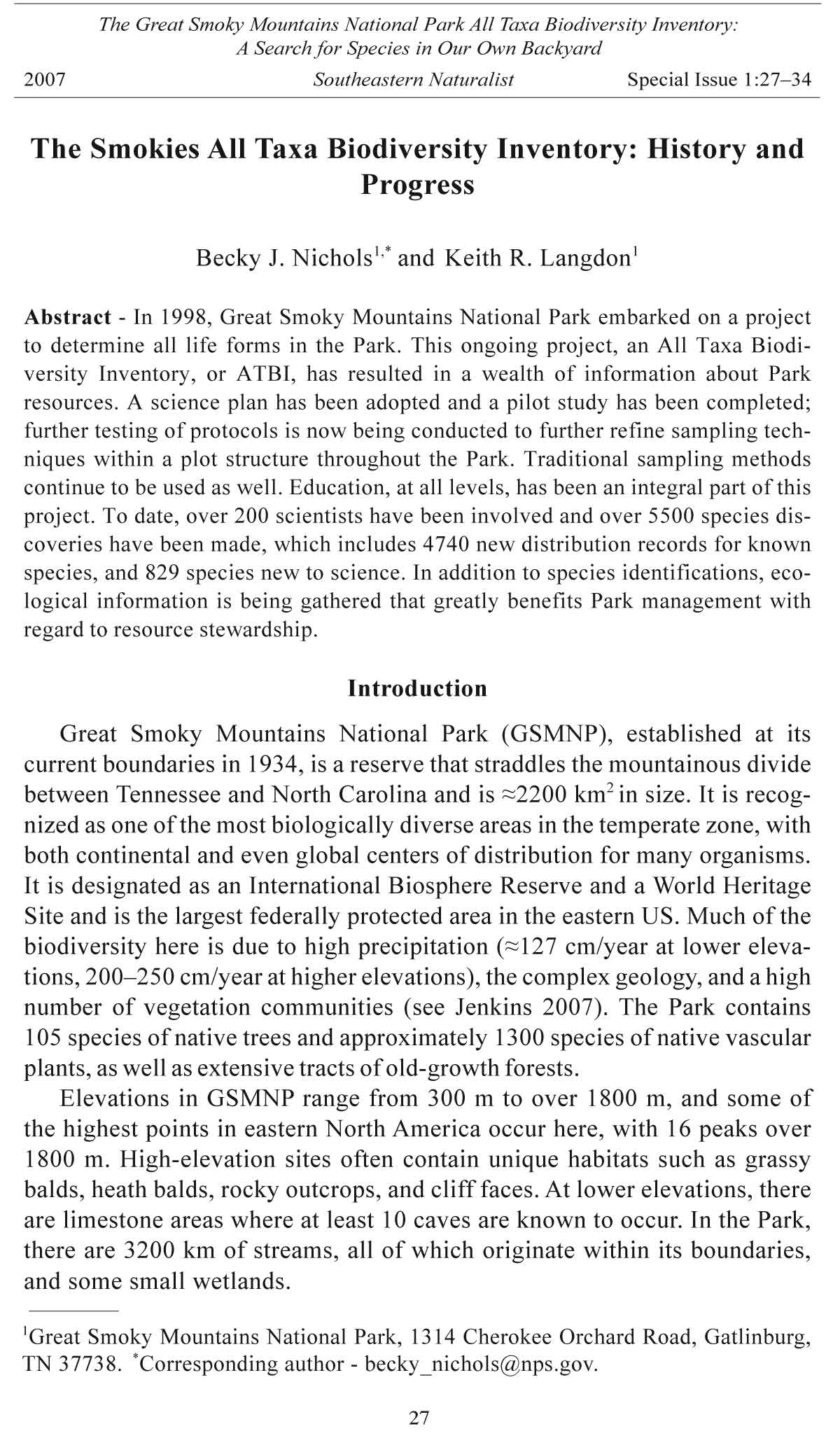
Vegetation Communities of Great Smoky Mountains
National Park
Michael A. Jenkins*
Abstract - Great Smoky Mountains National Park (GSMNP) contains one of the
most diverse assemblages of vegetation communities in North America. Over 70
unique community associations comprised of over 1300 native plant species have
been identified in the Park. This wide array of communities provides habitat for
unknown multitudes of other taxa whose abundance, distribution, and ecological
importance remain largely unknown. The All Taxa Biodiversity Inventory (ATBI)
underway in the Park is the first comprehensive attempt to better understand the
vast array of species present in the Park. This paper discusses the composition,
structure, distribution, and extent of vegetation communities in GSMNP. Detailed
assessments of the vegetation, site, and soil characteristics of the 19 ATBI plots are
also included.
Introduction
Great Smoky Mountains National Park (GSMNP) is internationally
renowned as a center of biodiversity within North America. Complex
ecological gradients combine to create a diverse mosaic of biological communities.
Elevations in the Park range from 267 to 2025 m with 16 peaks
greater than 1830 m. Topography is generally rugged and includes level valleys,
gentle to steep side slopes, incised drainages, talus slopes, and rocky
summits. The geology of the Great Smoky Mountains is extremely complex
and often highly variable over short distances. The bedrock is dominated
by metamorphosed sandstone, but acid-bearing slates, mafic and ultramafic
rock, and tectonic windows underlain with limestone also occur (Southworth
et al. 2005). This complex geology results in equally variable soils, which
for the first time are being comprehensively studied and mapped in GSMNP.
Annual rainfall varies from 140 cm at low elevations to over 200 cm on some
high peaks.
The biological importance and diversity of GSMNP led to its designation
as an International Biosphere Reserve in 1976 and World Heritage Site in
1983. Although the ATBI has helped highlight the diversity of many taxa
in GSMNP, the Park has long been viewed as a center of vascular plant diversity
in North America. White et al. (2003) identified 79 unique vegetation
communities or associations in GSMNP. These communities are comprised of
over 1600 species of vascular plants, of which less than a quarter are exotic
35
The Great Smoky Mountains National Park All Taxa Biodiversity Inventory:
A Search for Species in Our Own Backyard
2007 Southeastern Naturalist Special Issue 1:35–56
36 Southeastern Naturalist Special Issue 1
(NPS 2006). The Park also contains 86 vascular plant species endemic to the
southern Appalachians (White 1982), over 80 state-listed species (Bailey
2004, Franklin and Finnegan 2004), and 2 federally listed species (Franklin
and Finnegan 2004). In addition to its rich mix of vegetation communities,
GSMNP also contains one of the largest tracts of primary forest (a forest that
has never been logged and has developed following natural disturbances and
under natural processes) in eastern North America. Over 20% of the Park was
never cleared of timber (primary forest; Fig. 1), and these forests include
stands of old-growth that contain some of the largest trees in eastern North
America. According to the National Register of Big Trees (American Forests
2007), national champion trees of 13 species including Tsuga canadensis (L.)
Carr. (eastern hemlock), Picea rubens Sarg. (red spruce), and Acer rubrum L.
(red maple) are found in GSMNP.
Despite its large size (>200,000 ha) and protected status, numerous
biotic and abiotic factors have altered and continue to threaten vegetation
communities within GSMNP. Among biotic factors, exotic species (including
disease, insects, and plants) have been the most destructive. During the
1930s, Cryphonectria parasitica (Murrill) Barr (chestnut blight) virtually
Figure 1. Location of ATBI plots within anthropogenic disturbance types delineated
by Pyle (1988). 1 = Cades Cove, 2 = Gregory Bald, 3 = Tremont, 4 = Goshen Prong,
5 = Double Springs Gap, 6 = Andrews Bald, 7 = Clingmans Dome, 8 = Indian Gap, 9
= Mount LeConte-West Point, 10 = Mount LeConte-Boulevard, 11 = Twin Creeks, 12
= Trillium Gap, 13 = Brushy Mountain, 14 = Ramsay Cascade, 15 = Albright Grove,
16 = Snake Den Ridge, 17 = Oconaluftee, 18 = Cataloochee, 19 = Purchase Knob.
Purchase Knob was not included in the analyses of Pyle (1988).
2007 M.A. Jenkins 37
eliminated Castanea dentata (Marsh.) Borkh. (American chestnut) from the
forest landscape of eastern North America. Since it was first discovered in
1954 (Speers 1958), Adelges piceae (Ratzeburg), the balsam woolly adelgid,
has decimated Abies fraseri (Pursh) Poir. (Fraser fir) populations in
high-elevation spruce-fir forests (Jenkins 2003, Smith and Nicholas 1998),
and Adelges tsugae Annand (the hemlock adelgid) is already impacting
eastern hemlock in the Park. Since the late 1980s, Discula destructiva
Redlin, a pathogenic fungus that causes dogwood anthracnose, has
killed Cornus florida L. (flowering dogwood) trees throughout the Park,
and mortality has exceeded 90% in some forest types (Jenkins and White
2002). Over the past decade, beech bark disease, an insect/fungus complex,
has decimated Fagus grandifolia Ehrh. (American beech) trees in highelevation
hardwood forests (Vandermast 2005). Although the population
has been reduced since the 1970s, Sus scrofa L. (European wild boar) continues
to alter understory vegetation within the Park. Currently, GSMNP
actively controls around 50 exotic plant species that are known to displace
native species, hybridize with natives, or interfere with cultural landscapes
(Kristine Johnson, GSMNP Vegetation Management Specialist,Gatlinburg,
TN, pers. comm.).
Native ungulates also exert considerable influence on the composition
and structure of native vegetation. A lack of effective population control
often leads to extremely high population densities and heavy herbivory
that result in the degradation of vegetation communities (Rooney et al.
2004). In the woodlots and surrounding forests of Cades Cove, Odocoileus
virginianus Zimm. (white-tailed deer) have altered the cover, diversity,
and population demographics of forest herbs (Webster et al. 2005a) and
suppressed tree regeneration (Griggs et al. 2006). In 2001, Cervus elaphus
Erxleben (elk) was reintroduced in GSMNP. If this species is successfully
reestablished, it may have considerable effects on a wide range of vegetation
communities throughout the Park.
Alterations in the Park’s disturbance regimes have also impacted vegetation
communities. Throughout the Park, plant communities continue to
recover from past unregulated logging and agricultural use (Pyle 1988, Webster
et al. 2005b). Fire suppression has allowed the succession of numerous
pine stands to hardwood dominance. In the absence of fire, succession
towards hardwoods is accelerated by mortality caused by Dendroctonus
frontalis Zimmermann (southern pine beetle; Coulson et al. 1999). Within
hardwood stands, oak species are not regenerating under closed canopies on
mesic sites (Jenkins and White 2002). The recently implemented prescribed
burning program within the Park is counteracting many of these successional
changes, but the full effect of fire on species composition and stand structure
must be evaluated.
Among abiotic factors, inputs of air-borne pollutants have been well
documented for over two decades and are likely impacting vegetation communities
at high elevations. In GSMNP, research has shown that elevated
38 Southeastern Naturalist Special Issue 1
ozone levels have negative impacts on 25 species of plants (Chappelka
and Samuelson 1998). Although difficult to quantify, deposition of sulfur
dioxide, nitrogen oxides, and particulate matter may impact vegetation
communities by acidifying soils in susceptible areas, resulting in greater
aluminum toxicity and cation leaching (Cronan and Schofield 1990, Huntington
2000).
A long succession of researchers have examined the distribution and
underlying gradients of the complex mixture of vegetation communities that
occur in GSMNP (Cain 1930, 1931; Golden 1981; MacKenzie and White
1998; White et al. 2003; Whittaker 1956). In one of the earliest studies,
Cain (1931) examined the effects of soil acidity on the distribution of plant
species and vegetation communities within the Park. In a paper that greatly
infl uenced subsequent work, Whittaker (1956) examined the role of complex
environmental gradients, including elevation and topography, on the
distribution of vegetation communities. The vegetation types delineated by
Whittaker (1956) have served as the starting point for subsequent classification
efforts in GSMNP (Golden 1981, White et al. 2003). The conservation
organization NatureServe created a vegetation classification of GSMNP
that draws from the International Classification of Ecological Communities
(ICEC), a system developed by ecologists from NatureServe and The Nature
Conservancy to describe, classify, and rank specific ecological community
types (White et al. 2003). Like many federal agencies, the National Park
Service has adopted the ICEC as its standard for the classification and description
of vegetation. This hierarchal classification developed for GSMNP
describes 79 vegetation communities (or associations) and ranks them based
upon rarity and threats. This classification has proven to be an invaluable
resource for conservation planning, environmental impact analysis, and
ecological research.
In this paper, I describe the vegetation communities of Great Smoky
Mountains National Park. The species composition, site characteristics, and
extent of major vegetation types are described. In addition, more detailed
descriptions of the species composition, stand structure, coarse woody
debris, and soil chemistry of the 19 ATBI plots (Fig. 1, sampling methods
discussed below) are provided.
Methods used to sample ATBI plots
Between June and August of 1999, nineteen ATBI sites were established
to develop and test sampling methodologies. These sites were selected to
represent the range of vegetation communities that occur across the Park.
At each ATBI site, a large area was delineated (typically 1 ha) to serve as
a sampling and collecting area for ATBI researchers. Within each of these
areas, either a 0.1-ha (20-m x 50-m) or 0.2-ha (40-m x 50-m) permanent
vegetation plot was established. The larger plot size was used in the three
old-growth forest sites (Albright Grove, Cataloochee, Ramsay Cascade) to
better capture the variability of canopy trees; all other sites were sampled
with a 0.1-ha plot. On forested plots, the dbh of all living and dead stems
2007 M.A. Jenkins 39
less than 10 cm dbh were tallied by species into 4 dbh classes: 0.1–0.9 cm, 1.0–2.4
cm, 2.5–4.9 cm, and 5.0–9.9 cm. The dbh of all living and dead stems ≥10
cm was measured and recorded by species. Seedling density was recorded
in four 10-m2 (3.16-m x 3.16-m) subplots distributed across the 0.1-ha
plot (eight subplots were used within 0.2-ha plots). The percent cover of
all species was visually estimated in four 100-m2 (10-m x 10-m) modules
embedded within the larger 0.1-ha plot (eight modules were sampled
within 0.2-ha plots). The length and midpoint diameter (MPD) of all down
deadwood (DDW) with a MPD of ≥10 cm were also measured. Only portions
of DDW ≥10 cm diameter and located within the plot were measured.
Samples of the soil A-horizon (approximately 10 cm depth) were collected
from across the ATBI sites. The basal area of living and dead trees and the
volume of DDW were calculated for each plot and converted to a per hectare
basis (presented in Table 1 and Fig. 2).
Vegetation Communities of Great Smoky Mountains National Park
Because of the variety and complexity of vegetation communities in
GSMNP, a comprehensive discussion of individual communities is beyond
the scope of this paper. Although White et al. (2003) identified 79 unique
vegetation communities, for the purpose of this discussion I have grouped
these associations into 11 major types comprised of 8 forested (montane
Table 1. Anthropogenic disturbance history, down deadwood (DDW) volume, and basal area
of standing deadwood (SDW; snags) on the 19 ATBI plots established in 1999. Anthropogenic
disturbance is based upon Pyle (1988).
Anthropogenic DDW volume SDW basal
Site disturbance history (m3 ha-1) area (m2 ha-1)
Clingmans Dome Undisturbed Not sampled 30.5
Mt. LeConte- Boulevard Undisturbed 119.6 28.4
Mt. LeConte-West Point Undisturbed 199.1 29.1
Double Springs Diffuse 23.4 3.1
Indian Gap Undisturbed 25.6 2.4
Trillium Gap Undisturbed 22.8 4.0
Andrews Bald Settlement 1.5 1.4
Gregory Bald Settlement Absent Absent
Brushy Mt. Undisturbed Absent Absent
Albright Grove Undisturbed 164.4 9.6
Cataloochee Undisturbed 182.5 1.5
Ramsay Cascade Undisturbed 74.0 2.1
Snake Den Ridge Undisturbed 134.8 2.1
Goshen Prong Corporate logging 15.5 2.0
Oconaluftee Settlement 28.4 2.7
Purchase Knob Logging1 29.9 1.8
Tremont Corporate logging 126.1 1.6
Twin Creeks Settlement 17.0 2.4
Cades Cove Settlement Absent Absent
1Purchase knob was not included in the land-use history by Pyle (1988). Based upon the history
of western North Carolina and contemporary stand conditions, this site was most likely
logged.
40 Southeastern Naturalist Special Issue 1
Figure 2.
O v e r s t o r y
basal area of
living trees
on 14 forested
ATBI plots.
P l o t s a r e
grouped as
follows: (A)
mid-to-highe
l e v a t i o n
forests, (B)
mid-elevation
primary forest,
and (C)
low-to-midelevation
secondary
forest.
Ve g e t a t i o n
data were not
collected on
the Brushy
M o u n t a i n
ATBI plot.
2007 M.A. Jenkins 41
alluvial forests, early successional forests, cove forests, hemlock forests,
montane oak-hickory forests, xeric ridge forests, high-elevation hardwood
forests, and spruce-fir forests) and 3 non-forested types (heath balds,
grassy balds, and pasture). Associations were grouped into these types
based upon similarities in species composition, landscape position, and
management issues.
Montane alluvial forest
According to White et al. (2003), this forest type (comprised of 4 associations)
occurs within the narrow rocky floodplains and islands of
medium-sized rivers below 915 m elevation. The canopy of this forest type
in GSMNP typically contains Platanus occidentalis L. (American sycamore)
in varying amounts. Other overstory species include Liriodendron
tulipifera L. (tulip-poplar), eastern hemlock, and Betula (birch) species.
Rhododendron maximum L. (rosebay rhododendron) and Leucothoe fontanesiana
(L.) Gray (dog-hobble) typically dominate the shrub layer, which
may be quite dense along smaller streams and more narrow drainages. The
shrub layer is often less developed in forests along large rivers in GSMNP,
such as the Little River, Little Pigeon River, and Oconaluftee River. Herbaceous
species composition is quite variable in this forest type and can be
very patchy where shrubs dominate.
Montane alluvial forests are naturally uncommon in the southern Appalachians
because they occupy a very discrete landscape position. For example,
according to Madden et al. (2004), this forest type covers approximately 1%
Table 2. Total cover, percent of Park area, and NatureServe associations of 12 broad vegetation
types in Great Smoky Mountains National Park (GSMNP).
Total cover Percent of
Vegetation type (ha) Park area AssociationsA
Acid cove forests 8912 4.3 7543, 7693
Cove hardwood forests 25,130 12.2 7695, 7710, 7878
Early successional forests 10,295 5.0 2591, 7219, 7879, 7944
Heath balds 2613 1.3 3814, 7876
Hemlock forests 4089 2.0 7102, 7136
High-elevation hardwood forests 34,109 16.6 4973, 4982, 6124,6130,6246,7285,
7295, 7298, 7299, 7300, 7861
Montane alluvial forest 2579 1.3 4420, 4691, 7339, 7880
Montane oak-hickory forest 64,566 31.3 6192, 6286, 7230, 7240, 7267,
7691, 7692, 8558
Pasture, old fields, grassy balds 943 0.5 4048, 4242
Spruce-fir forest 15,514 7.5 3839, 4983, 6049, 6256, 6272,
6308,7130, 7131
Xeric ridge forests 33,331 16.2 3560, 6271,7078,7097,7100,7119,
7493,7517, 7519
Other 4005 1.9 Numerous
AVegetation types are based upon Ecogroups developed by NatureServe. Full association descriptions
are provided in White et al. (2003). Coverages were estimated using the vegetation
map of GSMNP created by Madden et al. (2004). Because some associations cannot be discerned
from aerial photographs, the vegetation map does not include all listed associations.
42 Southeastern Naturalist Special Issue 1
of GSMNP (Table 2). Most montane alluvial forest in the Park occurs along
smaller streams; the amount of this type that occurs within the fl oodplains
of larger streams is considerably less. In addition, many areas of this forest
type have been lost outside the Park due to agriculture and development.
This community type is further threatened by road building and alterations
to hydrology (White et al. 2003). Consequently, well-developed examples
are rare, and existing forests of this type are a conservation priority.
The Oconaluftee ATBI plot is located in montane alluvial forest. The
canopy of this site is dominated by Platanus occidentalis and Liriodendron
tulipifera (Fig. 2), but also contains Quercus imbricaria Michx. (shingle
oak) and Juglans cinerea L. (butternut: a rare species that has been heavily
impacted by Sirococcus clavigignenti-juglandacearum Nair, Kostichka &
Kuntz [butternut canker]). Because of the presence of Q. imbricaria, this
site is classified as Platanus occidentalis-Fraxinus pennsylvanica-Quercus
imbricaria Forest, a variant of montane alluvial forest (White et al. 2003).
The shrub layer at this site is rather sparse, but the herb layer is quite species
rich. Overall, this plot had a high richness of vascular plant species; total
richness across all strata was 100 species. However, six of these species
were exotic. Despite historically intensive land use (Table 1), this site still
Table 3. Site and soil characteristics of the 19 ATBI plots established in 1999. OM = organic
matter, CEC = cation exchange capacity.
Elevation Slope Soil Soil OM Ca/K/Mg
Site (m) Aspect (%) pH (%) CEC saturation (%)
High-elevation spruce-fir forest
Clingmans Dome 1956 98 32 3.6 3.9 8.4 7.0/1.5/3.0
Mt. LeConte-Boulevard 1978 45 15 3.6 3.8 7.4 6.8/1.2/2.4
Mt. LeConte-WP 1912 10 33 3.5 3.8 8.2 12.7/1.9/4.8
Mid-to-high-elevation beech forest
Double Springs 1685 20 60 3.4 2.8 7.0 9.5/1.6/3.3
Indian Gap 1634 143 48 3.4 3.5 6.6 13.5/2.9/4.1
Trillium Gap 1429 285 47 3.5 3.5 8.0 9.5/2.2/3.0
Grassy and heath balds
Andrews Bald 1757 NA NA 4.4 3.5 7.9 5.8/2.4/3.2
Gregory Bald 1506 NA NA 4.0 3.9 9.5 7.8/2.4/3.2
Brushy Mt. (heath) 1468 135 24 3.7 4.4 8.3 6.9/2.0/4.2
Low-to-mid-elevation primary forest
Albright Grove 1033 353 36 3.5 3.9 10.0 11.3/2.5/3.0
Cataloochee 1385 188 32 4.8 3.8 7.8 13.8/2.7/3.8
Ramsay Cascade 935 220 36 4.0 3.5 7.2 7.3/2.6/3.9
Snake Den Ridge 932 20 60 3.5 3.9 8.8 15.5/1.8/2.9
Low-to-mid-elevation secondary forest
Goshen Prong 917 11 12 4.1 3.0 8.7 19.7/2.7/4.0
Oconaluftee 612 NA NA 4.7 2.3 6.9 33.1/3.5/6.8
Purchase Knob 1324 165 23 4.5 3.5 8.9 15.7/2.5/4.0
Tremont 544 28 35 5.7 3.0 12.3 62.1/2.1/9.0
Twin Creeks 594 311 10 4.8 3.1 8.1 20.5/2.8/6.6
Old field
Cades Cove 522 NA NA 5.7 2.6 8.8 48.4/2.7/10.9
2007 M.A. Jenkins 43
had relatively high cation (Ca, K, Mg) saturation values (Table 3). Due to
rapid decomposition and regular fl ooding, this site had the lowest percent
organic matter (OM) of any site (2.3%). This lack of organic matter likely
resulted in low overall cation exchange capacity (CEC = 6.9) compared to
other low-elevation sites.
Early successional forests
This very common forest type is comprised of 4 associations that regenerated
on abandoned agricultural land or heavily logged forests (Fig. 1) and
covers over 10,000 ha in the Park (5% of total park area; Table 2). As its name
suggests, this forest type is transitional on the landscape and is dominated
by early successional species such as L. tulipifera, Robinia pseudoacacia L.
(black locust), and Pinus virginiana P. Mill. (Virginia pine). Other canopy
species may include A. rubrum, Pinus strobus L. (white pine), and Betula
lenta L. (black birch). Sites that have experienced more severe disturbance
that left exposed mineral soil are often dominated by P. virginiana. Shrub
cover is typically sparse to moderate. Herbaceous cover is also sparse to
moderate and of mixed species composition with no clear dominant. On sites
dominated by P. virginiana, the understory is typically open with little shrub
or herbaceous cover. Because this forest type is successional, most species
that currently dominate the stand will decrease in dominance with stand development
and succession. Many stands of this forest type were originally
montane alluvial or cove forest and with time may redevelop the species
composition and structure associated with these forest types.
The Tremont ATBI plot is located in this general forest type. Because of
its heavy dominance by L. tulipifera and history of corporate logging, this
site is classified as Liriodendron tulipifera-Acer rubrum-Robinia pseudoacacia
Forest (Early Successional Appalachian Hardwood Forest; White
et al. 2003). Although this site was heavily logged prior to creation of the
Park (Fig. 1), its soil was the most productive of any of the ATBI plots and
had the highest pH (5.7), CEC (12.3), and calcium saturation (62.1%) of all
the plots (Table 3). In addition, its magnesium saturation (9.0%) was second
only to the Cades Cove plot. The productivity and topographic position
of this site suggest that it was a cove forest prior to logging. This secondary
forest site contained a volume of DDW (126.1 m3 ha-1) comparable to some
primary forests (Table 1).
Cove forests
NatureServe lists five different associations of cove forest in GSMNP,
comprised of 2 acid cove and 3 cove hardwood associations (White et al.
2003), which are separated by the relative dominance of hardwoods versus
T. canadensis and the richness of the herb layer. Cove forests are typically
found in sheltered landscape positions below 1200 m, although some types
are found above 1300 m. Aspects are generally northerly, but cove forests
occur across a range of aspects. Rich coves, defined as Southern Appalachian
Cove Forest (Rich Montane Type) by White et al. (2003), typically
44 Southeastern Naturalist Special Issue 1
have canopies dominated by Acer saccharum Marsh. (sugar maple), Aesculus
fl ava Ait. (yellow buckeye), Tilia americana L. (American basswood),
and Halesia tetraptera var. monticola (Rehd.) Reveal & Seldi (silverbell).
The shrub layer is typically sparse or absent, and the herbaceous layer is
lush and species-rich. Although similar in composition, typic coves, defined
as Southern Appalachian Cove Forest (Typic Montane Type) by White et
al. (2003), contain a larger component of overstory L. tulipifera intermixed
with H. tetraptera, T. americana, and A. rubrum. The shrub layer is sparse
to moderate in cover, and the herb layer is diverse, but has lower cover than
rich coves. Rich and typic cove forests cover approximately 25,000 ha of
GSMNP (12% of total Park area; Table 2).
The canopies of acid cove forests are typically dominated by T.
canadensis. White et al. (2003) delineated two types of acid cove forest:
Southern Appalachian Acid Cove Forest (Typic Type) and Southern Appalachian
Acid Cove Forest (Silverbell Type). The canopy of the typic type
is dominated by T. canadensis and may also contain L. tulipifera, B. lenta,
and A. rubrum. The shrub layer is typically dominated by R. maximum,
which ranges in density from scattered to heavy. The herbaceous layer is
typically sparse with low species richness. The typic type often occurs in
association with upland streams. The Silverbell Type is typically dominated
by T. canadensis and H. tetraptera var. monticola. Some forests of
the Silverbell Type have dense R. maximum in the shrub layer, but typically
the shrub layer is relatively open. The herbaceous layer of this type
is typically sparse to moderate in coverage and usually contains more species
than the typic type. Acid cove forests cover approximately 8900 ha in
GSMNP (4% of total Park area; Table 2).
Five of the ATBI plots are located in cove forests: Albright Grove,
Snake Den Ridge, Goshen Prong, Twin Creeks, and Purchase Knob
(Fig. 1). Two of these plots—Albright Grove and Snake Den Ridge—are
located in primary forest. The three other plots—Goshen Prong, Twin
Creeks, and Purchase Knob—are located in secondary forest that regenerated
following logging.
The Albright Grove ATBI plot is located in Tsuga canadensis-Halesia
tetraptera-(Fagus grandifolia, Magnolia fraseri)/Rhododendron maximum/
Dryopteris intermedia Forest (White et al. 2003). As described
above, the common community name for this association is Southern
Appalachian Acid Cove Forest (Silverbell Type). The canopy on this plot
is dominated by T. canadensis and H. tetraptera var. monticola with a
lesser component of B. lenta (Fig. 2). The shrub layer of this plot is fairly
open with scattered H. tetraptera var. monticola and A. saccharum saplings
and widely spaced stems of R. maximum. Percent herbaceous cover
is moderate, and 34 herbaceous species have been identified on the plot.
Structurally, Albright Grove is in the old-growth stage of stand development
(Oliver and Larson 1996). Consequently, it contains the greatest
live basal area of any plot sampled (Fig. 2), as well as a large volume of
2007 M.A. Jenkins 45
DDW (164.4 m3 ha-1) and basal area of standing deadwood (SDW; 9.6 m2
ha-1; Table 1).
The Snake Den Ridge ATBI plot is also located in Tsuga canadensis-
Halesia tetraptera-(Fagus grandifolia, Magnolia fraseri)/Rhododendron
maximum/Dryopteris intermedia Forest (White et al. 2003). Although
similar to Albright Grove in overstory composition, this site contains a more
diverse canopy, including a fairly large component of F. grandifolia (Fig. 2).
Compared to Albright Grove, this plot has a denser shrub layer dominated
by R. maximum. In addition, the herbaceous layer is sparse and less diverse
than Albright Grove (19 total herbaceous species). This site also is in the
old-growth stage of stand development and contains the second highest basal
area of any plot. This site also contains a volume of DDW comparable to
other old-growth plots (134.8 m3 ha-1; Table 1).
The Goshen Prong ATBI plot is located in Liriodendron tulipifera-Aesculus
fl ava-(Fraxinus americana, Tilia americana var. heterophylla)/Actaea
racemosa-Laportea canadensis Forest (White et al. 2003). As described
above, the common community name for this association is Southern Appalachian
Cove Forest (Typic Montane Type). The overstory of this plot
is dominated by L. tulipifera, with large components of H. tetraptera var.
monticola, Aesculus fl ava, and B. alleghaniensis (Fig. 2). The shrub layer
is very sparse, but the herb layer is species rich (52 herbaceous species). As
with many post-logging forests that are still in the stem-exclusion stage of
stand development (Oliver and Larson 1996), the plot contains relatively
little coarse woody debris. Although this plot had a low pH compared to
other low-to-mid-elevation secondary forests, its CEC and cation-saturation
values were comparable to other coves (Table 3).
The Twin Creeks ATBI plot is also located in Liriodendron tulipifera-
Aesculus fl ava-(Fraxinus americana, Tilia americana var. heterophylla)/
Actaea racemosa-Laportea canadensis Forest. Its overstory is dominated by
L. tulipifera, with large components of A. rubrum and B. lenta (Fig. 2). The
shrub layer is dominated by T. canadensis, R. maximum, and B. lenta. However,
prior to the onset of dogwood anthracnose, C. fl orida was a common
understory species. The herbaceous layer of the plot is relatively species
rich (34 herbaceous species), but no single species dominates cover. The soil
chemistry of this site is very similar to other low-to-mid-elevation hardwood
forests (Table 3).
The Purchase Knob ATBI plot is also located in Liriodendron tulipifera-
Aesculus fl ava-(Fraxinus americana, Tilia americana var. heterophylla)/
Actaea racemosa-Laportea canadensis Forest. However, the large component
of R. pseudoacacia (Fig. 2) suggests that this site was logged more
recently than the other secondary cove forests. This plot is located at a
higher elevation, by far, than any other cove forest ATBI plot (1324 m).
Northern hardwood forests typically occur at this elevation, but because this
plots contains L. tulipifera as a canopy co-dominant, it is not classified as a
northern hardwood forest (White et al. 2003). The understory of this plot is
46 Southeastern Naturalist Special Issue 1
open and dominated by A. saccharum, H. tetraptera var. monticola, and T.
canadensis. The herbaceous layer contains more species than any other cove
forest (63 herbaceous species). Perhaps as a result of slower decomposition
at higher elevations, this plot has the highest organic matter content of any
low-to-mid-elevation secondary forest (Table 3).
Hemlock forests
NatureServe (White et al. 2003) has delineated two associations of
hemlock forest in GSMNP: Southern Appalachian Eastern Hemlock Forest
(White Pine Type) and Southern Appalachian Eastern Hemlock Forest (Typic
Type). Although T. canadensis occurs in the overstory of both types, the
canopy of the white pine type is dominated or co-dominated by P. strobus.
The shrub layer of these forests is typically dominated by R. maximum and
L. fontanesiana. The herb layer is sparse; typical species include Dryopteris
intermedia (Muhl. Ex illd.) Gray (intermediate wood fern), Goodyera
pubescens (Willd.) R. Br. Ex Ait. F. (downy rattlesnake-plantain), Mitchella
repens L. (partridgeberry), and Polystichum acrostichoides (Michx.) Schott
(Christmas fern). These forests typically occur on lower protected slopes
and terraces below 2300 m elevation. According to Madden et al. (2004),
hemlock forest comprise only 2% of the Park’s forest cover (Table 2). However,
T. canadensis is one of the most common tree species in the Park and
occurs as a co-dominant or subcanopy species across a broad range of forest
community associations.
Montane oak-hickory forests
NatureServe has identified eight associations of montane oak-hickory
forests in GSMNP (White et al. 2003). These forests occur across a wide
range of elevations extending from 340 m to 1370 m and are found on a
range of aspects. Generally, these forests occur on more-exposed convexshaped
slopes than cove forests. However, this forest type is often found
in protected landscape positions. Montane oak-hickory forest is the most
common general forest type in GSMNP and covers approximately 64,600
ha (31% of total Park area; Table 2). The Cataloochee ATBI plot is located
in this general forest type.
The Cataloochee ATBI plot is located in Quercus rubra-Acer rubrum/
Calycanthus fl oridus-Pyrularia pubera/Thelypteris noveboracensis Forest
(White et al. 2003). The common community name for this association is
Appalachian Montane Oak-Hickory Forest (Red Oak Type). The overstory
of this plot is dominated by Quercus rubra L. (northern red oak) with lesser
amounts of A. rubrum, Quercus prinus L. (chestnut oak), and Quercus alba
L. (white oak; Fig. 2). The shrub layer of this plot is relatively open and
dominated by Acer pensylvanicum L. (striped maple), Amelanchier laevis
Wieg. (serviceberry), and sprouts of C. dentata. The herbaceous layer of this
plot contained 51 species.
Although this stand has old-growth characteristics, its total basal area
is comparable to that of the low-to-mid-elevation secondary forest ATBI
2007 M.A. Jenkins 47
plots (Fig. 2). However, the DDW volume (Table 2) of this plot is higher
than that of other old-growth plots (Albright Grove, Snake Den Ridge, and
Ramsay Cascade). Much of the DDW on this plot was C. dentata that was
killed by chestnut blight at the turn of the century, suggesting that this forest
was once heavily dominated by C. dentata. The lower basal area found
on this site suggests that this stand is still accruing biomass following the
loss of C. dentata. The very low basal area of SDW (1.5 m2 ha-1; Table 1)
suggests that the dominant Quercus overstory has not begun to experience
significant mortality.
Xeric ridge forests
This suite of forest types is dominated by Pinus and Quercus species and
typically occurs on ridges and exposed south- to west-facing slopes. This
broad group of forest types covers 33,330 ha of GSMNP (16% of total Park
area, Table 2). NatureServe has identified 7 associations within the general
forest type that occur within the Park and two that are likely to occur. The
more xeric of these types are dominated by yellow pine species: Pinus echinata
P. Mill. (shortleaf pine), Pinus pungens Lamb. (Table Mountain pine),
Pinus rigida P. Mill. (pitch pine), and P. virginiana. Pinus pungens, which
is a dominant species in the Pinus pungens-Pinus rigida-(Quercus prinus)/
Kalmia latifolia-Vaccinium pallidum Forest association (White et al. 2003),
is endemic to the central and southern Appalachian Mountains. This species
has serotinous cones and is likely dependent upon fire for reproduction
(Zobel 1969, but see Barden 2000). Over the past 20 years, yellow pine
stands throughout the southern Appalachians have been decimated by the
southern pine beetle (SPB). Although this insect is native, over 70 years
of fire suppression have altered its role in the disturbance regime of native
pine forests (Harrod et al. 1998). As a result of fire suppression, overstory
tree density and the density of Kalmia latifolia L. (mountain laurel) have increased
and thick layers of leaf litter have accumulated. The resulting heavy
shade and thick duff layer prevent pine seedlings from establishing (Welch
et al. 2000). The increased density of pine trees increases the abundance and
spread of the SPB, resulting in greater rates of mortality (Zhang and Zeide
1999). Following mortality, the lack of pine regeneration causes the developing
stand to be dominated by hardwood species.
Less xeric associations within this general type include forests dominated
by P. strobus, Q. prinus, Quercus coccinea Muenchh. (scarlet oak),
and Q. alba. These forest types are typically found on lower ridges and
less-exposed slopes. This general forest type also includes an association
comprised of Q. prinus and Q. coccinea, but without a yellow pine component.
The Ramsay Cascade ATBI plot is located in this association.
The Ramsay Cascade ATBI plot is located in Quercus (prinus, coccinea)/
Kalmia latifolia/ (Galax urceolata, Gaultheria procumbens) Forest (White
et al. 2003). The common community name for this association is Chestnut
Oak Forest (Xeric Ridge Type). Quercus prinus dominates the overstory
(Fig. 2) and occurs over a dense shrub layer of R. maximum, K. latifolia, and
48 Southeastern Naturalist Special Issue 1
Gaylussacia ursina (M.A. Curtis) Torr. & Gray ex Gray (bear huckleberry).
The herbaceous layer is dominated by typical dry-site species such as G.
urceolata and Smilax rotundifolia L. (greenbrier). Overall, the herbaceous
layer is relatively depauperate of species (11 herbaceous species). This plot
contained the lowest volume of DDW of any low-to-mid-elevation primary
forest sampled (74.0 m3 ha-1; Table 1). Soils were acidic (pH = 4.0) with low
CEC and cation saturation (Table 3).
High-elevation hardwood forests
This group of forest types includes northern hardwood forests, highelevation
oak forests, forested boulderfields, and beech gap forests. These
forests cover 34,109 ha of GSMNP (17% of total Park area; Table 2). NatureServe
identifies 11 associations within this class of forest types. These
forest types all occur at elevations greater than 1040 m and range as high
as 1645 m. More-exposed landforms with more southerly aspects are often
dominated by Q. rubra or Q. alba. Less-exposed sites with more northerly
aspects are often dominated by northern hardwood species including Betula
alleghaniensis Britt. (yellow birch), A. saccharum, Aesculus fl ava, and F.
grandifolia. In northeastern North America, large-scale decline of A. saccharum
has occurred, likely as a result of the combined effects of insect
defoliation, soil acidification, and drought (Horsley et al. 2002). An exotic
insect, Taeniothrips inconsequens (Uzel; pear thrips), that has been a major
contributor to A. saccharum decline in the Northeast was recently collected
in GSMNP by an ATBI researcher. High-elevation forests in the Park have
long experienced heavy levels of acid deposition (Shaver et al. 1994), and
drought is a common occurrence in the southern Appalachians (Clinton et
al. 2003). Therefore, this forest type should be monitored for the onset of A.
saccharum defoliation and decline.
This class of forest types also includes one of the most threatened communities
in the southern Appalachians: beech gap forests. These forests occur
at elevations above 1370 m and typically are located on upper slopes or in
saddles or gaps. They often are found within a matrix of other high-elevation
hardwood forests, but also occur as islands within P. rubens forest. These
unique forests are comprised of nearly pure stands of F. grandifolia where
reproduction is almost exclusively from root sprouts (Russell 1953). This
results in high stem densities of F. grandifolia, but also produces low genetic
diversity within the species (Kitamura et al. 2001, but see Morris et al. 2004).
Beech forests throughout eastern North America have been decimated
by beech bark disease, an exotic insect-fungal pathogen complex (Houston
1994). Infection with beech bark disease is initiated with an infestation
of Cryptococcus fagisuga Lind. (beech scale), a parthenogenic insect that
facilitates infection of meristematic tissue with one of two species of Nectria
fungi: N. coccinea, an exotic species, or N. galligena, a native species
(Mahoney et al. 1999). Between 1986–2002, Vandermast (2005) found an
annual mortality rate of 5.4% in infected stands and nearly 100% cumulative
mortality in the most severely infected stands.
2007 M.A. Jenkins 49
Three ATBI plots are located in beech gap forests (Indian Gap, Trillium
Gap, and Double Springs Gap). All of these plots are in Fagus grandifolia/
Carex pensylvanica–Carex brunnescens Forest (White et al. 2003). The
canopies of all three plots are dominated by F. grandifolia, although all
three stands have experienced heavy dieback and mortality from beech bark
disease (Fig. 2). The canopy at Trillium Gap has a large component of H.
tetraptera var. monticola, and the canopy at Double Springs Gap has a large
component of Aesculus fl ava. The shrub layers of all three plots are heavily
dominated by root sprouts of F. grandifolia. Carex pensylvanica Lam.
(Pennsylvania sedge), D. intermedia, Rugelia nudicaulis Shuttlw. Ex Chapman
(Rugel’s ragwort), and Laportea canadensis (L.) Weddell (wood-nettle)
are important herbaceous species at Trillium Gap and Indian Gap. The
herbaceous layer of Double Springs Gap was dominated by C. pensylvanica
and two fern species: D. intermedia and Athyrium filix-femina (southern lady
fern). Total herbaceous-layer richness was similar at the three sites; Indian
Gap contained 27 herbaceous species, Trillium Gap contained 23 species,
and Double Springs Gap contained 20 species. Soils at all three beech gap
plots were very acidic (maximum pH = 3.5) with low to moderate cation
saturation and CEC (Table 3).
Spruce-fir forests
Spruce-fir forests cover 15,500 ha of GSMNP (8% of total Park area;
Table 1). Picea rubens and A. fraseri are the dominant overstory species,
with A. fraseri typically dominating stands above 1890 m elevation, P.
rubens co-dominating between approximately 1675 and 1890 m elevation
(Whittaker 1956), and P. rubens co-dominating with northern hardwoods
and T. canadensis as low as 1480 m elevation. Although the range of P.
rubens extends to northeastern Canada, A. fraseri is endemic to the southern
Appalachian Mountains (White 1984). Betula alleghaniensis is the most
common hardwood species in spruce-fir forest, with Acer spicatum Lam.
(mountain maple), Prunus pensylvanica L. f. (pin cherry), and Sorbus americana
Marsh. (American mountain ash) also occurring (Whittaker 1956).
NatureServe identified 8 associations of spruce-fir forest in GSMNP (White
et al. 2003, Table 2).
Because of their topographic and geographic isolation, spruce-fir forests
of the southern Appalachian Mountains are rich in rare and endemic species.
Eight plant species, 17% of the characteristic species of these forests, are
endemic to the high peaks of the southern Appalachians (White 1984). One
of these species, R. nudicaulis, is only found within the boundary of Great
Smoky Mountains National Park. Southern Appalachian spruce-fir forest
is also listed as critical habitat for the federally endangered Microhexura
montivaga Crosby & Bishop (spruce-fir moss spider) and provides important
foraging habitat for two federally endangered southern Appalachian subspecies
of northern fl ying squirrel (Glaucomys sabrinus fuscus Miller and G. s.
coloratus Handley; Loeb et al. 2000).
50 Southeastern Naturalist Special Issue 1
Spruce-fir forests in the southern Appalachians were commercially
logged, and huge slash fires occurred after logging. As a result, present-day
southern Appalachian spruce-fir forest has been estimated to occupy 10% to
50% of its former extent (Korstian 1937, Saunders 1979). The reduction of
spruce-fir forest in GSMNP has been less severe than elsewhere in the southern
Appalachians. According to Pyle (1988), the area that became GSMNP
contained 17,910 ha of spruce-fir forest prior to logging. Following logging,
this total was reduced by 25% to 13,370 ha. Dull et al. (1988) estimated that
present-day spruce-fir forest in the southern Appalachians occupies 26,610
ha, of which 74% is found in the Great Smoky Mountains. According to
the vegetation map developed by Madden et al. (2004), GSMNP contains
15,514 ha of spruce-fir forest.
Over the past 40 years, spruce-fir forests have been decimated by Adelges
piceae (Ratzenburg) (balsam woolly adelgid), an aphid-like insect
introduced from Europe that attacks A. fraseri. The adelgid feeds in the
bark fissures of A. fraseri trees over 4 cm dbh (Eagar 1984), causing the tree
to produce abnormally short and heavily lignified tracheids which reduces
water conduction and kills the tree in 2–7 years (Amman and Speers 1965).
Across the southern Appalachians, most mature A. fraseri trees have died
as a result of adelgid infestation (Jenkins 2003, Pauley and Clebsch 1990).
Because they occur at high elevations in exposed topographic conditions,
these forests also receive the highest levels of acid deposition and ozone
exposure in GSMNP (Johnson et al. 1991, Shaver et al. 1994).
Three of the ATBI plots are located in spruce-fir forest: Clingmans
Dome, Mt. LeConte-Boulevard, and Mt. Leconte-West Point. The three
plots are located in Abies fraseri/Viburnum lantanoides/Dryopteris campyloptera–
Oxalis montana/Hylocomium splendens Forest (White et al. 2003).
The common community name for this association is Fraser Fir Forest
(Deciduous Shrub Type). As a result of heavy overstory mortality from the
balsam woolly adelgid, all three of these plots have relatively low basal
area of living trees. This is particularly evident in the two plots located on
Mt. LeConte. Most of the overstory trees (≥10 cm dbh) are P. rubens or
species other than A. fraseri (Fig. 2). Due to heavy mortality of A. fraseri,
these plots have large volumes of DDW and basal area of SDW (Table 2).
Post-adelgid regeneration of A. fraseri dominated the sapling layer of two
plots: Clingmans Dome and Mt. LeConte-Boulevard (65% and 82% of total
sapling density, respectively). Although A. fraseri is present, saplings in
the Mt. LeConte-West Point plot consist largely of hardwood species, with
Viburnum lantanoides Michx. (hobblebush) comprising over 90% of the
total density of saplings. The shrub layers at both Mt. LeConte plots contain
heavy coverage of Rubus canadensis L. (smooth blackberry), an earlysuccessional
species that often dominates spruce-fir understories following
A. fraseri mortality. Soils on the three plots are acidic with low to moderate
cation saturation (Table 3).
2007 M.A. Jenkins 51
Non-forested Communities
Although most of GSMNP is forested, the Park does contain some notable
non-forested community types. Because they are surrounded by forest,
these communities may serve as islands of habitat for species that require
open non-forested or forest-edge habitat. In GSMNP, heath balds, grassy
balds, and pastures/old fields are the three most common non-forested community
types (Madden et al. 2004).
Heath balds
Heath balds are an unusual shrubland community type whose origin
has long been a mystery to ecologists. NatureServe has identified 2 associations
of heath balds in GSMNP (White et al. 2003). They occur at
elevations above 1270 m on exposed ridges, steep slopes, and rock outcrops
and cover approximately 2600 ha (approximately 1% of total Park
area; Table 2). The vegetation of heath balds consists of dense, nearly
impenetrable ericaceous shrubs. Rhododendron catawbiense Michx.
(catawba rhododendron) is typically the dominant species, but R. maximum
and K. latifolia are also common. Because of their thick shrub cover,
heath balds are very resistant to tree invasion and have not changed in area
within GSMNP since the 1930s (White et al. 2001). Other less common
species include Leiophyllum buxifolium (Berg.) Ell. (sand myrtle) and
Rhododendron carolinianum Rehd. (Carolina rhododendron). Typically,
herbaceous cover is sparse and consists of few species. The presence of
heath balds is positively correlated with burned sites, old-growth conditions,
and a highly acidic rock type. An ongoing study of bald age and
formation has revealed radiocarbon ages of base organic deposits ranging
from approximately 1000 to 3000 years before present (Robert Young,
Western Carolina University, Cullowhee, NC, pers. comm.). These dates
represent a minimum age of formation for each bald. In addition, the base
of the soil has consistently been a thick, persistent charcoal layer, suggesting
that bald formation may be initiated by fire. However, the carbon dating
results show that these fires predate European settlement.
One ATBI plot, Brushy Mountain, is located in a heath bald. This site
is classified as Kalmia latifolia–Rhododendron catawbiense–(Gaylussacia
baccata, Pieris fl oribunda, Vaccinium corymbosum Shrubland (common
community name: Southern Appalachian Mountain Laurel Bald; White et al.
2003). Soils on this site were very acidic (pH = 3.7) with low cation saturation
(Table 3). Because of the slow decomposition of ericaceous litter, this
plot had the highest percent organic matter of any plot (4.4%). The infl uence
of this organic matter on soil exchange sites contributed to the moderate
CEC value of this site (CEC = 8.3).
Grassy balds
As the name describes, grassy balds are treeless areas covered by grasses,
sedges, and forbs. In GSMNP, they occur on gently sloping ridges between
52 Southeastern Naturalist Special Issue 1
1320 m and 1615 m elevation. Danthonia compressa Austin ex Peck (mountain
oat grass) strongly dominates vegetation. Other characteristic species
include Potentilla canadensis L. (dwarf cinquefoil), Rumex acetosella L.
(common sheep sorrel), and Cinna latifolia Griseb. (woodreed). Some balds
contain populations of unusual or rare plants that cannot grow in shady environments.
Although most balds in GSMNP are thought to have originated
from livestock grazing, two balds—Gregory Bald and Parsons Bald—are
described as “bald spots” in an 1821 survey of the Tennessee–North Carolina
state line (Langdon 1999).
Following the creation of the Park and the resulting cessation of grazing,
trees and shrubs began to encroach onto the balds. Early experiments
revealed that burning accelerated the advancement of woody species by
stimulating sprouting from the root collar of burned trees (Langdon 1999).
Grazing or repeated cutting are the most effective techniques to control the
invasion of woody species. Currently, the National Park Service uses mechanical
cutting of woody stems to manage two balds in GSMNP, Gregory
and Andrews Balds, both of which contain ATBI plots. Soils on these plots
had moderate pH, low CEC, and low cation saturation (Table 3).
Pasture and old fields
Great Smoky Mountains National Park contains approximately 940 ha of
pastures, old fields, and other graminoid-dominated areas (including grassy
balds) comprised of 2 associations (Table 2). Most pastures and old fields
are located within Cades Cove, Oconaluftee, and Cataloochee and are maintained
as cultural landscapes. Many of these areas, including Cades Cove,
were planted in Lolium pratense (Huds.) S.J. Darbyshire (meadow fescue)
after creation of GSMNP. However, composition is variable and some areas
are dominated by other species including Andropogon glomeratus (Walt.)
B.S.P. (marsh broomsedge) and numerous forb species. The National Park
Service has an ongoing program to restore native grasses in some parts of
Cades Cove through the combined use of prescribed fire, herbicide, and
planting. An ATBI plot is located within an old-field in Cades Cove. This
site has a mixed composition of old-field and grassland species and includes
a marshy area adjacent to a historically disturbed stream. The soils at this
site had a relatively high pH (pH = 5.7), CEC (8.8), and cation saturation
(48.4/2.7/10.9; Ca/K/Mg) (Table 3).
Rare and unusual communities
Great Smoky Mountains National Park contains numerous small, spatially
scattered community types that may provide habitat for rare or unusual
species. These communities include dry cliffs and outcrops, spray cliffs associated
with waterfalls, rocky summits, bogs, marshes, and seeps. Many of
the rare, threatened, and endangered species that occur in the Park are found
in these habitats. Although a discussion of these communities is beyond the
scope of this paper, White et al. (2003) provides detailed descriptions.
2007 M.A. Jenkins 53
Conclusions
The wide variety of vegetation communities in GSMNP is not only a
testament to the vascular plant diversity of southern Appalachia, but also
provides habitat for and depends upon a wide range of other less-studied
taxa. When describing the Great Smoky Mountains in 1913, Horace Kephart
(Kephart 1976) stated that “upon them today the last great hardwood forests
of our country stand in primeval majesty, mutely awaiting their imminent
doom.” Although the creation of GSMNP in 1934 prevented their complete
loss, over the past 70 years, these forests have been severely impacted by a
staggering array of factors. Exotic insects and disease have fundamentally
altered ecological relationships and in many cases effectively eliminated
entire species. Control of exotic insects, diseases, plants, and vertebrates
requires continuous effort. Abiotic factors, such as acid deposition and altered
disturbance regimes, have also contributed to the degradation of many
communities. Understanding the impacts of both biotic and abiotic factors is
critical to the successful management of this biologically rich and wondrous
place. The information produced by the ATBI will take us one step closer to
truly understanding and preserving the biodiversity of GSMNP.
Acknowledgments
I thank Steve Gagnon, Jennifer Hammond, Heather MacCulloch, Hilary Oles,
Wylie Paxton, and Mark Whited for their assistance with fieldwork. I also thank
Becky Nichols Keith Langdon, Robert Carter, and two anonymous reviewers for
their helpful comments on an earlier version of this manuscript.
Literature Cited
American Forests. 2007. National Register of Big Trees: 2006–2007. Available
online at wwww.americanforests.org/resources/bigtrees/register.php. Accessed
January 17, 2007.
Amman, G.D., and C.F. Speers. 1965. Balsam woolly aphid in the southern Appalachians.
Journal of Forestry 63:18–20.
Bailey, C. 2004. Tennessee Natural Heritage Program rare plant list: 2004. Division
of Natural Heritage, Tennessee Department of Environment and Conservation,
Nashville, TN. 49 pp.
Barden, L.S. 2000. Population maintenance of Pinus pungens Lam. (Table Mountain
pine) after a century without fire. Natural Areas Journal 20:227–233.
Cain, S.A. 1930. Certain fl oristic affinities of the trees and shrubs of the Great Smoky
Mountains and vicinity. Butler University Botanical Studies 1:129–150.
Cain, S.A. 1931. Ecological studies of the vegetation of the Great Smoky Mountains
of North Carolina and Tennessee. I. Soil reaction and plant distribution. Botanical
Gazette 91:22–41.
Chappelka, A.H., and L.J. Samuelson. 1998. Ambient ozone effects on forest trees of
the eastern United States: A review. New Phytologist 139:91–108.
Clinton, B.D., J.A. Yeakley, and D.K. Apsley. 2003. Tree growth and mortality in a
southern Appalachian deciduous forest following extended wet and dry periods.
Castanea 68:189–200.
54 Southeastern Naturalist Special Issue 1
Coulson, R.N., B.A. McFadden, P.E. Pulley, C.N. Lovelady, J.W. Fitzgerald,
and S.B. Jack. 1999. Heterogeneity of forest landscapes and the distribution
and abundance of the southern pine beetle. Forest Ecology and Management
114:471–485.
Cronan, C.S., and C.L. Schofield. 1990. Relationships between aqueous aluminum
and acid deposition in forested watersheds of North America and northern Europe.
Environmental Science and Technology 24:1100–1105.
Dull, C.W., J.D. Ward, H.D. Brown, G.W. Ryan, W.H. Clerke, and R.J. Uhler.
1988. Evaluation of spruce and fir mortality in the southern Appalachian
Mountains. Protection Report R8-PR 13. USDA Forest Service, Southern Region,
Atlanta, GA.
Eagar, C. 1984. Review of the biology and ecology of the balsam woolly aphid in
southern Appalachian spruce-fir forests. Pp. 36–50, In P.S. White (Ed.). The
Southern Appalachian Spruce-fir Ecosystem: Its Biology and Threats. Research/
Resource Management Report SER-71. USDI, National Park Service, Southeast
Regional Office, Atlanta, GA.
Franklin, M.A., and J.T. Finnegan. 2004. Natural Heritage Program list of rare plant
species of North Carolina: 2004. North Carolina Natural Heritage Program, NC
Department of Environmental and Natural Resources, Raleigh, NC. 112 pp.
Golden, M.S. 1981. An integrated multivariate analysis of forest communities of the
central Great Smoky Mountains. American Midland Naturalist 106:37–53.
Griggs, J.A., J.H. Rock, C.R Webster, and M.A. Jenkins. 2006. Vegetative legacy
of a protected deer herd in Cades Cove, Great Smoky Mountains National Park.
Natural Areas Journal 26:126–136.
Harrod, J., P.S. White, and M.E. Harmon. 1998. Changes in xeric forests in western
Great Smoky Mountains National Park, 1936–1995. Castanea 63:346–360.
Horsley S.B., R.P. Long, S.W. Bailey, R.A. Hallett, and P.A. Wargo. 2002. Health
of eastern North American sugar maple forests and factors affecting decline.
Northern Journal of Applied Forestry 19:34–44.
Houston, D.R. 1994. Major new tree disease epidemics: Beech bark disease. Annual
Review of Phytopathology 32:75–87.
Huntington, T.G. 2000. The potential for calcium depletion in forest ecosystems of
southeastern United States: review and analysis. Global Biogeochemical Cycles
14:623–638.
Jenkins, M.A. 2003. Impact of the balsam woolly adelgid (Adelges piceae Ratz.)
on an Abies fraseri (Pursh) Poir. dominated stand near the summit of Mount
LeConte, Tennessee. Castanea 68:109–118.
Jenkins, M.A., and P.S. White. 2002. Cornus fl orida mortality and understory composition
changes in western Great Smoky Mountains National Park. Journal of
the Torrey Botanical Society 129:194–206.
Johnson, D.W., H. Van Miegroet, S.E. Lindberg, D.E. Todd, and R.B. Harrison.
1991. Nutrient cycling in red spruce forests of the Great Smoky Mountains.
Canadian Journal of Forest Research 21:769–787.
Kephart, H. 1976. Our Southern Highlanders: A Narrative of Adventure in the Southern
Appalachians and a Study of Life Among the Mountaineers. University of
Tennessee Press, Knoxville, TN. 486 pp.
Kitamura, K., K. Homma, H. Takasu, S. Hagiwara, F.H. Utech, D.F. Whigham, and
S. Kowano. 2001. Demographic genetics of the American beech, Fagus grandifolia.
II. Genet substructure of populations for the Blue Ridge, Piedmont and
Great Smoky Mountains. Plant Species Biology 16:219–230.
2007 M.A. Jenkins 55
Korstian, C.F. 1937. Perpetuation of spruce on cut-over and burned lands in the
higher southern Appalachian Mountains. Ecological Monographs 7:125–167.
Langdon, K. 1999. The origins of grassy balds. Discovering the Smokies: A Science
Journal 2:3–5.
Loeb, S.C., F.H. Tainter, and E. Cazares. 2000. Habitat associations of hypogeous
fungi in the southern Appalachians: Implications for the endangered northern
fl ying squirrel (Glaucomys sabrinus coloratus). American Midland Naturalist
144:286–296.
MacKenzie, M.D., and P.S. White. 1998. Vegetation of Great Smoky Mountains
National Park, 1935–1938. Castanea 63:323–336.
Mahoney, E.M., M.G. Milgram, W.A. Sinclair, and D.R. Houston. 1999. Origin,
genetic diversity and population structure of Nectria coccinea var. faginata in
North America. Mycologia 9:583–592.
Madden, M., R. Welch, T. Jordan, P. Jackson, R. Seavey, and J. Seavey. 2004. Digital
vegetation maps for the Great Smoky Mountains National Park, Final Report to
the US Department of Interior National Park Service, CA 1443-CA-5460-98-019,
Center for Remote Sensing and Mapping Science, University of Georgia, Athens,
GA. 112 pp.
Morris, A.B., R.L. Small, and M.B. Cruzan. 2004. Variation in frequency of clonal
reproduction among populations of Fagus grandifolia Ehrh. in response to disturbance.
Castanea 69:38–51.
National Park Service (NPS). 2006. Species: The National Park Service Biodiversity
Database. Available online at https://science1.nature.nps.gov/npspecies/ (park
list). Accessed May 1, 2006.
Oliver, C.D., and B.C. Larson. 1996. Forest Stand Dynamics. John Wiley and Sons,
Inc., New York, NY. 520 pp.
Pauley, E.F., and E.E.C. Clebsch. 1990. Patterns of Abies fraseri regeneration in a
Great Smoky Mountains spruce-fir forest. Bulletin of the Torrey Botanical Club
117:375–381.
Pyle, C. 1988. The type and extent of anthropogenic vegetation disturbance in the
Great Smoky Mountains before National Park Service acquisition. Castanea
53:225–235.
Rooney, T.P., S.M. Wiegmann, D.A. Rogers, and D.M. Waller. 2004. Biotic impoverishment
and homogenization in unfragmented forest understory communities.
Conservation Biology 18:787–798.
Russell, N.H. 1953. The beech gaps of the Great Smoky Mountains. Ecology
34:366–374.
Saunders, P.R. 1979. The vegetation impact of human disturbance on the spruce-fir
forests of the southern Appalachian Mountains. Ph.D. Dissertation. Duke University,
Durham, NC.
Shaver, C.L., K.A. Tonnessen, and T.G. Maniero. 1994. Clearing the air at Great
Smoky Mountains National Park. Ecological Applications 4:690–701.
Smith, G.F., and N.S. Nicholas. 1998. Patterns of overstory composition in the fir
and fir-spruce forests of the Great Smoky Mountains after balsam woolly adelgid
infestation. American Midland Naturalist 139:340–352.
Southworth, S., A. Schultz, and D. Denenny. 2005. Generalized geologic map of
bedrock lithologies and surficial deposits in the Great Smoky Mountains National
Park Region, Tennessee and North Carolina. Open-File Report 2004-1410 Version
1.0. US Geological Survey, Reston, VA. 109 pp.
56 Southeastern Naturalist Special Issue 1
Speers, C.F. 1958. The balsam woolly aphid in the Southeast. Journal of Forestry
56:515–516.
Vandermast, D.B. 2005. Disturbance and long-term vegetation change in the
high-elevation deciduous forests of Great Smoky Mountains National Park.
Ph.D. Dissertation. University of North Carolina at Chapel Hill, Chapel Hill,
NC. 191 pp.
Webster, C.R., M.A. Jenkins, and J.H. Rock. 2005a. Long-term response of spring
fl ora to chronic herbivory and deer exclusion in Great Smoky Mountains National
Park, USA. Biological Conservation 125:297–307.
Webster, C.R., M.A. Jenkins, and J.H. Rock. 2005b. Twenty years of forest change
in the woodlots of Cades Cove, Great Smoky Mountains National Park. Journal
of the Torrey Botanical Society 132:280–292.
Welch, N.T., T.A. Waldrop, and E.R. Buckner. 2000. Response of southern Appalachian
table mountain pine (Pinus pungens) and pitch pine (Pinus rigida) stands
to prescribed burning. Forest Ecology and Management 136:185–197.
White, P.S. 1982. The fl ora of Great Smoky Mountains National Park: An annotated
checklist of the vascular plants and a review of previous fl oristic work. US Department
of the Interior, National Park Service Atlanta, GA, Research/Resources
Management Report SER-55. 219 pp.
White, P.S. 1984. The southern Appalachian spruce-fir ecosystem, an introduction.
Pp. 1–21, In P.S. White (Ed.). The Southern Appalachian Spruce-fir Ecosystem:
Its Biology and Threats. Research/Resource Management Report SER-71.
USDI, National Park Service, Southeast Regional Office, Atlanta, GA.
White, P.S., S.P. Wilds, and D.A. Stratton. 2001. The distribution of heath balds in
the Great Smoky Mountains, North Carolina and Tennessee. Journal of Vegetation
Science 12:453–466.
White, R.D., K.D. Patterson, A. Weakley, C.J. Ulrey, and J. Drake. 2003. Vegetation
classification of Great Smoky Mountains National Park. Report submitted to
BRD-NPS Vegetation Mapping Program. NatureServe, Durham, NC. 376 pp.
Whittaker, R.H. 1956. Vegetation of the Great Smoky Mountains. Ecological Monographs
26:1–80.
Zhang, Y., and B. Zeide. 1999. Which trees are attacked by the southern pine beetle?
Southern Journal of Applied Forestry 23:217–223.
Zobel, D.B. 1969. Factors affecting the distribution of Pinus pungens, an Appalachian
endemic. Ecological Monographs 39:303–333.


 The Southeastern Naturalist is a peer-reviewed journal that covers all aspects of natural history within the southeastern United States. We welcome research articles, summary review papers, and observational notes.