2006 SOUTHEASTERN NATURALIST 5(3):473–498
Survey and Monitoring of Species at Risk at
Camp Blanding Training Site, Northeastern Florida
Christopher J. Gregory1,*, Raymond R. Carthy1, and Leonard G. Pearlstine2
Abstract - We studied the presence and distribution of 19 species at risk in northeastern
Florida at the Camp Blanding Training Site (CBTS) during 2000–2001, seven
years after the first major baseline surveys of CBTS were conducted. Much of the
training conducted at CBTS deals with light infantry exercises, but the site is also
used for mining, silviculture, hunting, fishing, emergency logistical support, and
entertainment purposes. CBTS contains more than 2000 species of plants and animals
in 14 natural communities, each impacted to various degrees by past and current
land management. Adaptive management plans for species may be ineffective without
continual feedback and the flexibility for change. Here we summarize and
discuss the results of our surveys, compare these results with those of past surveys,
identify differences between the surveys, and discuss the importance of systematic
protocols and study design for CBTS environmental managers.
Introduction
The southeastern United States of America (USA; Alabama, Florida,
Georgia, Louisiana, Mississippi, North Carolina, South Carolina, and Tennessee)
contains a variety of unique species (e.g., Alligator mississippiensis
Daudin [American alligator], Gopherus polyphemus Daudin [Gopher Tortoise],
Picoides borealis Vieillot [Red-cockaded Woodpecker], and
Notophthalmus perstriatus Bishop [Striped Newt]) and ecosystems (e.g.,
coastal marsh and Pinus palustris P. Miller [longleaf pine] forest), yet is
similar to the rest of the USA (and world) in that the existence of many of its
taxa and areas are in jeopardy. The causes and problems of these threats
(mostly anthropogenic in origin), too, are consistent throughout the country.
The lack of fire affects community structure, while habitat alteration increases
patchiness of natural areas and encourages the proliferation of invasive
species (Groom et al. 2005, Krebs 2002). Individually, or in some combination,
these and other problems have already led to declines in the health of
species, population sizes of species, habitat quality, and habitat availability
(Groom et al. 2005, Krebs 2002).
Conservation solutions, or even the acknowledgement of the need for
conservation, are more recent in origin. In the USA, conservation initiatives
and strategies such as the Lacey Act, the proliferative creation of state and
national parks, the Endangered Species Act, linking “natural” areas via
1Florida Cooperative Fish and Wildlife Research Unit, US Geological Survey, Biological
Resources Division, Department of Wildlife Ecology and Conservation,
University of Florida, PO Box 10485, Gainesville, FL 32611. 2Fort Lauderdale
Research and Education Center, University of Florida, 3205 College Avenue, Fort
Lauderdale, FL 33314-7799. *Corresponding author - phd2be@ufl.edu.
474 Southeastern Naturalist Vol. 5, No. 3
corridors, risk matrices used to establish priorities in species-level management,
and the landscape-level approach to conservation biology were all
established in the 20th century. Sadly, there is often a time lag between
introduction of a conservation strategy and its endorsement and implementation
by scientists and policy-makers. As a result, a typical landscape in the
USA today is a patchwork of areas in critical need of restorative efforts,
areas under protection but lacking basic data for management decisions,
areas with older baseline data but lacking updated information, areas with
updated information but lacking an adaptive management scheme, and a few
areas that are well-managed or pristine. Even though certain lands may have
different conservation needs, effective, practical ecosystem- and speciesdriven
integrated management requires consistent monitoring designed to
detect the extent of change in species populations and distributions over
time, and that detection must be in a timely manner in order to inform
management decisions. In order to have an indication of management success
or failure, perhaps the most pertinent changes to detect are those that
result from management decisions (New 2000).
The effectiveness of any potential management solution will be influenced
by several factors, including the location and past use of the affected
area. A remote area with limited access and use may be more simply
managed than an area subject to greater and more varieties of use. Military
bases are one such type of heavily trafficked, multi-use areas. The United
States Department of Defense (DOD) currently manages over 25 million
acres of land and is the third-largest federal land-management department in
the USA (DENIX 2004, Leslie et al. 1996). Over 500 species at risk (rare,
threatened, endangered, or at risk of being listed as such) are reported from
DOD installations, and at least 30% of the military bases that comprise the
DOD’s land holdings contain multiple species at risk and parts of unique
ecosystems (DENIX 2004, USACERL 1997). Particularly high numbers of
species at risk occur on installations in the southeast United States
(NatureServe 2004). Due to the inherent and historic nature of their use,
DOD lands may be best-suited for natural integrated management. As with
all other lands, DOD properties are subject to United States laws and regulations
regarding species and land supervision.
The Sikes Act of 1960 (16 USC 670a et seq.) enabled the Secretary of
Defense to voluntarily coordinate natural resource management of its lands
through cooperation with other federal and state agencies. Over time, various
amendments and enhancements to the Sikes Act and its principles have
given rise to mandatory, individual-base Integrated Natural Resource Management
Plans (INRMPs). Most INRMPs have several points in common:
they first and foremost support the installations’ military mission, they
provide sustainable and multiple usage (including public access) of their
lands, and they seek to conserve and manage their natural resources without
jeopardizing their military operations. The Camp Blanding Training Site
(CBTS), in northeastern Florida, has an INRMP that, in part, calls for
2006 C.J. Gregory, R.R. Carthy, and L.G. Pearlstine 475
outside monitoring and surveillance. The first, large-scale baseline surveys
were conducted in 1994 by the Florida Natural Areas Inventory (Hipes and
Jackson 1996). Several smaller surveys were undertaken in the following
years (Franz 2000, Hipes et al. 1998, Minno and Minno 2000). Ideally, these
data along with subsequent survey results should provide insight on species
populations and ecosystem health.
This paper discusses data collected by the Florida Cooperative Fish and
Wildlife Research Unit at the University of Florida, which was contracted to
conduct a larger-scale Species At Risk (SAR) study at CBTS from February
2000 through August 2001. The SAR program was started in 1995 by the
United States Geological Survey (USGS), Biological Resources Division, in
part to identify and report on deficiencies in biological knowledge of species
status in an effort to stabilize at-risk species and to minimize further listings,
as well as to assist Federal, State, and private land and resource managers in
their decisions regarding the protection of sensitive species and their habitats.
Accordingly, we conducted baseline and updated surveys of 19 plant
and animal species for initial and updated review. In particular, we sought to
determine if populations and distributions of previously-surveyed species
decreased, stayed the same, or increased since the timing of previous surveys
and after several years of INRMP enactment. Adaptive management
plans for species may be ineffective without continual feedback and the
flexibility for change. Such information provides an opportunity to manage
proactively and increase resource stewardship. The purpose of this paper is
to summarize and discuss the results of our surveys of 19 SAR species found
on CBTS, to compare these results with those of past surveys, to identify
differences between the surveys, and to discuss the importance of systematic
protocols for environmental managers.
Materials and Methods
Study site
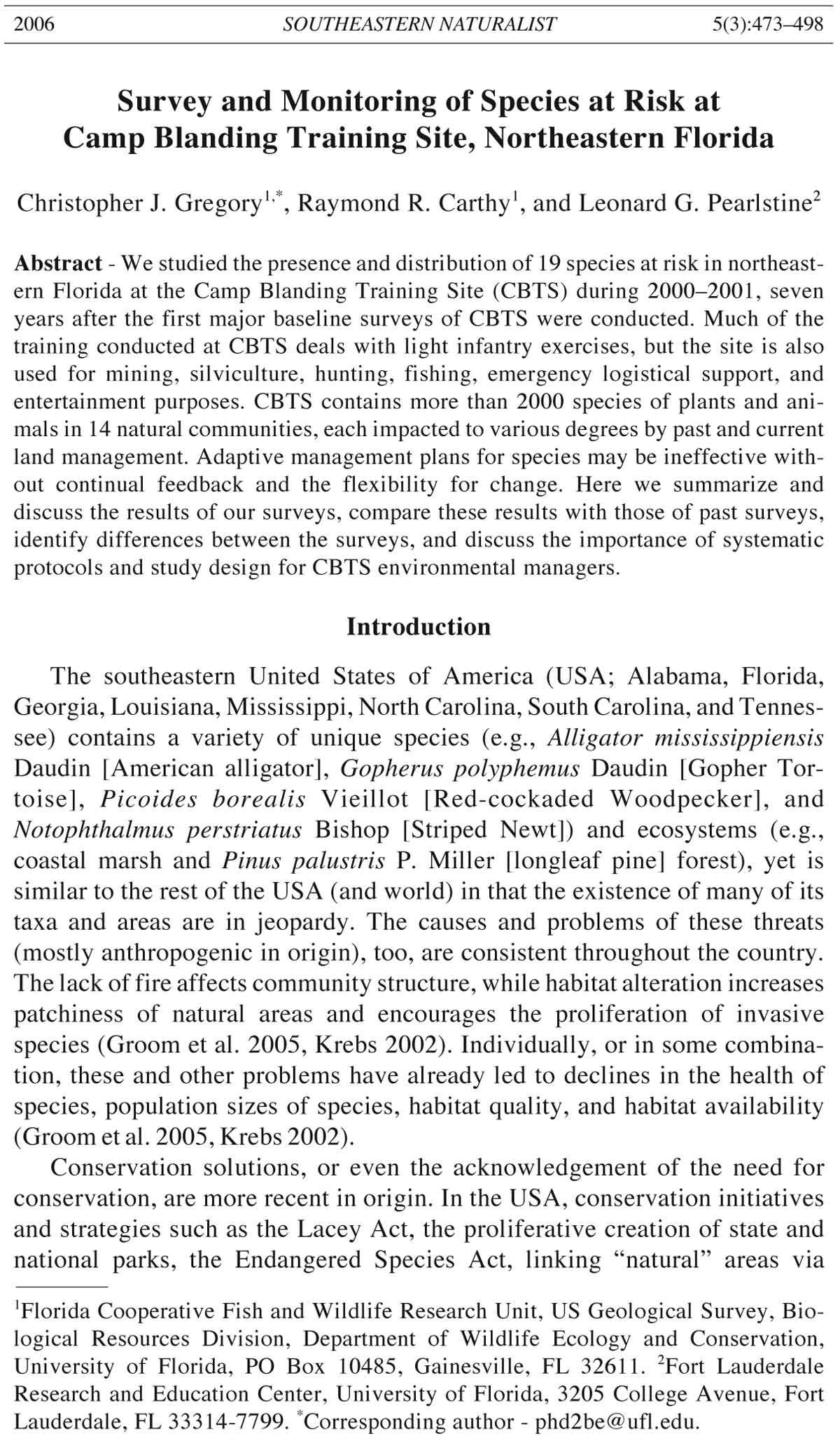
The Camp Blanding Training Site (Fig. 1) is a 29,542-hectare military
installation owned by the State of Florida and managed by the Florida Army
National Guard (FLARNG) in northeastern (Clay County) Florida. Much of
the training conducted at Camp Blanding deals with light infantry exercises,
but the site is also used for federal and state emergency logistical support,
public recreation and hunting, non-military education and training, silviculture,
mining, and professional entertainment purposes. Centered between
Jacksonville to the northeast, Gainesville to the southwest, and Live Oak to
the northwest, CBTS lies within an important ecological and transportation
linkage of the southeast United States (Hipes and Jackson 1996, King 1998).
Its westernmost edge is contained within the Trail Ridge, part of a series of
sandhill ridges which begin in southern Florida and most likely formed
during the Pleistocene (King 1998, Myers and Ewel 1990, Opdyke et al.
1984). Typical features include pine-wiregrass communities and oak
476 Southeastern Naturalist Vol. 5, No. 3
Figure 1. Vicinity map showing the location of Camp Blanding Training Site in Florida.
2006 C.J. Gregory, R.R. Carthy, and L.G. Pearlstine 477
scrubland. Although most of CBTS consists of well-drained soils, there are
poorly to moderately poorly drained soil areas, which are often able to hold
water and contain significant organic nutrients (Long and Catlett 1996).
Cypress swamps and mesic hardwood hammocks are two of the notable
landscape features in these areas. CBTS contains a variety of natural communities
(see Hipes and Jackson 1996 and King 1998 for reviews), each
impacted to various degrees by past and ongoing land stewardship. The
status of the more than 2000 species of flora and fauna accounted for at
CBTS are likewise affected.
Selection of study species
CBTS Range Control provided a list of 119 species known to occur
(historically or currently) or which had the potential to occur at Camp
Blanding. The most current (in 1999) conservation status was recorded for
each species, compiled from the following sources: United States Fish and
Wildlife Service (USFWS), Florida Natural Areas Inventory (FNAI), CBTS,
Convention on International Trade in Endangered Species of Wild Fauna
and Flora (CITES), Florida Committee on Rare and Endangered Plants and
Animals (FCREPA), Florida Fish and Wildlife Conservation Commission
(FWCC), and the Florida Department of Agriculture and Consumer Services
(DACS). As the resources of this project did not allow for the effective study
of the 119 species, a working list was created by ranking the species using
the following criteria:
• A numerical rank (0–5) was assigned to each conservation status for
each species. Higher values corresponded to poorer status.
• A numerical rank (0–1) was assigned to each species based on
whether the species had strong obligate habitat requirements.
Strong habitat requirements were given a value of 1, and little-to-no
habitat requirements were given a value of 0.
• A numerical rank (0–1) was assigned to each species based on its
potential to provide habitat for other species. High potential was
given a value of 1, and little-to-no potential was given a value of 0.
After the numerical ranks were summed for each species, a meeting with
CBTS environmental managers was held at Camp Blanding on January 18,
2000. Comments and decisions were solicited for all species on the modified
study list. Species were then excluded from consideration if they were
occasional migrants, never previously recorded at Camp Blanding, had a
higher relative positive conservation standing, or were part of concurrent
surveys by other researchers (such as the Red-cockaded Woodpecker). Two
final lists were compiled: a list of 15 focal species (those species to be
actively surveyed) and a list of 4+ incidental species (those species whose
presence, numbers, locations, etc. were to be recorded on an opportunistic
basis while searching for focal species). Both focal and incidental species
are presented in Table 1.
478 Southeastern Naturalist Vol. 5, No. 3
Table 1. Species chosen for SAR study at CBTS, 2000–2001, and their conservation status as of 1999. Focal species were those for which we actively surveyed.
Incidental species were noted opportunistically during focal species surveys.
Class Survey type Common name Scientific name Federal statusA State statusB Natural heritage statusC
Plants Focal St. John’s Susan Rudbeckia nitida None E G2/S2
Focal Bartram’s ixia Sphenostigma coelestinum None E G2/S2
Focal Giant orchid Pteroglossapsis ecristata MC T G2/S2
Insects Incidental Say’s spiketail dragonfly Cordulegaster sayi None None G2/S1S2
Amphibians Focal Striped Newt Notophthalmus perstriatus None None G2G3/S2S3
Incidental Flatwoods Salamander Ambystoma cingulatum T SSC G2G3/S2S3
Incidental Gopher Frog Rana capito None SSC G3G4/S3
Reptiles Focal Eastern Indigo Snake Drymarchon corais couperi T T G4T3/S3
Focal Gopher Tortoise Gopherus polyphemus T T G3/S3
Incidental Eastern Diamondback Rattlesnake Crotalus adamanteus None None G4/S3
Incidental All other snakes N/A N/A N/A N/A
Birds Focal Florida Scrub Jay Aphelocoma coerulescens T T G3/S3
Mammals Focal Round-tailed muskrat Neofiber alleni None T G3/S3
Focal Sherman’s fox squirrel Sciurus niger shermani None SSC G5T3/S3
Focal Eastern red bat Lasiurus borealis None None None
Focal Seminole bat Lasiurus seminolus None None None
Focal Southeastern bat Myotis austroriparius None None G3G4/S3
Focal Evening bat Nycticeius humeralis None None None
Focal Eastern pipistrelle Pipistrellus subflavus None None None
Focal Brazilian free-tailed bat Tadarida brasiliensis None None None
AFederal status: T = threatened, a species that may become endangered if not protected; MC = management concern.
BState status: E = endangered, a species which is in danger of extinction throughout all or part of its range in Florida; T = threatened, a species which is likely to
become endangered in the future throughout all or part of its range in Florida; SSC = species of special concern, a species facing a moderate risk of extinction
throughout all or part of its range in Florida.
CNatural heritage status: G1 = critically imperiled globally because of extreme rarity (5 or fewer occurrences); G2 = imperiled globally because of rarity (6 to 20
occurrences); G3 = rare and local throughout range or in a special habitat or narrowly endemic (21 to 100 occurrences); G4 = apparently secure and of no
immediate conservation concern; G5 = demonstrably secure globally; S1 = critically imperiled in Florida because of extreme rarity (5 or fewer occurrences); S2
= imperiled in Florida because of rarity (6 to 20 occurrences); S3 = rare and uncommon throughout the state or in a special habitat or narrowly endemic (21 to 100
occurrences); S4 = apparently secure and of no immediate conservation concerN; S5 = demonstrably secure in state; T = taxonomic subdivision (trinomial, either
a subspecies or variety), used in global rank, for example “G2T2.”
2006 C.J. Gregory, R.R. Carthy, and L.G. Pearlstine 479
Data collection, analysis, mapping, and storage
A number of different survey methods were used to study species
presence/absence, population levels, habitat associations, and vulnerability.
Individual methods used are listed below for each species. Unless
otherwise noted, all surveys took place during February 2000 through
August 2001, and traps were checked every 24 to 48 hours. All sightings,
captures, and trap locations were georeferenced (coordinate system: Universal
Transverse Mercator, Zone 17, units in meters; datum: North American
Datum of 1927; spheroid: Clarke 1866) with a Trimble GeoExplorer
IV Global Positioning System device and recorded on field data sheets.
Digital photographs were taken to document field conditions as well as
species captures and sightings. All animals were released at the site of
capture. Weather data (temperature, rainfall, cloud cover, wind speed)
were recorded and compared with historical climate data obtained from
Gainesville, FL (Alachua County), the nearest locale with uninterrupted
(October 1953 to May 2001) climate records. Field data were transferred to
a Microsoft Access 97 database for permanent storage. Location data were
projected using ArcView, version 3.2a.
Plant surveys
Pteroglossapsis ecristata (Fernald) Rolfe (giant orchid), Rudbeckia
nitida Nuttall (St. John’s Susan), Sphenostigma coelestinum (Bartram)
Goldblatt & Henrich (Bartram’s ixia) - During spring, summer, and early fall
(the flowering periods for these species), we conducted walking and driving
visual searches for individuals of these species at and near previously recorded
areas (KBN Engineering and Applied Sciences, Inc. 1998) as well as
new areas in an effort to record variation from past documented ranges.
Incidental sightings were recorded throughout the year; however, survey
effort was decreased outside of the flowering periods.
Insect surveys
Cordulegaster sayi Selys (Say’s spiketail dragonfly) - Based on extensive
surveys for this species in past years (Minno and Minno 2000) and the
suggestion of the CBTS environmental personnel, we planned only to
model potential habitat for this species, using information on point location
data and complete habitat descriptions for larvae and adults. However,
some sampling was carried out actively and incidentally. While seining for
amphibians, captured larval dragonflies were examined in an effort to
determine species. Also, sites previously surveyed (Minno and Minno
2000; M. Minno, Gainesville, FL, pers. comm.) for Say’s spiketail dragonfly
were re-examined.
Modeling included use of data obtained from habitat maps and digital
elevation models (DEMs) of CBTS, natural history information on the
species, and historic point locations at CBTS. Natural history notes on this
species were taken from published literature (Dunkle 1994, Westfall and
Mauffray 1994). Thirty-meter DEMs were downloaded from the USGS
480 Southeastern Naturalist Vol. 5, No. 3
Earth Resources Observation Systems Data Center in Sioux Falls, SD. The
CBTS Environmental Center provided hard-copy point data from previous
Say’s spiketail dragonfly surveys. Due to non-availability of previous digital
land classifications collected by the CBTS Environmental Center, we created
new digital habitat maps of CBTS.
To create these maps, we used landcover mapped for the USGS Florida
Gap Analysis Program (Pearlstine et al. 2000) from the classification of
1993 and 1994 Landsat Thematic Mapper satellite imagery at a spatial
resolution of 30 m. Bands 2, 3, 4, and 5 of the imagery and a Tassel Cap
transformation (Crist and Cicone 1984) were used in an iterative unsupervised
clustering algorithm. Labeling of the spectral clusters with
vegetation associations followed The Nature Conservancy/United Nations
Educational, Scientific, and Cultural Organization (UNESCO), Southeastern
Region classification scheme (Nature Conservancy 1998). This
hierarchical, ecologically based classification scheme delineates plant associations
in the southeast United States. The UNESCO classification
scheme is the basis for the National Vegetation Classification Standard
adopted by the Federal Geographic Data Committee. The basic assumptions
and definitions for this classification system have been described by
Jennings (1993). The basis for aggregation of the scheme for Gap analysis
is presented in Pearlstine et al. (1999). Labeling in the Camp Blanding area
was assisted with auxiliary information from St. Johns River Water Management
District land-use/land-cover maps, National Wetlands Inventory
maps, county-level soils maps, vegetation surveys, and photo-interpreted
points from low-altitude aerial digital photography. In all, 14 land-cover
classes are present in CBTS: dry shrubland, freshwater marsh/wet prairie,
inland water, low herbaceous/pasture, non-vegetated, row and tree crops,
upland coniferous forest, upland hardwood forest, upland mixed forest,
urban/developed, wet shrubland, wetland hardwood forest, wetland mixed
forest, and woodland/savannah.
CBTS land cover created in Erdas Imagine was transferred to a gridbased
modeling software package (MFWorks) to facilitate modeling tasks.
Land covers that provided suitable habitat for foraging and reproduction for
Say’s spiketail dragonfly were identified and entered into the MFWorks
program. Using map algebra, unsuitable areas were subtracted from the
entire CBTS map to give a final approximation of where Say’s spiketail
dragonfly may potentially be found.
Amphibian surveys
Ambystoma cingulatum Cope (Flatwoods Salamander), Notophthalmus
perstriatus Bishop (Striped Newt), Rana capito LeConte (Gopher Frog) -
Breeding ponds identified as being surveyed in past studies (Hipes and
Jackson 1996) were surveyed biannually (at a minimum) with the use of dipnets.
We surrounded one pond with drift-fencing and pitfall traps in order to
monitor incoming and outgoing species. Ponds not previously surveyed in
2006 C.J. Gregory, R.R. Carthy, and L.G. Pearlstine 481
past studies were sampled opportunistically. In addition, all ponds (Fig. 2)
were sampled at night in an effort to catch and observe anurans engaged in
breeding behaviors. We also searched for amphibians by overturning logs,
raking through debris, setting funnel traps overnight, and video-scoping
Gopher Tortoise burrows.
Reptile surveys
Gopherus polyphemus Daudin (Gopher Tortoise) - Efforts were made
to estimate total population size based on the sampling of twenty-one
Gopher Tortoise subpopulations (Fig. 2) delineated by Hipes and Jackson
(1996). Total area was calculated in ArcView for each subpopulation. A
C++ program used to generate random transects was written by the
Figure 2. Camp
Blanding Training
Site, including
major lakes
and streams. Dark
circles = amphibian
breeding
ponds. Dark pentagons
= Florida
Scrub Jay sightings.
Clear, numbered
circles =
Gopher Tortoise
subpopulations as
delineated by
Hipes and Jackson
(1996). The
sections of subpopulations
19
and 20 falling
within the impact
area could not be
surveyed due to
CBTS regulations.
These areas
were excluded
from analyses.
482 Southeastern Naturalist Vol. 5, No. 3
authors using standard random-number library functions. The program
returns a user-selected number of random values without replacement and
within a user-selected range. Two people walked random transects ten
meters wide until a minimum of ten percent of the entire subpopulation
area had been surveyed.
Gopher Tortoise subpopulation counts were estimated as follows, using
methods taken from Auffenberg and Franz (1982). Every Gopher Tortoise
burrow encountered within the transect area was assigned a usage value:
active (burrow opening clear of debris and soil of burrow apron recently
disturbed), inactive (burrow opening relatively maintained and soil of burrow
apron undisturbed), or abandoned (burrow opening closed or covered
with debris and soil of burrow apron undisturbed). Special burrow camera
equipment (Ed Wester, Southern Ecosystems Research, AL) was used to
scope the burrows and record any tortoise or commensal species found.
Tortoises captured outside their burrows were processed as described below.
Measuring and camera equipment were washed with alcohol after each use
to prevent potential disease transfer. For each subpopulation, the number of
active + inactive burrows was divided by the area surveyed (hectares) to
calculate burrow density. This number was multiplied by the total hectares
of the subpopulation area, then multiplied by 0.614—a correction factor first
described by Auffenberg and Franz (1982) as an estimate of the number of
tortoises using all active and inactive burrows—to obtain the estimated
population size.
Tortoises were observed opportunistically throughout CBTS. When
caught, individuals were permanently and uniquely marked using a numbering
system devised by Cagle (1939). Size, weight, gender, ectoparasite load,
and upper respiratory tract disease (URTD) symptoms were recorded for
most tortoises.
Crotalus adamanteus Baird & Girard (Eastern Diamondback Rattlesnake),
Drymarchon corais couperi Holbrook (Eastern Indigo Snake) - Funnel traps
were set in suitable habitats, near areas of sightings from previous surveys
(Hipes and Jackson 1996, Hipes et al. 1998), and in locations where snakes
were observed but not readily able to be captured by hand (i.e., underground,
spotted using a video-scope). Special surveys were made during warm periods
of cold-weather months when Eastern Indigo Snakes might have been basking
at the front of and/or in transit to Gopher Tortoise burrows. Incidental snake
surveys and observations were also made while surveying for other species.
Bird surveys
Aphelocoma coerulescens Bosc (Florida Scrub Jay) - Taped Florida
Scrub Jay calls (obtained from James Garrison, Florida Wildlife Conservation
Commission, CBTS Wildlife Management Area, FL) were played for
two minutes at a minimum of every 250 m while walking transects during
Gopher Tortoise burrow surveys, while surveying for other plants and animals,
and while actively surveying for this species.
2006 C.J. Gregory, R.R. Carthy, and L.G. Pearlstine 483
Mammal surveys
Neofiber alleni True (Round-tailed muskrat) - Major bodies of water,
swamps, and marshes identified from USGS 1:24,000 7.5-minute quadrangle
map sheets, and CBTS aerial photographs were surveyed biannually
for muskrat presence. Opportunistic searches of smaller bodies of water
were also conducted.
Sciurus niger shermani Moore (Sherman’s fox squirrel) - We scored
squirrel sightings using three main survey methods: incidentally while
searching for other species or driving, while walking transects in conjunction
with Gopher Tortoise surveys, and through targeted surveys throughout
CBTS. Indirect methods of detecting squirrel presence (e.g., distinctive
pattern of shredded long-leaf pine cones) were not employed.
Lasiurus borealis Muller (eastern red bat), Lasiurus seminolus Rhoads
(seminole bat), Myotis austroriparius Rhoads (southeastern myotis),
Nycticeius humeralis Rafinesque (evening bat), Pipistrellus subflavus F.
Cuvier (eastern pipistrelle), Tadarida brasiliensis I. Geoffroy (Brazilian
free-tailed bat) - Bat surveys were subcontracted to Fly By Night, Inc., a bat
research organization based in Osteen, FL. Surveys were undertaken for
roosting and active bats. Roost surveys involved visually searching buildings
(both occupied and unoccupied), military structures, bridges, culverts,
and tree cavities for the presence of bats, or evidence of bat activity (e.g.,
staining, guano accumulation, odor, or an accumulation of insect body
segments). Mobile and stationary surveys of active bats were performed
using the Anabat bat detector system (Titley Electronics, New South Wales,
Australia) to monitor bat activity. A laptop computer running Anabat software
was used to record echolocation events for analysis. Mist nets were set
at or near sites where bat activity was confirmed during roost or Anabat
surveys. Configurations of three or more nets (6, 9, and 12-meter) were set
near or over water using both single and stacked sets (Kunz 1988). To reduce
the number of bats chewing through nets or becoming overly entangled, mist
nets were checked at intervals of ten minutes or less. Captured bats were
held in cloth bags and hung on the mist-net poles in an attempt to attract
additional bats.
Small SAR sampling by habitat
Although habitats throughout CBTS were surveyed on foot and vehicle,
five habitat types were chosen by CBTS personnel for long-term monitoring
of small SAR: hardwood hammock, depression marsh, sandhill, riverine,
and sand pine. Determination of the five habitats chosen for long-term
surveys, as well as all habitats delineated on survey forms, came from four
main sources: Ecosystems of Florida (Myers and Ewel 1990), 26 Ecological
Communities of Florida (US Soil Conservation Service 1980), Guide to the
Natural Communities of Florida (Florida Natural Areas Inventory 1990),
and our habitat interpretation from ground-truth surveys. Definition of these
habitats are as follows:
484 Southeastern Naturalist Vol. 5, No. 3
• “Depression marsh is characterized as a shallow, usually rounded
depression in sand substrate with herbaceous vegetation often in
concentric bands.” (Florida Natural Areas Inventory 1990).
• “Hardwood hammock forests are characterized as well-developed,
closed canopy forests of upland hardwoods on steep slopes, bluffs,
and ravines. The combination of densely shaded slopes and cool,
moist microclimate produces conditions that are conducive for the
growth of many species.” (Florida Natural Areas Inventory 1990)
• Riverine habitats are perennial or intermittent seasonal watercourses
(Florida Natural Areas Inventory 1990) and nearby, associated
habitats.
• Sand pine habitats are dense forests composed primarily of mature
Pinus clausa (Chapm. ex Engelm.) Vasey ex Sarg. (sand pines).
• “Sandhills are characterized as a forest of widely spaced pine trees
with a sparse understory of deciduous oaks and a fairly dense
ground cover of grasses and herbs on rolling hills of sand. The most
typical associations are dominated by longleaf pine (Pinus
palustris P. Miller), turkey oak (Quercus laevis Walt.), and
wiregrass (Aristida stricta var. beyrichiana Trin. & Rupr.).”
(Florida Natural Areas Inventory 1990).
Using advice from CBTS Range Control personnel about frequent military
conflicts and hazards, and the subsequent inability to check traps on a
regular basis if we proceeded as planned, hardwood hammock trapping was
combined with the riverine trapping in an area in which they both overlapped.
Trap locations were chosen and 30.5 m of construction silt fencing
was installed within each habitat. Five funnel traps were set on each side of
the fence (ten traps total). Funnel traps were also used opportunistically
without fence lines throughout the base.
Results, Comparisons, and Discussion
Climate
During the survey period, Florida experienced a drought brought on by
the 1998 La Niña weather event. Having enormous ecological and economic
effects throughout the state, 2000 was the driest year on record (Department
of Environmental Protection 2001). The event affected CBTS, as the water
table dropped dramatically and left most ephemeral ponds dry. Many larger
lakes and ponds were drawn down noticeably.
Table 2. Climate data at CBTS.
Jan Feb Mar Apr May June July Aug Sep Oct Nov Dec
Mean rainfall (cm) 9.1 9.6 10.5 7.4 9.2 16.4 17.2 19.5 13.5 6.6 5.5 7.4
Mean temp (°C) 13.0 14.5 17.4 20.5 24.0 26.5 27.4 27.3 26.1 21.8 17.6 14.1
Maximum temp (°C) 19.9 21.7 24.6 27.9 31.0 32.6 33.2 33.1 31.7 28.1 24.4 20.9
Minimum temp (°C) 6.2 7.4 10.1 13.1 17.0 20.4 21.6 21.6 20.4 15.5 10.9 7.3
2006 C.J. Gregory, R.R. Carthy, and L.G. Pearlstine 485
Temperatures were more stable (Table 2). Mean high temperatures were
slightly higher and mean low temperatures were slightly lower than historic
means (Fig. 3). Although current overall temperature means were near
historic levels, these slight differences may exacerbate stresses individual
Figure 3. Mean high, low, and overall temperatures and mean rainfall at CBTS for all
years of data availability (1953–2001), years of all major surveys (1994–2001), and
years of this survey (2000–2001).
486 Southeastern Naturalist Vol. 5, No. 3
animals undergo due to drought, habitat conversion, incompatible land-use
practices, or other impacts.
Plants
Giant orchid. The only previous report (KBN Engineering and Applied
Sciences, Inc. 1998) available to us dealing with the giant orchid at CBTS
consisted mostly of natural history information, a CBTS distribution map,
and general recommendations for creating optimal conditions for healthy
and viable populations of this species. Three locations were identified on the
species map, but no information on their status, numbers of individuals seen,
etc. were provided. We were able to find only one individual in one location
during our survey. Whether this is due to survey error or the death of
individual plants is unknown.
St. John’s Susan. The previous survey report on this species is as above.
Five locations were identified on the species map: no plants were found at
one of the previous locations, two closely mapped locations of this species
had expanded and merged, and the final two mapped distributions were
approximately identical to the distribution found during our survey. We also
found three new localities, two of which contained only one plant. Discovery
of individual plants by any surveyor may simply be a case of being in the
right place at the right time; however, as all individuals sighted were found
near or along roads, the possibility is raised that the dispersal of St. John’s
Susan may be facilitated by vehicular or mower traffic.
Bartram’s ixia. Although we were able to find individuals of this species
in only one of four previously recorded locations (KBN Engineering and
Applied Sciences, Inc. 1998), we found three small, new populations in the
northern half of CBTS. Unfortunately, we were unable to access up-to-date
fire records and prescribed burning events. As the presence of flowering ixia
is directly tied to the time and seasonality of previous fires, examination of
fire data with previous and current distributions of ixia may shed light on the
distributional changes we have documented.
Insects
Say’s spiketail dragonfly. No Say’s spiketail dragonflies were found
during the current survey. An adult from the genus Cordulegaster was
observed flying near a pond on the northern half of CBTS, at a location
different from those of a previous survey (Minno and Minno 2000). Due to
its protected status and delicate body condition, we did not wish to risk
potential injury to the individual during capture, so positive (species-level)
identification was not possible. Predictions from our Say’s spiketail dragonfly
model (Fig. 4) closely match previously documented Say’s spiketail
dragonfly locations. It also identified other locations with the same or
similar characteristics, which may help reduce search effort during future
surveys for this species.
2006 C.J. Gregory, R.R. Carthy, and L.G. Pearlstine 487
Amphibians
Flatwoods Salamander. Although populations of Flatwoods Salamanders
exist relatively close to CBTS to the north, no Flatwood
Salamanders have been found at CBTS during past (Hipes and Jackson 1996,
Hipes et al. 1998) or current surveys. The suboptimal habitat conditions
inherent to CBTS discussed in Hipes and Jackson (1996) make it unlikely
that Flatwoods Salamanders have been resident at CBTS, at least in recent
times. Additionally, persistent silvicultural alteration to the flatwoods of
CBTS (Hipes and Jackson 1996) and the drought conditions experienced
during our survey period may have decreased our chances of finding any
potential migrant Flatwoods Salamanders.
Striped Newt. Unlike past surveys (10 sites recorded in Hipes and Jackson
1996, 7 sites recorded in Hipes et al. 1998), no Striped Newts were found at
CBTS during the survey period. The inability to find one Striped Newt is
disturbing, especially as Hipes and Jackson (1996) have speculated that CBTS
may be the home to Florida’s second largest population of Striped Newts on
public land. This absence of Striped Newts may be explained by drought
conditions. Most breeding ponds were dry, and the lack of consistent rain may
have precluded behavioral stimulus to seek breeding ponds. Many of the
Figure 4. Model of suitable habitat for Say’s spiketail dragonfly. Final habitats
mostly consist of wetland hardwood forests and woodlands/savannas along with
some pastures/low herbaceous vegetation.
488 Southeastern Naturalist Vol. 5, No. 3
ponds containing water had seemingly healthy numbers of dragonfly larvae,
which can be predators of amphibian eggs (Caldwell et al. 1980, Van Buskirk
1988). As salamanders tend to be relatively long-lived, breeding or emigrant
adult Striped Newts may resume or return with consistent rains.
Gopher Frog. Gopher Frogs were found in seven locations at CBTS.
All but one were associated with Gopher Tortoise burrows. Egg masses
and larval Gopher Frogs were found at one breeding pond, approximately
one kilometer from a site where two adults were found. Fewer Gopher
Frogs were found than in previous surveys (31 individuals captured and 21
ponds with calling Gopher Frogs recorded in Hipes and Jackson 1996,
9 sites with eggs or tadpoles recorded in Hipes et al. 1998), especially in
ponds. The drought conditions may directly affect Gopher Frog mortality
or cause surviving individuals to seek refuge in areas where they are not
easily discovered.
Reptiles
Gopher Tortoise. We captured 26 live tortoises and found 416 Gopher
Tortoise burrows during our surveys. Active burrows accounted for 42.3%
of our totals (n = 176), inactive 22.4% (n = 93), and abandoned 35.3% (n =
147). The habitats in which live tortoises and all burrows were found are
listed in Table 3. Two interesting observations were made when surveying
tortoise burrows. First, we observed a few active burrows in dry ponds or
marshes. Not completely desiccated and dense, the moist soils and open
overstory of these areas supported a variety of vegetative food species that
may often be crowded or shaded out in other habitats. Additionally, many
burrows seemed to be located on grassy road shoulders and aircraft aprons
used for military exercises, even though there were adjacent pine forests or
other woodland habitats. The lack of fire in many of these forest stands has
led to high pine needle deposits and thick understory growth, suboptimal
Table 3. Habitat summaries for Gopher Tortoise captures and burrows at CBTS during the
current survey.
Burrows
Habitat Captures Active Inactive Abandoned Total
Dry shrubland 1 2 2 6 11
Freshwater marsh/wet prairie 0 3 0 0 3
Low herbaceous/pasture 1 0 1 0 2
Non-vegetated 4 49 21 23 97
Upland coniferous forest 6 24 13 22 65
Upland hardwood forest 0 7 4 3 14
Upland mixed forest 3 12 8 10 33
Urban/developed 3 11 8 12 34
Wet shrubland 0 14 9 14 37
Wetland mixed forest 4 0 0 0 4
Woodland/savannah 4 54 27 57 142
Total 26 176 93 147 442
2006 C.J. Gregory, R.R. Carthy, and L.G. Pearlstine 489
habitat for a Gopher Tortoise. The potential for disaster due to rapid rates of
disease transmission or local habitat alteration is increased as long as
tortoise densities remain high in these areas. Upper Respiratory Tract Disease
(URTD) signs of captured tortoises were mostly low to moderate, with
only one tortoise exhibiting extreme signs of infection. Tick count of captured
tortoises was generally low. As there have been no previous parasite or
disease studies at CBTS, we can not compare our results with past surveys.
Total and subpopulation population-size estimates are listed in Table 4.
Three of the five smallest subpopulations had an estimated tortoise density
of zero due to the lack of burrows (subpopulation 5) or the presence only of
abandoned burrows (subpopulations 8 and 17). Overall tortoise densities
were low, ranging from 0.07–1.39 tortoises per hectare, with a mean density
of 0.32 tortoises per hectare. The total number of Gopher Tortoises estimated
present at CBTS during our surveys was 1599, over six times lower
than the previous estimate of 10,607 given by Hipes and Jackson (1996).
There may be methodological and reporting explanations for the different
estimates. Using GIS calculations of the areas, 14 subpopulations may
have been underestimated and seven subpopulations may have been overestimated
in the first survey. Two of the potential area overestimates are also
the two largest subpopulations (19 and 20) at CBTS, with much of their land
lying within impact area (central portion of CBTS used for firing and testing
large-caliber artillery). Due to dangers such as unexploded ordinance, the
impact area is off-limits for safety reasons, yet was included in Hipes and
Jackson’s 1996 calculations even though large portions of those subpopulations
were not surveyed. Additionally, there is an apparent error in the
tortoise densities that are reported in the text (roughly 60% smaller than that
reported in the detailed table) of Hipes and Jackson (1996).
Despite the problems of comparing the data from these two surveys,
there is an apparent precipitous decline in Gopher Tortoise density and total
population size at CBTS. The decline in tortoise population size is consistent
with the preliminary results from other researchers working on public lands
(including Goldhead Branch State Park, adjacent to CBTS) in Florida (H.
Mushinsky, Tampa, FL, pers. comm.). Causality for these declines has yet to
be determined, and whether Gopher Tortoises have moved away from or
died at CBTS during the time between surveys is unknown.
Eastern Diamondback Rattlesnake and Eastern Indigo Snake. Three
Eastern Diamondback Rattlesnakes and three Eastern Indigo Snakes were
observed or caught, and one additional animal of each species was found as
a roadkill during our survey period. These amounts and locations are consistent
with past surveys (three each recorded in Hipes and Jackson 1996, three
Eastern Indigo Snakes recorded in Hipes et al. 1998). Neither species was
caught using funnel traps. Although it is unknown how well hunters can
identify rattlesnakes at the species level, anecdotal information from hunters
interviewed throughout the base indicate that CBTS has an extremely high
490 Southeastern Naturalist Vol. 5, No. 3
Table 4. Summary of the current and 1994 (Hipes and Jackson 1996) surveys of Gopher Tortoise population size at CBTS.
Current Current Current Current Current Current Current Previous Previous Previous
Sub- active inactive total area (ha, %) Correction tortoise total population tortoise total population
population burrows burrows burrows surveyed factor density area (ha) estimate density area (ha) estimate
1 5 3 8 20.9, 10.2% 0.614 0.24 204.7 48 2.40 71.0 170
2 3 0 3 21.0, 10.1% 0.614 0.09 207.9 18 1.98 118.4 235
3 26 16 42 28.4, 10.0% 0.614 0.91 284.5 258 1.27 151.8 194
4 4 3 7 14.8, 11.7% 0.614 0.29 126.7 37 1.10 20.0 22
5 0 0 0 3.3, 10.9% 0.614 0.00 29.8 0 0.93 38.8 36
6 4 1 5 8.4, 10.1% 0.614 0.36 83.3 30 1.96 61.9 121
7 1 1 2 16.5, 10.9% 0.614 0.07 151.6 11 1.86 124.7 233
8 0 0 0 5.4, 10.5% 0.614 0.00 51.9 0 1.18 40.8 48
9 6 2 8 21.2, 10.0% 0.614 0.23 212.1 49 0.93 287.3 267
10 6 5 11 26.4, 10.0% 0.614 0.26 263.8 68 3.72 183.7 683
11 9 7 16 12.3, 11.6% 0.614 0.80 106.1 85 1.86 79.6 148
12 10 0 10 5.2, 10.0% 0.614 1.18 52.0 61 2.23 40.8 91
13 5 1 6 12.9, 10.6% 0.614 0.29 121.5 35 3.06 118.0 361
14 1 0 1 1.0, 14.5% 0.614 0.60 7.1 4 2.40 18.2 44
15 2 0 2 2.2, 34.0% 0.614 0.55 6.6 4 1.96 4.1 8
16 10 4 14 6.2, 11.4% 0.614 1.39 54.4 75 2.40 16.7 40
17 0 0 0 1.5, 11.5% 0.614 0.00 13.4 0 2.43 9.4 23
18 1 1 2 6.5, 10.5% 0.614 0.19 61.9 12 2.05 70.2 144
19 2 2 4 33.5, 10.1% 0.614 0.07 331.9 24 1.91 1122.3 2144
20 73 37 110 224.1, 10.1% 0.614 0.30 2218.4 669 1.45 3469.4 5031
21 8 10 18 47.5, 10.0% 0.614 0.23 474.9 111 1.15 489.8 564
Total, mean 176 93 269 519.3, 10.3% 0.614 0.32 5064.4 1599 1.62 6536.9 10,607
2006 C.J. Gregory, R.R. Carthy, and L.G. Pearlstine 491
prevalence of Eastern Diamondback Rattlesnakes. While these views may or
may not be true (perhaps motivated by a fearful respect by the hunters), we
found Sistrurus miliarius Linnaeus (Pygmy Rattlesnakes) to be more
common during our surveys. The Eastern Diamondback Rattlesnakes were
found in an upland mixed forest, a woodland/savannah, a non-vegetated plot
of land, and on a paved road. Two Eastern Indigo Snakes were found on
paved roads, while the others were found in an upland coniferous forest and
an upland hardwood forest.
Birds
Florida Scrub Jay. Most surveys since the early 1990s have reported no
more than a few Florida Scrub Jays at CBTS. Hipes and Jackson (1996)
describe finding no jays in a 1993 survey, then seeing three birds numerous
times in the “Kingsley Scrub” section of the cantonment area two years later.
Hipes et al. (1998) subsequently observed two scrub jays in the same area.
Since then, unofficial surveys have shown Florida Scrub Jays to be consistently
present in the “Kingsley Scrub” in small numbers (2–5; P. Hall,
Starke, FL, pers. comm.). At various times throughout our survey period, we
have found 2–6 Florida Scrub Jays in this area. We have additionally found
seven new sighting locations containing this species (Fig. 2), including the
first known sighting on the northern half of CBTS. Only the “Kingsley
Scrub” population was found in true scrub habitat.
The most westerly observation was of 3–4 birds near the edge of the
DuPont area in a low herbaceous/pasture habitat. Approximately 1.6 km east
of this point, 7–8 birds were spotted in a wetland mixed forest along the side
of a paved road. All responded to the taped calls by vocalizing and coming
down closer to the observer. Two populations were observed on the periphery
of the buffer zone of the impact area in areas classified as woodlands/
savannahs. The northern impact-area population contained four scrub jays,
while the southern impact-area population contained 6–8 birds. The latter
were observed constantly flying up and down to a water seepage near an
open woodland, and may be the same birds (or their descendants) previously
observed residing nearby within the impact area (J. Garrison, Starke, FL,
pers. comm.). The final three sightings were in upland coniferous forests.
One scrub jay was observed in the far north during a random area search, 5–
6 were seen in the central section of CBTS, and two birds were observed in
the far south while conducting a Gopher Tortoise transect. Interestingly, the
new locations form a somewhat southeast–northwest line across CBTS in
the direction of Gold Head Branch State Park.
Each of the 8 areas were subsequently resurveyed several times. Scrub
jays were not seen or heard again in four locations, heard but not seen in two
locations, and seen and heard in two locations. However, during one survey,
no Florida Scrub Jays were observed or heard in any of the locations,
including the original “Kingsley Scrub.” Thus, absence to response of taped
492 Southeastern Naturalist Vol. 5, No. 3
calls should not be construed as absence of Florida Scrub Jays. We estimate
having seen 30–39 individual Florida Scrub Jays, and none found in the
seven new sites were observed wearing leg identification bands.
Mammals
Round-tailed muskrat. No round-tailed muskrats were observed during
our surveys. Though this species has never been seen on CBTS, two potential
sites were recorded. During a winter 2000 survey of Magnolia Lake, a
potential nest site was observed. No animals were ever found. A second site
was reported in 2000 by Franz (2000) in an interim report to CBTS. While
surveying ponds for Flatwoods Salamanders, grass cuttings potentially
caused by round-tailed muskrats were found floating in one pond. Again, no
individuals were ever seen on CBTS.
Sherman’s fox squirrel. Fourteen Sherman’s fox squirrels were observed
throughout the base, one-third of the 42 observed by Hipes and Jackson
(1996). No threats (e.g., road-kill) were noticed during the survey period to
explain this apparent decrease in numbers. One Sherman’s fox squirrel was
observed in a low herbaceous/pasture habitat, one in a non-vegetated plot of
land, four were crossing paved or dirt roads, one was seen in an upland
mixed forest, three in upland coniferous forests, two in an upland hardwood
forest, and two were spotted in a wetland mixed forest.
Eastern red bat, seminole bat, southeastern myotis, evening bat, eastern
pipistrelle, and Brazilian free-tailed bat. Four bat species were observed
roosting in 13 locations: southeastern myotis (n > 38), evening bat (n > 114),
eastern pipistrelle (n = 2), and the Brazilian free-tailed bat (n > 117).
Analysis of 10.75 hours of recorded bat echolocation indicates 773 passes,
76 buzzes, and 39 social vocalizations. Four species were captured by mist
nets: eastern red bat (n = 2), seminole bat (n = 4), southeastern myotis
(n = 5), and the eastern pipistrelle (n = 1). Bats were not included in previous
studies, so these data can be used as baseline data for future surveys.
Small SAR trapping by habitat
All traps caught a number of different invertebrates and small vertebrates
which were not pertinent to the study (e.g., wasps, spiders, anoles, and
skinks). Trap success was generally low, but enabled capture of some species
not seen during our other surveys, including five species not yet
recorded at CBTS: Bufo quercicus Holbrook (Oak Toad; several dozen at
three sites), Gastrophryne carolinensis Holbrook (Eastern Narrowmouth
Toad; one individual), Rhineura floridana Baird (Florida Worm Lizard; one
individual), Sternotherus minor minor Agassiz (Loggerhead Musk Turtle;
one individual), and Storeria dekayi victa Holbrook (Florida Brown Snake;
one individual). Traps and fence lines incurred damage throughout the
survey period and may have contributed to the low trapping success. Examples
of this include: wood posts being eaten by termites; posts being shot,
broken, uprooted, and stolen during hunting seasons and training exercises
2006 C.J. Gregory, R.R. Carthy, and L.G. Pearlstine 493
(some found later being used for unknown purposes at other locations on
CBTS); and traps torn open by predators. Surveys and trapping throughout
the base enabled us to capture Gopher Frogs and a Podomys floridanus
Chapman (Florida mouse) associated with Gopher Tortoise burrows. We
were also able to document several new locations of the Sarracenia minor
Walter (hooded pitcher plant), state-listed as threatened in Florida and
unusual in Georgia. A previous report (KBN Engineering and Applied
Sciences, Inc. 1998) on the hooded pitcher plant at CBTS contained a
distribution map of two populations, both in the northern section of CBTS.
Over half of the new S. minor locations we recorded were in the central and
southern portions of the installation.
Conclusions and Recommendations
Integrated management has become an increasingly important protocol
for natural resource managers to balance the needs of property owners, local
community interests, state and federal laws, and environmental processes.
However, many challenges can confound its successful implementation.
Examples of potential problems include aberrant climatological events, poor
study design, incorrect methodology, loss of data, social bias for and against
specific taxa, technological limitations, funding issues, and the scale at
which environmental planners collect data, set management priorities, and
judge their success. Consistently well-planned, well-gathered, long-term
data are important to minimize misinterpretation of results due to the effects
mentioned above. One of the largest uses of integrated natural resource
management and planning is on United States military installations, necessitated
in part due to DOD program mandates (King 1998).
The determination by land stewards that existing integrated ecological
management plans are fundamentally sound will depend on how relevant
data are collected, analyzed, and interpreted. For example, the Camp
Blanding INRMP might be viewed as a success due to the fact we were able
to document the persistence of eleven species at risk, increased distribution
of three species, and confirmed records of eleven other species not previously
recorded at CBTS. However, success may be viewed as questionable
as three species of risk previously documented at CBTS could not be located
during this study, ranges of at least three species had contracted, fewer
individuals were caught of at least five other species, and newly documented
species were not the target of previous surveys. Due to the design of the
present and past surveys, in part due to the goals set forth by CBTS personnel
for each survey, direct causality of species or ecosystem health at CBTS
could not be determined.
An obvious stress noted during our surveys was human influence on
CBTS ecological processes (e.g., fire regimes, hydrology, forest structure
and composition, and the presence of exotic species). Almost 29% of Camp
494 Southeastern Naturalist Vol. 5, No. 3
Blanding’s ≈ 29,500 hectares can be classified as sub-optimal to most native
wildlife (e.g., logged forests, disturbed, mined, and/or located in the impact
area) (King 1998, our analyses). An additional 17% is slated to be clear-cut
within the next 25 years for future pine plantations (Long and Catlett 1996).
Although fulfilling the installation’s military mission is the CBTS’ highest
priority, pursuing revenue from forest harvest and other uses ranks higher in
importance than enhancing the quality of forest habitat for wildlife (Long
and Catlett 1996). Wildlife sustainability is strained not only by the loss of
habitat, but also by the ensuing landscape fragmentation.
Another potential cause of population declines is climate. During the
course of our survey, Florida experienced the worst drought on record,
which both directly and indirectly influenced CBTS species. Paul Catlett
(Starke, FL, pers. comm.) and other fire scientists noted that environmental
conditions reduced the amount of days per year in which conditions were
safe for natural fires to burn or to initiate prescribed fires, causing multi-year
setbacks in the CBTS burn schedule. This lack of fire appears to be having
an effect on some areas in CBTS. Habitats are being altered through unchecked
succession. As nesting habitats are lost or degraded, and important
food species (e.g., wiregrass) are crowded or shaded out, vertebrate species
compositions are altered as well.
A direct effect of the drought is the dramatic drop of the water table,
leaving most ponds dry and many larger lakes and ponds drawn down
noticeably. At the very least, this greatly impacted the ecology of amphibians
on CBTS. The single breeding pond we found containing Gopher Frog
eggs and larvae dried up at least twice during the survey period, leading to
unsuccessful breeding events. This additional pressure may also be an important
factor for the local survival of this species in an environment already
feeling the effects from a variety of stresses. As Dodd (1993) summarized,
there may be three effects from severe drought: local amphibian populations
may become extirpated, they may be long-lived and hardy enough to survive
harsh climate events within refugia, or they may attempt to migrate to areas
with better, wetter conditions. Without regular, long-term sampling efforts,
researchers may miss species or genera (such as certain amphibians) whose
behavioral cues require specific climactic events for emergence.
To help obtain results with the largest possible relevancy, long-term
monitoring at a site should follow consistent, standardized protocols. Irregular
sampling may lead to a reduced, incorrect conclusion as to the total
biodiversity of an area. Each successive wildlife inventory of CBTS has
focused on different numbers of species than the preceding survey. Budgetary
constraints will likely cause this trend to continue.
However, monitoring alone, without a study plan designed to uncover
causalities, lacks value for stewards interested in adaptive management.
According to military guidelines for the preparation of INRMPs, “ecosystem
management must be based on clearly stated goals and objectives, and the
2006 C.J. Gregory, R.R. Carthy, and L.G. Pearlstine 495
INRMP must identify these goals and objectives, means to accomplish them,
and methodologies to monitor results against objectives” (USAEC 1997).
Current and previous CBTS requests for monitoring have been solely to
determine presence, absence, distribution, or population size, with management
plans or updates influenced by those results. Without the requirement
and commitment from CBTS to allow for proper study designs that include
control plots (some which may have to be closed to most human use) and the
ability to determine causality (e.g., management, climatic effects, pollution,
land usage) of results, simple monitoring efforts as conservation tools are
exercises in futility. At best, the current and past studies are snapshots in
time, their value mostly to raise alarm regarding any perceived declines in
species numbers. CBTS may be the exception to the rule, but if not, there
may be great value in reviewing INRMP implementation in other DODmanaged
lands.
The Camp Blanding Training Site occupies an important place in the
southeastern USA as part of an ecological corridor between southern Georgia
and central Florida. Sound management of this heavily utilized landscape is
crucial to maintain viable populations of species at risk as well as to prevent
future listings. Merely possessing an integrated approach to management does
not mean possessing a healthy ecosystem, and no single monitoring study can
possibly assess the health of an ecosystem. Further efforts by CBTS environmental
stewards to standardize methodologies (both in the field and with the
storage and availability of data) that are tied to management questions and are
designed to determine causality, to gather baseline data (on- and off-base), to
initiate long-term studies, and to eliminate (or minimize) incompatible landmanagement
practices, will help ensure the success of the CBTS INRMP and
lead to improved ecological management.
Acknowledgments
We thank John Bardwell and the Army Environmental Center for Species at Risk
guidance and funding; Mike Adams for coordinating all agencies involved with this
project; CBTS Range Control for taking the time daily to direct us out of harms way;
Paul Catlett and James Garrison for giving us an initial tour and answering numerous
questions about CBTS; Dan Hipes for answering questions about his previous surveys
and providing guidance for this survey; Barbara Fesler, Laura Hayes, Debra
Hughes, and Caprice McRae for providing clerical support at the University of
Florida; Joan Berish, Dick Franz, Mark Brown, Steve Christman, Steve Johnson,
Paul Moler, F. Wayne King, and Max Nickerson for answering questions about the
general ecology of CBTS, for teaching us the skills and techniques that we did not
know, and for developing what we knew; Marc Minno for answering questions about
previous insect surveys; Scott Berish, Kent Williges, and H. Franklin Percival for
helping us acquire field equipment; Patricia Hague and David Wright for providing
insight into the silviculture processes taking place at CBTS and sharing their historical
rain data; Angela Gruschke for countless hours of field and laboratory assistance;
Amr Abdelrahman, Janell Brush, Jennifer Donze, Linda Gregory, Edna Losada, Lisa
496 Southeastern Naturalist Vol. 5, No. 3
Ojanen, Joann Tiersma, and LeAnn White for volunteering their time and support
either in the field or in the lab (sometimes both); Fly By Night, Inc. for their work on
the bat surveys; and three anonymous reviewers for their many helpful comments and
suggestions. Surveys were conducted under the authorization of Florida Wildlife
Conservation Commission (including permit WX02144) and the University of
Florida Institutional Animal Care and Use Committee.
Literature Cited
Auffenberg, W., and L.R. Franz. 1982. The status and distribution of the Gopher
Tortoise (Gopherus polyphemus) in Florida. Pp. 108–113, In R. Bury (Ed.).
North American Tortoises: Conservation and Ecology. US Fish and Wildlife
Service Wildlife Research Report 12. Washington, DC. 126 pp.
Cagle, F.R. 1939. A system of marking turtles for future identification. Copeia
1939(3):170–173.
Caldwell, J.P., J.H. Thorpe, and T.O. Jervey. 1980. Predator-prey relationships
among larval dragonflies, salamanders, and frogs. Oecologia 46:285–289.
Crist, E., and R. Cicone. 1984. Applications of the tasseled cap concept to simulated
Thematic Mapper data. Photogrammetric Engineering and Remote Sensing
50(3):343–352.
Defense Environmental Network and Information Exchange (DENIX). 2004. Official
website. Available online at http://www.denix.us.mil. Last accessed September
1, 2004.
Department Of Environmental Protection. 2001. Official website. Available
online at http://207.156.43.72/floridadisaster/drought/overview.htm. Accessed
1 February 2004.
Dodd, Jr., C.K. 1993. Cost of living in an unpredictable environment: The ecology of
Striped Newts Notophthalmus perstriatus during a prolonged drought. Copeia
1993(3):605–614.
Dunkle, S.W. 1994. Say’s spiketail: Cordulegaster sayi. Pp. 295–296, In R. Deyrup
and L.R. Franz (Eds.). Rare and Endangered Biota of Florida. Vol. 4: The
Invertebrates. University of Florida Press, Gainesville, FL. 798 pp.
Florida Natural Areas Inventory. 1990. Guide to the Natural Communities of
Florida. Florida Department of Natural Resources and Florida Natural Areas
Inventory, Tallahassee, FL. 97 pp.
Franz, L.R. 2000. Camp Blanding Flatwoods Salamander Project interim report:
Field trips 1–6. Florida Army National Guard, Gainesville, FL. 13 pp.
Groom, M.J., G.K. Meffe, and C.R. Carroll. 2005. Principles of Conservation Biology,
3rd Edition. Sinauer Associates, Sunderland, MA. 779 pp.
Hipes, D.L., and D.R. Jackson. 1996. Rare vertebrate fauna of Camp Blanding
Training Site, a potential landscape linkage in northeastern Florida. Florida
Scientist 59(2):96–114.
Hipes, D.L., K. Nesmith, and D. Printiss. 1998. A Five-year follow-up survey for six
rare animals at Camp Blanding Training Site. Florida Natural Areas Inventory,
Tallahassee, FL. 47 pp.
Jennings, M.D. 1993. Natural terrestrial cover classification: Assumptions and definitions.
Gap Analysis Technical Bulletin 2. Idaho Cooperative Fish and Wildlife
Research Unit, Moscow, ID: University of Idaho. 29 pp.
2006 C.J. Gregory, R.R. Carthy, and L.G. Pearlstine 497
KBN Engineering and Applied Sciences, Inc. 1998. Integrated Natural Resources
Management Plan, 1998–2002: Camp Blanding Training Site. Vol. 3. Florida
Army National Guard, Gainesville, FL. 337 pp.
King, F.W. 1998. Integrated Natural Resources Management Plan, 1998–2002:
Camp Blanding Training Site. Vol. 1. Florida Army National Guard, Gainesville,
FL. 261 pp.
Krebs, C.J. 2002. Ecology: The Experimental Analysis of Distribution and Abundance,
5th Edition. Benjamin-Cummings Publishing Company, San Francisco,
CA, 608 pp.
Kunz, T. 1988. Ecological and Behavioral Methods for the Study of Bats.
Smithsonian Institution Press, Washington, DC. 553 pp.
Leslie, M., G.K. Meffe, J.L. Hardesty, and D.L. Adams. 1996. Conserving
Biodiversity on Military Lands: A Handbook for Natural Resource Managers.
The Nature Conservancy, Arlington, VA. 341 pp.
Long, A., and P. Catlett. 1996. Forest Resources Management Plan for the Period
1995 through 2020. Pp. 1–115, In Florida Army National Guard (Ed.). Integrated
Natural Resources Management Plan, 1998–2002: Camp Blanding Training Site.
Vol. 2. Florida Army National Guard, Gainesville, FL. 337 pp.
Minno, M.C., and M. Minno. 2000. Insect surveys of the Camp Blanding Training Site,
Clay County, Florida. Final Report. Eco-Cognizant, Inc., Gainesville, FL. 57 pp.
Myers, R.L., and J.J. Ewel (Eds.). 1990. Ecosystems of Florida. University of
Central Florida Press, Orlando, FL. 765 pp.
Nature Conservancy. 1998. International Classification Of Ecological Communities:
Terrestrial Vegetation Of The Southeastern United States. Vol. 2. The Nature
Conservancy, Chapel Hill, NC. 501 pp.
NatureServe. 2004. Official website. Available online at http://www.natureserve.org.
Last accessed September 1, 2004.
New, T.R. 2000. Conservation Biology. Oxford University Press, Oxford, UK. 422 pp.
Opdyke, N.D., D.P. Spangler, D.L. Smith, D.S. Jones, and R.C. Lindquist. 1984.
Origin of the epeirogenic uplift of the Pliocene-Pleistocene beach ridges in
Florida and development of the Florida Karst. Geology 12:226–228.
Pearlstine, L., A. McKerrow, M. Pyne, S. Williams, and S. McNulty. 1999. Compositional
groups and ecological complexes: A method for alliance-based vegetation
mapping. Pp. 16–17, In E. Brackney and M. Jennings (Eds.). Gap Analysis
Bulletin. Vol. 7. United States Geological Survey, Biological Resources Division,
Moscow, ID. 140 pp.
Pearlstine, L., S.E. Smith, and W.M. Kitchens. 2000. A gap analysis of Florida: Final
report. Technical Report No. 65. United States Geological Survey, Florida Cooperative
Fish and Wildlife Research Unit, Gainesville, FL. 379 pp.
United States Army Construction Engineering Research Laboratory (USACERL).
1997. Installation Summaries from the 1996 Survey of Threatened and Endangered
Species on Army Lands. USACERL Technical Report 98/19, Washington, DC.
United States Army Environmental Center (USAEC). 1997. Guidelines to prepare
integrated natural resources management plans for army installations and activities.
USAEC, Aberdeen Proving Ground, MD. 37 pp.
United States Soil Conservation Service. 1980. 26 Ecological Communities of
Florida. US Department of Agriculture Press, Washington, DC. 268 pp.
498 Southeastern Naturalist Vol. 5, No. 3
Van Buskirk, J. 1988. Interactive effects of dragonfly predation in experimental
pond communities. Ecology 69:857–867.
Westfall, Jr., M.J., and W. Mauffray. 1994. Report of the dragonfly, Cordulegaster
sayi (Selys), a C2 candidate for endangered species status, in the Possum Branch
of the Hogtown drainage system, and the potential devastation of the largest
known breeding area by a proposed City of Gainesville flood-control project.
International Odonate Research Institute, Gainesville, FL. 10 pp.


 The Southeastern Naturalist is a peer-reviewed journal that covers all aspects of natural history within the southeastern United States. We welcome research articles, summary review papers, and observational notes.