Landscape Patterns Associated with Occupancy of
Disturbance-Dependent Birds in the Blackland Prairie
Ecoregion of Alabama and Mississippi
Neil A. Gilbert and Paige F.B. Ferguson
Southeastern Naturalist, Volume 18, Issue 3 (2019): 381–404
Full-text pdf (Accessible only to subscribers.To subscribe click here.)
381
2019 SOUTHEASTERN NATURALIST 18(3):381–404
Landscape Patterns Associated with Occupancy of
Disturbance-Dependent Birds in the Blackland Prairie
Ecoregion of Alabama and Mississippi
Neil A. Gilbert1,2,* and Paige F.B. Ferguson1
Abstract - The Blackland Prairie Ecoregion of Alabama and Mississippi, formerly a
mosaic of prairie, shrubland, and forest, has undergone massive landcover change in the
past 2 centuries. Even though the region is now dominated by agriculture and ranchland,
disturbance-dependent birds—a guild in decline—continue to inhabit the Blackland Prairie
Ecoregion. Therefore, we investigated the relationship between landscape patterns at 4 spatial
scales (within 200 m, 600 m, 1000 m, and 3000 m of survey points) and occupancy for
17 species of disturbance-dependent birds. We used a Bayesian occupancy model to relate
avian detections to landcover covariates and used stochastic search variable selection to
identify covariates that were relevant to occupancy for each species. The amount of canopy
cover was the covariate most frequently identified as relevant to occupancy. Grassland and
open-country species showed a negative relationship with canopy cover, while shrubland
species showed a positive relationship with canopy cover. The association between occupancy
and covariates was strongest at the smaller spatial scales, though covariates at
the larger spatial scales were still selected as relevant to occupancy. Our results highlight
the importance for land managers to consider the landscape context prior to making onthe-
ground conservation action; measures aimed to conserve grasslands, for example, will
likely be ineffective if they take place in landscapes with high canopy cover.
Introduction
Anthropogenic modification of the environment has allowed small numbers of
generalist species to thrive while driving declines of many specialists (McKinney
and Lockwood 1999). Among birds, disturbance-dependent species (e.g., shrubland
and grassland birds) are some of the fastest-declining specialists in North America
(Brennan and Kuvlesky 2005, Hunter et al. 2001). Scientists implicate habitat
loss—especially from landcover conversion and alteration of natural disturbance
regimes—as the greatest cause of declines (Brennan and Kuvlesky 2005).
Prior to European colonization, eastern North America was not completely
forested (Askins 1999). Rather, certain regions contained extensive early-successional
vegetation, including grassland and shrubland (Hunter et al. 2001). One
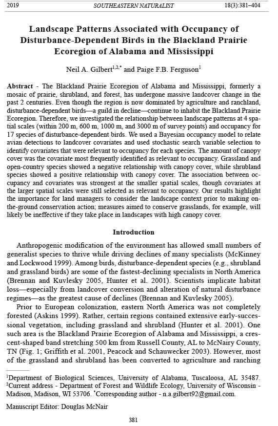
such area is the Blackland Prairie Ecoregion of Alabama and Mississippi, a crescent-
shaped band stretching 500 km from Russell County, AL to McNairy County,
TN (Fig. 1; Griffith et al. 2001, Peacock and Schauwecker 2003). However, most
of the grassland and shrubland has been converted to agriculture and ranching
1Department of Biological Sciences, University of Alabama, Tuscaloosa, AL 35487.
2Current address - Department of Forest and Wildlife Ecology, University of Wisconsin -
Madison, Madison, WI 53706. *Corresponding author - n.a.gilbert92@gmail.com.
Manuscript Editor: Douglas McNair
Southeastern Naturalist
N.A. Gilbert and P.F.B. Ferguson
Vol. 18, No. 3
382
2019
(Brown 2003); for example, it is estimated that 99% of the native prairie has been
lost (Noss et al. 1995). These shifts in land use have produced ecological issues
such as woody encroachment and extreme erosion (Schotz and Barbour 2009).
Conservation and restoration efforts have been limited (Schotz and Barbour
2009), but in the past decade, landowners, state agencies, and nonprofit organizations
have begun collaborating with the goal of restoring prairies and managing
working lands to more closely resemble native landscapes (Coggin and Gruchy
2012, Schotz and Barbour 2009). The majority of the Blackland Prairie is privately
owned; thus, these efforts have targeted private lands (Burger 2012). Although
early results have been encouraging, widespread restoration and conservation has
been hindered by low landowner participation (Gruchy et al. 2012) and financial
cost (Coggin and Gruchy 2012).
Despite the land-use change in the region, several disturbance-dependent bird
species persist in the Blackland Prairie Ecoregion and occupy these modified landscapes
(Haggerty 2006). However, the Blackland Prairie Ecoregion has received
little research attention from biologists, and studies investigating habitat selection
of disturbance-dependent birds in the region have been limited. For example, Farrell
(2015) investigated landscape patterns associated with occupancy but studied
only 3 species of grassland birds, and Monroe et al. (2016) studied vegetation
Figure 1. The location of the Blackland Prairie Ecoregion within Alabama, Mississippi, and
Tennessee. Point-count locations are shown.
383
Southeastern Naturalist
N.A. Gilbert and P.F.B. Ferguson
2019 Vol. 18, No. 3
characteristics associated with productivity of just a single grassland species.
Therefore, the landscape-scale habitat associations of the region’s disturbancedependent
birds are poorly documented. Further, information from other locations
cannot necessarily be applied to the Blackland Prairie because habitat preferences
and spatial-scale effects vary regionally (Askins et al. 2007). A landscape perspective
on habitat preferences is crucial for successful habitat conservation and
restoration (McGarigal et al. 2016).
Our objective was to identify landscape patterns associated with occupancy of
disturbance-dependent birds in the Blackland Prairie Ecoregion in order to inform
additional conservation efforts in the region. We selected 17 disturbance-dependent
species known to breed in the region (Haggerty 2006, Post et al. 2009) that represent
a successional gradient from species that require open grasslands to species
that use shrublands and openings within forests. We predicted the direction of the
relationship between occupancy and each landscape pattern we evaluated (Table 1),
dividing the selected disturbance-dependent birds into 2 categories: grassland (i.e.,
preferring grassland or open areas with scattered trees or fencelines) or shrubland
(i.e., preferring scrub-shrub, edges, or openings within forests). The grassland species
were Colinus virginianus L. (Northern Bobwhite; NOBO), Zenaida macroura
L. (Mourning Dove; MODO), Tyrannus tyrannus L. (Eastern Kingbird; EAKI),
Lanius ludovicianus L. (Loggerhead Shrike; LOSH), Sialia sialis L. (Eastern
Bluebird; EABL), Mimus polyglottos L. (Northern Mockingbird; NOMO), Sturnella
magna L. (Eastern Meadowlark; EAME), Icterus spurius L. (Orchard Oriole;
OROR), Passerina caerulea L. (Blue Grosbeak; BLGR), and Spiza americana
(Gmelin) (Dickcissel; DICK). The shrubland species were Vireo griseus (Boddaert)
(White-eyed Vireo; WEVI), Toxostoma rufum L. (Brown Thrasher; BRTH), Pipilo
erythrophthalmus L. (Eastern Towhee; EATO), Icteria virens L. (Yellow-breasted
Chat; YBCH), Piranga rubra L. (Summer Tanager; SUTA), Passerina cyanea L.
(Indigo Bunting; INBU), and Passerina ciris L. (Painted Bunting; PABU).
Field-Site Description
We focused on the central portion of the Blackland Prairie Ecoregion, conducting
surveys in Noxubee and Kemper counties in Mississippi and Sumter, Greene,
Hale, Marengo, Perry, and Dallas counties in Alabama (Fig. 1). The topography is
flat to undulating and is low (less than 100 m) in elevation (Griffith et al. 2001). The climate
is humid subtropical, with hot summers, mild winters, and abundant (132–142
cm annually) precipitation throughout the year, particularly in the winter months
(Griffith et al. 2001). Millions of years ago, the region was covered by a shallow
sea, which formed the Blackland Prairie’s limestone substrate (Peacock and Schauwecker
2003). Prior to European colonization, the region was a mosaic of prairies
interspersed with Quercus-Carya-Pinus spp. (oak-hickory-pine) forests and Juniperus
virginiana L. (Eastern Redcedar) thickets (Barone 2005, Griffith et al. 2001).
The prairies were dominated by Schizachyrium scoparium (Nees) (Little Bluestem)
and Sorghastrum nutans (Nash) (Indiangrass), and shared many taxa with the
Great Plains (including Bison bison L. [American Bison]) but also hosted many
Southeastern Naturalist
N.A. Gilbert and P.F.B. Ferguson
Vol. 18, No. 3
384
2019
Table 1. Landscape patterns that we hypothesized would be associated with disturbance-dependent
bird occupancy. Covariate = the covariate measured; Prediction = the predicted direction of the association
(+ for positive, - for negative, +/- for variable by species), with separate predictions provided
for grassland/open country species (“Grass”) and for shrubland/edge species (“Shrub”); and Justification
= our rationale for including the covariate in the analysis. Under the “Covariate” column, AG is
the percentage of the landscape that is agriculture, CANOPY is the mean percent canopy cover of the
landscape, CONTAG is contagion (a metric of landscape heterogeneity), FALLOW is the percentage
of the landscape that is fallow fields, FOREST is the percentage of the landscape that is forested (all
forest subcategories aggregated), IMPERV is the mean percent impervious cover of the landscape,
PAFRAC is perimeter-area fractal dimension (a metric of patch shapes), PASTURE is the percentage
of the landscape that is pasture, and SHRUB is the percentage of the landscape that is shrub. We
measured all covariates within 200-m, 600-m, 1000-m, and 3000-m radii of point-count locations
Covariate Prediction Justification
AG Grass +/- Agricultural fields do not provide habitat for grassland birds, but some
Shrub - species use edges within agricultural landscapes (Dechant et al. 1999,
Warner 1994). Agricultural edges are associated with decreases in
shrubland bird nesting success (Shake et al. 2011).
CANOPY Grass- Landscapes dominated by closed-canopy forests do not provide habitat
Shrub +/- for grassland or most shrubland birds; however, later-successional shrub
or edge species may prefer areas that are more forested (Schlossberg and
King 2007, 2008).
CONTAG Grass + Grassland species favor uniformly open landscapes (high contagion;
Shrub - Ribic and Sample 2001). Shrubland species select for heterogeneous
landscapes, which are formed by disturbance and contain earlysuccessional
vegetation (Swanson et al. 2011).
FALLOW Grass + Fallow fields may provide habitat for certain grassland and edge species
Shrub +/- but may be too open to host later-successional shrubland species (Sample
and Mossman 1997).
FOREST Grass - Forested landscapes contain less open space and early-successional
Shrub +/- vegetation and therefore do not provide habitat for grassland and most
shrubland species; however, later-successional shrubland species may
prefer more forested areas (Lumpkin and Pearson 2013).
IMPERV Grass +/- Development is a form of ecological disturbance and may form open
Shrub +/- space, early-successional vegetation, and heterogeneous landscapes;
however, it only benefits urban-adapted species (Schlossberg et al. 2011).
PAFRAC Grass - Many grassland birds prefer grassland patches with simpler edges (Davis
Shrub +/- 2004); however, complex patch shapes increase the amount of edge, which
can be used by some shrubland and edge species (Hawrot and Niemi
1996).
PASTURE Grass + Grassland birds use pastures (Gawlik and Bildstein 1993, Hanauer et al.
Shrub - 2010, Knopf 1994). Landscapes dominated by pasture, however, may be
undesirable for shrubland birds that require at least some woody
vegetation (Schlossberg and King 2007).
SHRUB Grass +/- Some grassland birds cannot tolerate even small amounts of low woody
Shrub + vegetation (Graves et al. 2010). Shrubland bird occurrence should
increase with amount of early successional vegetation (Fahrig 2013,
Roberts and King 2017).
385
Southeastern Naturalist
N.A. Gilbert and P.F.B. Ferguson
2019 Vol. 18, No. 3
endemic plant and insect species (Brown 2003). Europeans arrived in the 18th and
19th centuries and converted nearly all of the prairie to agriculture (Brown 2003).
Over the ensuing decades, cattle ranching and catfish farming became major forms
of land use in addition to agriculture (Peacock and Schauwecker 2003). Currently,
the region is a mosaic dominated by ranching, forestry, aquaculture, and agriculture—
especially Zea mays L. (Corn), Gossypium hirsutum L. (Cotton), and Poaceae
spp. (hay) (Peacock and Schauwecker 2003). According to the 2011 National Land
Cover Database (NLCD), the landcover of our study landscapes (within a 3000-m
radius of points) was characterized by pasture (44%), forest (21%), wetland (10%),
shrub and agriculture (7% each), open water and development (5% each), and
grassland (1%) (Homer et al. 2015). Socioeconomically, the region is characterized
by high rates of absentee landowners (Majumdar 2010), while the resident population
shows steadily declining densities over the last century and some of the highest
poverty rates in the country (USCB 2016).
Methods
Study species
We broadly defined disturbance-dependent birds as species that require some
level of ecological disturbance to create habitat (Hunter et al. 2001). Within our
set of study species, we aimed to capture a gradient of habitat requirements, from
grassland species that require large expanses of open habitat (e.g., Eastern Meadowlark)
to late-successional species that occupy open forests or gaps within forests
(e.g., Summer Tanager). We used habitat descriptions in Birds of North America
Online to determine whether potential study species were disturbance-dependent
and then to classify them as either grassland or shrubland species (Rodewald 2015).
We analyzed only species that we detected at >10% of study sites because rare detection
can be problematic for occupancy modeling (MacKenzie et al. 2006).
Survey protocol
We conducted roadside point-count routes because most of the land in the region
was under private ownership and because roadside point-counts do not introduce
excessive bias into avian survey data (Lituma and Buehler 2016). Each route was
composed of 9–12 points separated by 1-km intervals. We used a stratified random
sampling method based on landcover to identify route starting points, and used a
systematic method to create subsequent points on the routes (see Supplemental
File 1 for more details, available online at http://www.eaglehill.us/SENAonline/
suppl-files/s18-3-S2499-Gilbert-s1, and for BioOne subscribers, at https://dx.doi.
org/10.1656/S2499.s1). The total number of points surveyed was 173.
We performed 15-minute, double-observer point counts from 15 May to 5 July
2017. To avoid violating the closure assumption of single-season occupancy models,
we designed our survey window to include the breeding season of the study
taxa, a period when birds are vocal and relatively sedentary (MacKenzie et al.
2006). Moreover, our survey window was of comparable length to those of many
published occupancy studies (e.g., Holoubek and Jensen 2015). We conducted
Southeastern Naturalist
N.A. Gilbert and P.F.B. Ferguson
Vol. 18, No. 3
386
2019
surveys between twilight (i.e., 30 min before sunrise) and 1000 h CST (Ralph et al.
1995). The 2 observers conducted point-counts simultaneously but stood on opposite
sides of the field vehicle and did not share information (Farnsworth et al. 2005).
During the counting period, the observers recorded all species detected and noted
whether each species was <25 m or >25 m from the point. Prior to the point count,
the observers paced off 25 m to calibrate their distance estimates. We conducted
3 replicate surveys during the study period, reversing the direction the route was
traveled in the second replicate to obtain counts at different times of day.
Covariates quantifying landscape patterns
We measured 9 covariates that we hypothesized would be associated with disturbance-
dependent bird occupancy (Table 1). We measured each covariate within
radii of 200 m, 600 m, 1000 m, and 3000 m of points. While previous studies have
found that landscape patterns within 100–1000 m of points were good predictors
of passerine distributions (e.g., Morelli et al. 2013), we included the 3000-m scale
because recent studies have identified grassland bird responses to even larger
scales (e.g., Dreitz et al. 2017). The points were separated by 1000 m; thus, the
landscapes at the larger scales overlapped. While overlapping landscapes can
result in higher spatial autocorrelation of predictor variables, they do not impair
the independence of model error, which is the critical independence assumption
(Zuckerberg et al. 2012).
We measured mean percent canopy cover (CANOPY) at each scale from the
NLCD 2011 Tree Canopy cartographic layer using the R package “raster” (Hijmans
2017, Homer et al. 2015). We predicted that grassland species would show a negative
association with CANOPY and that most shrubland species would exhibit a
positive association with CANOPY (Table 1; Schlossberg and King 2007).
We measured mean percent impervious surface (IMPERV) at each scale from
the NLCD 2011 Percent Developed Imperviousness layer using the R package
“raster” (Hijmans 2017, Homer et al. 2015). Development is a form of disturbance,
but generally only urban-adapted species benefit (Marzluff 2001). Therefore, we
predicted a negative relationship between occupancy and IMPERV, though we
anticipated exceptions for urban-tolerant species (e.g., Northern Mockingbird;
Table 1).
We measured the remaining 7 covariates from the 2016 CropScape data layer
(USDA 2016) using FRAGSTATS with the 8-cell neighbor rule (McGarigal et al.
2012). The CropScape layer is based on the NLCD but is updated annually with
information about agricultural landcover. Therefore, CropScape shares the NLCD’s
30 m x 30 m resolution and landcover categories with the addition of more detailed
agricultural categories. We used CropScape because we were interested in a subset
of those agricultural categories and because CropScape provided more recent landcover
information (2016) than the latest available NLCD layer (2011).
Of the CropScape covariates, 5 were class-level metrics that quantified
the percentage of the landscape (PLAND) comprised of agriculture (AG), fallow
fields (FALLOW), forest (FOREST), pasture (PASTURE), or shrubland
387
Southeastern Naturalist
N.A. Gilbert and P.F.B. Ferguson
2019 Vol. 18, No. 3
(SHRUB). We aggregated CropScape’s subcategories for AG and FOREST
(e.g., evergreen, mixed, and deciduous for FOREST) because we expected birds
to respond to the structure of these landcovers regardless of crop or forest type
(Warner 1994). We provide the predicted relationship between each PLAND covariate
and occupancy in Table 1.
In addition to the class-level metrics, we calculated 2 landscape-level metrics
of landscape configuration: perimeter–area fractal dimension (PAFRAC) and contagion
(CONTAG). PAFRAC evaluates the shape of patches; values approaching
1 are associated with landscapes containing patches with simple geometries, while
values approaching 2 are associated with landscapes containing patches with convoluted
perimeters (McGarigal et al. 2012). We predicted that grassland species,
which prefer patches with simple perimeters, would show negative relationships
with PAFRAC (Davis 2004), while shrubland species, which use edge habitat,
would show positive relationships with PAFRAC (Terraube et al. 2016). CONTAG
measures patch aggregation (spatial distribution of 1 landcover class) and interspersion
(spatial distribution of all landcover classes relative to each other) (McGarigal
et al. 2012). Formally, it is defined as the sum of 2 probabilities: first, the probability
that a pixel is of class i, which is equivalent to the proportional representation
of that class in the landscape, and second, the probability, given a pixel is of class
i, that 1 of the neighboring pixels is of class j (Hargis et al. 1998, McGarigal et al.
2012). CONTAG spans from 0 to100, with low values describing landscapes having
maximally disaggregated and interspersed patch types and high values describing
landscapes with patch types maximally aggregated (McGarigal et al. 2012). We predicted
that grassland species, which prefer uniformly open landscapes (Ribic and
Sample 2001), would show positive relationships with CONTAG, and that shrubland
species, which prefer heterogeneous landscapes with early-successional vegetation
(Swanson et al. 2011), would show negative relationships with CONTAG
(Table 1).
Occupancy model
Occupancy modeling has emerged as a prominent method for analyzing presence/
absence (more accurately, detection/nondetection) data in ecology (Bailey et
al. 2014). These models account for the imperfect detection inherent to surveys
by modeling the probability of detecting the species of interest at site i during
survey t, given the species is present (MacKenzie et al. 2006). Occupancy models
that also account for false positive detection errors have recently been developed
(e.g., Ferguson et al. 2015) to address the fact that false positive detections are
pervasive in auditory surveys, and, when unaccounted for, lead to biased inference
about occupancy and covariate relationships (Bailey et al. 2014). We used
a hierarchical Bayesian occupancy model that estimates occupancy probability
ψi while accounting for true positive detection probability (p11) and false positive
detection probability (p10) (Ferguson et al. 2015; see Supplemental File 2, available
online at http://www.eaglehill.us/SENAonline/suppl-files/s18-3-S2499-Gilbert-s2,
and for BioOne subscribers, at https://dx.doi.org/10.1656/S2499.s2). In order to
distinguish between true positive and false positive detections, the model requires
Southeastern Naturalist
N.A. Gilbert and P.F.B. Ferguson
Vol. 18, No. 3
388
2019
a subset of the detections to be confirmed (i.e., no chance of a false positive detection).
We considered detections to be confirmed when both observers detected a
species within 25 m (Ferguson et al. 2015).
Across i sites and t surveys, we modeled confirmed detections cit as outcomes
of a Bernoulli trial with probability b*zi, where zi indicates the occupancy state of
a site and b is the probability of a confirmed detection (Ferguson et al. 2015). We
modeled all detections (i.e., both confirmed and unconfirmed) yit as outcomes of a
Bernoulli trial with probabilities dependent upon the states of cit and zi (Ferguson
et al. 2015). We modeled zias
outcomes of a Bernoulli trial with probability ψi,
which we modeled as a function of the landcover covariates. We held the detection
parameters (i.e., p11, p10, and b) constant across sites and surveys.
Bayesian analysis requires the assignment of prior probability distributions for
model parameters. We used Beta(4, 4) priors for p11, b, and the intercept of the function
relating covariates to ψi (Cruz 2019). We used a Beta(4, 10) prior for p10, which
suggests that if a site is unoccupied, there is a greater chance that an observer will
make a true negative detection than a false positive detection (Miller et al. 2012).
For the covariate coefficients, we used a mixture of 2 normal prior distributions to
perform indicator variable selection (details below).
Stochastic search variable selection
We used stochastic search variable selection (SSVS) to determine which covariates
were relevant to occupancy for each species (George and McCulloch 1993,
O’Hara and Sillanpää 2009). With this method, indicator variables δj are added to
the regression model to indicate which of j = 1, 2, …, n covariates are important in
explaining occupancy (Hooten and Hobbs 2015, O’Hara and Sillanpää 2009).
For each spatial scale, we built a global model containing all standardized (mean
= 0, s = 1), non-collinear covariates (Pearson’s |r| < 0.7; Dormann et al. 2013). For
the 200-m scale, we omitted PAFRAC from the global model because of missing
values, a frequent problem in calculating this metric for small landscapes (McGarigal
et al. 2012). For the 600-m scale, we omitted FOREST because of collinearity
with CONTAG. Although it is important to consider multiple scales because of the
scale dependency of habitat selection (McGarigal et al. 2016), collinearity between
the different scales prevented us from constructing a global model containing every
covariate measured at all of the scales.
Within the global model at each scale, the regression coefficients βj were replaced
by the product of a binary indicator variable and a regression coefficient,
δj*βj. We gave the δj parameters an uninformative Bern(0.5) prior. If the posterior
of δj approaches 1, the jth covariate is important in the model; conversely, if the
posterior of δj approaches 0, the effect of the jth covariate is essentially removed
from the model. We judged an indicator δj with posterior mean >0.7 to indicate that
the jth covariate was important in the model (Weiser et al. 2018). The prior for βj | δj
was δjN(0, c2τ2) + (1 - δj)N(0, τ2). Within each Markov Chain Monte Carlo (MCMC)
iteration of the model, each βj is given either a normal prior centered at 0 with a
large (c2τ2 = 2) variance when δj = 1 or a normal prior centered at 0 with a small
389
Southeastern Naturalist
N.A. Gilbert and P.F.B. Ferguson
2019 Vol. 18, No. 3
(τ2 = 0.02) variance when δj = 0 (Cruz 2019, Hooten and Hobbs 2015). The global
models for each scale (200-m, 600-m, 1000-m, and 3000-m scales, respectively) are
as follows:
logit(ψi) = β0 + δ1 β1AGi + δ2 β2CANOPYi + δ3β3CONTAGi + δ4 β4FALLOWi
+ δ5 β5FORESTi + δ6 β6IMPERVi + δ7 β7PASTUREi + δ8 β8SHRUBi
logit(ψi) = β0 + δ1 β1AGi + δ2β2CANOPYi + δ3 β3CONTAGi + δ4β4FALLOWi
+ δ5β5FORESTi + δ6β6IMPERVi + δ7 β7PARFACi + δ8β8PASTUREi
+ δ9β9SHRUBi
logit(ψi) = β0 + δ1 β1AGi + δ2 β2CANOPYi + δ3β3CONTAGi + δ4 β4FALLOWi
+ δ5 β5IMPERVi + δ6 β6PARFACi + δ7 β7PASTUREi + δ8 β8SHRUBi
logit(ψi) = β0 + δ1 β1AGi + δ2β2CANOPYi + δ3 β3CONTAGi + δ4β4FALLOWi
+ δ5β5FORESTi + δ6β6IMPERVi + δ7 β7PARFACi + δ8β8PASTUREi
+ δ9β9SHRUBi
We fit models in OpenBUGS 3.2.3 using the R2OpenBUGS package and R
3.5.1 (R Core Team 2017, Sturtz et al. 2005). We used 3 MCMC chains with
100,000 iterations, a burn-in of 25,000, and thinning of 5. We assessed convergence
via visual inspection of traceplots and the Gelman-Rubin potential scale
reduction factor (Rhat); chains with Rhat ≤ 1.1 were considered converged
(Brooks and Gelman 1998).
Model predictive performance
We used the area under the receiver operating characteristic curve (AUROC) to
assess the predictive performance of each of the 4 single-scale models after SSVS
was performed. In the context of occupancy modeling, models with high predictive
performance are expected to correctly classify sites as occupied or unoccupied
(Hosmer et al. 2013). The ratio of true positives (i.e., the species occupied the
site and the model predicted it) to false positives (i.e., the species did not occupy
the site but the model predicted the site was occupied) is plotted using a range of
cutoff values (in our case, thresholds in occupancy probabilities that differentiated
occupied and unoccupied sites). AUROC ranges from 0 to 1, with 0.5 describing
performance no better than random and larger values describing greater discriminatory
ability. We used the “plotROC R” package (Sachs 2017) to create AUROC
plots for the global model at each spatial scale.
Results
Landscape patterns associated with occupancy
The most frequently selected covariate was CANOPY, which was selected
50 times for 14 species (Table 2, Fig. 2). Grassland species showed consistent
negative relationships with CANOPY, while shrubland species exhibited consistent
positive relationships with CANOPY (Table 2, Fig. 3). IMPERV, the next most
commonly selected covariate, was selected 8 times for 7 species. Five were grassland
species, and all but one (Eastern Meadowlark) showed positive associations
Southeastern Naturalist
N.A. Gilbert and P.F.B. Ferguson
Vol. 18, No. 3
390
2019
Table 2. Covariates associated with disturbance-dependent bird occupancy. For each covariate, we
provide the species, ordered by habitat group and then by taxonomy (Chesser et al. 2018), that had the
covariate selected. We present the spatial scale at which the covariate was measured. “Mean” reports
the mean of the posterior distribution for each parameter. “Lower” and “Upper” are the bounds of the
parameter’s 95% credible interval. “Trend 95%” provides the effect direction of each covariate (“+”
for positive, “-“ for negative, and “?” for cases in which the 95% credible interval spanned zero). Finally,
the “% > 0” column provides the percentage of posterior distribution that was greater than zero.
Within the “Species” column, the species are presented with their standard four-letter banding code
(USGS 2016). NOBO = Northern Bobwhite, MODO = Mourning Dove, EAKI = Eastern Kingbird,
LOSH = Loggerhead Shrike, WEVI = White-eyed Vireo, EABL = Eastern Bluebird, BRTH = Brown
Thrasher, NOMO = Northern Mockingbird, EATO = Eastern Towhee, YBCH = Yellow-breasted Chat,
EAME = Eastern Meadowlark, OROR = Orchard Oriole, SUTA = Summer Tanager, BLGR = Blue
Grosbeak, INBU = Indigo Bunting, PABU = Painted Bunting, and DICK = Dickcissel. [Table continued
on following page.]
Species Group Covariate Scale Mean Lower Upper Trend 95% % >0
EAKI Grass AG 200 -0.66 -1.44 0.01 ? 2.70%
EAME Grass AG 600 -0.59 -1.36 0.06 ? 5.00%
EAME Grass AG 1000 -0.56 -1.13 -0.01 - 2.30%
DICK Grass AG 200 0.50 -0.04 1.21 ? 95.80%
DICK Grass AG 1000 0.52 0.03 1.09 + 98.50%
DICK Grass AG 3000 0.72 0.13 1.31 + 99.60%
MODO Grass CANOPY 200 -1.20 -2.14 -0.28 - 3.00%
MODO Grass CANOPY 600 -1.08 -1.90 -0.23 - 0.40%
MODO Grass CANOPY 1000 -0.87 -1.60 -0.10 - 0.90%
EAKI Grass CANOPY 200 -1.31 -1.96 -0.76 - 0.00%
EAKI Grass CANOPY 600 -1.05 -1.61 -0.55 - 0.00%
EAKI Grass CANOPY 1000 -0.86 -1.40 -0.31 - 0.00%
LOSH Grass CANOPY 200 -0.9 -1.93 0.01 ? 2.90%
LOSH Grass CANOPY 600 -1.05 -1.98 -0.07 - 1.20%
LOSH Grass CANOPY 1000 -0.65 -1.57 0.08 ? 6.30%
EABL Grass CANOPY 200 -0.86 -1.53 -0.15 - 0.40%
EABL Grass CANOPY 600 -0.79 -1.46 -0.13 - 0.50%
EABL Grass CANOPY 1000 -0.7 -1.36 -0.08 - 0.90%
NOMO Grass CANOPY 200 -1.52 -2.24 -0.90 - 0.00%
NOMO Grass CANOPY 600 -1.51 -2.22 -0.90 - 0.00%
NOMO Grass CANOPY 1000 -1.31 -1.90 -0.79 - 0.00%
NOMO Grass CANOPY 3000 -0.84 -1.39 -0.27 - 0.00%
EAME Grass CANOPY 200 -2.35 -3.05 -1.73 - 0.00%
EAME Grass CANOPY 600 -2.77 -3.57 -2.06 - 0.00%
EAME Grass CANOPY 1000 -2.39 -3.13 -1.75 - 0.00%
EAME Grass CANOPY 3000 -1.50 -2.06 -0.98 - 0.00%
OROR Grass CANOPY 200 -1.54 -2.40 -0.83 - 0.00%
OROR Grass CANOPY 600 -1.10 -1.79 -0.50 - 0.00%
OROR Grass CANOPY 1000 -0.85 -1.51 -0.18 - 0.30%
BLGR Grass CANOPY 200 -1.63 -2.44 -0.94 - 0.00%
BLGR Grass CANOPY 600 -1.37 -2.13 -0.71 - 0.00%
BLGR Grass CANOPY 1000 -1.16 -1.85 -0.56 - 0.00%
DICK Grass CANOPY 200 -1.57 -2.32 -0.92 - 0.00%
DICK Grass CANOPY 600 -1.48 -2.14 -0.88 - 0.00%
DICK Grass CANOPY 1000 -1.29 -1.93 -0.70 - 0.00%
DICK Grass CANOPY 3000 -0.91 -1.58 -0.17 - 0.40%
WEVI Shrub CANOPY 200 2.20 1.55 2.95 + 100.00%
391
Southeastern Naturalist
N.A. Gilbert and P.F.B. Ferguson
2019 Vol. 18, No. 3
with IMPERV (Table 2). The other 2 selected were shrubland species; Indigo
Bunting showed a negative association, while Eastern Towhee showed a positive
association with IMPERV (Table 2). AG was selected 6 times for 3 grassland species;
Eastern Kingbird and Eastern Meadowlark showed negative relationships,
while Dickcissel showed a positive relationship (Table 2). PAFRAC was selected 4
times for 3 grassland species, all of which showed a positive association (Table 2).
CONTAG was selected 3 times for 2 species; Orchard Oriole (a grassland species)
showed a negative association, and Painted Bunting (a shrubland species) showed
a positive association (Table 2). Finally, PASTURE was selected only for Summer
Tanager (a shrubland species) and showed a negative association with occupancy
(Table 2).
Table 2, continued
Species Group Covariate Scale Mean Lower Upper Trend 95% % >0
WEVI Shrub CANOPY 600 2.31 1.66 3.09 + 100.00%
WEVI Shrub CANOPY 1000 2.24 1.61 2.98 + 100.00%
WEVI Shrub CANOPY 3000 1.91 1.24 2.75 + 100.00%
EATO Shrub CANOPY 200 1.66 0.94 2.68 + 100.00%
EATO Shrub CANOPY 600 1.61 0.99 2.38 + 100.00%
EATO Shrub CANOPY 1000 1.60 0.97 2.37 + 100.00%
EATO Shrub CANOPY 3000 1.05 0.31 1.83 + 99.90%
YBCH Shrub CANOPY 200 0.70 0.16 1.21 + 99.80%
YBCH Shrub CANOPY 600 1.11 0.63 1.66 + 100.00%
YBCH Shrub CANOPY 1000 1.03 0.55 1.58 + 100.00%
YBCH Shrub CANOPY 3000 0.61 0.07 1.15 + 99.20%
SUTA Shrub CANOPY 200 1.51 0.89 2.28 + 100.00%
SUTA Shrub CANOPY 600 1.74 0.97 2.69 + 100.00%
SUTA Shrub CANOPY 1000 1.40 0.68 2.34 + 100.00%
SUTA Shrub CANOPY 3000 1.35 0.62 2.29 + 100.00%
INBU Shrub CANOPY 200 1.15 0.51 1.85 + 100.00%
INBU Shrub CANOPY 600 1.45 0.82 2.22 + 100.00%
INBU Shrub CANOPY 1000 1.30 0.68 2.06 + 100.00%
INBU Shrub CANOPY 3000 0.90 0.14 1.66 + 99.50%
OROR Grass CONTAG 200 -0.63 -1.57 0.08 ? 6.10%
OROR Grass CONTAG 3000 -0.65 -1.62 0.09 ? 6.40%
PABU Shrub CONTAG 1000 0.81 -0.11 1.96 ? 92.50%
MODO Grass IMPERV 200 1.04 -0.12 2.36 ? 92.60%
MODO Grass IMPERV 600 1.17 -0.15 2.82 ? 90.00%
EABL Grass IMPERV 200 0.83 0.11 1.66 + 99.50%
NOMO Grass IMPERV 200 1.37 0.09 2.44 + 98.80%
EAME Grass IMPERV 3000 -1.23 -2.33 -0.14 - 0.50%
OROR Grass IMPERV 200 0.61 -0.02 1.59 ? 96.80%
EATO Shrub IMPERV 3000 0.69 -0.08 1.92 ? 93.20%
INBU Shrub IMPERV 200 -0.55 -1.33 0.03 ? 3.80%
EAKI Grass PAFRAC 600 0.70 0.01 1.41 + 97.60%
EAME Grass PAFRAC 600 0.81 -0.02 1.67 ? 97.00%
OROR Grass PAFRAC 600 1.21 0.20 2.09 + 99.50%
OROR Grass PAFRAC 1000 0.83 -0.01 1.67 ? 97.10%
SUTA Shrub PASTURE 200 -0.59 -1.45 0.08 ? 6.30%
Southeastern Naturalist
N.A. Gilbert and P.F.B. Ferguson
Vol. 18, No. 3
392
2019
In summary, the maximum number of covariates that could possibly be selected
was 578 (i.e., if every covariate from all 4 global models had been selected for every
species). Across all species, 72 covariates were selected (Table 2, Fig. 2). No
covariates were selected for 2 species (Northern Bobwhite and Brown Thrasher).
For the other 15 species, 1–8 covariates were selected as important for each species
(Table 2). Three covariates (FALLOW, FOREST, and SHRUB) were never selected.
Spatial scale patterns
We assessed spatial scale patterns by comparing the following items: the number
of covariates selected per scale, the strength of the relationship between occupancy
and the covariates at the different scales, and the predictive performance of the
global model at the different scales.
Covariates measured at the smaller spatial scales dominated the selected set of
covariates; 23, 19, 18, and 12 covariates were selected for the 200-, 600-, 1000-,
and 3000-m scales, respectively (Fig. 2).
CANOPY was the only covariate that was selected frequently enough to evaluate
the strength of relationship between occupancy and the covariate at different
Figure 2. Covariates associated with disturbance-dependent bird occupancy across all species
and all spatial scales.
393
Southeastern Naturalist
N.A. Gilbert and P.F.B. Ferguson
2019 Vol. 18, No. 3
scales for the same species. CANOPY was selected for 14 species; it was selected
for all 14 taxa at its 200-, 600-, and 1000-m measures, but for only 8 species at the
3000-m scale. The strongest relationships with occupancy (judged by distance of
the coefficient from zero) were seen for the 200-m scale (8 species) and the 600-m
scale (6 species; Fig. 3).
Figure 3. Coefficient estimates for CANOPY for the 14 species for which this covariate was
selected. The points represent the mean of the coefficient’s posterior distribution and the
bars represent the 95% credible interval.
Southeastern Naturalist
N.A. Gilbert and P.F.B. Ferguson
Vol. 18, No. 3
394
2019
Table 3. Area under the receiver operator characteristic curve (AUROC) for the global models at
each spatial scale for all of the study species. Larger values indicate models with better predictive
performance.
Species AUROC200m AUROC600m AUROC1000m AUROC3000m Highest
NOBO 0.79 0.68 0.78 0.85 3000 m
MODO 0.94 0.92 0.84 0.86 200 m
EAKI 0.85 0.76 0.70 0.60 200 m
LOSH 0.79 0.86 0.78 0.81 600 m
WEVI 0.92 0.93 0.91 0.85 600 m
EABL 0.82 0.78 0.72 0.67 200 m
BRTH 0.62 0.68 0.69 0.68 1000 m
NOMO 0.94 0.93 0.88 0.80 200 m
EATO 0.88 0.88 0.86 0.79 200 m
YBCH 0.77 0.82 0.79 0.68 600 m
EAME 0.92 0.95 0.92 0.83 600 m
OROR 0.92 0.86 0.81 0.77 200 m
SUTA 0.89 0.91 0.89 0.85 600 m
BLGR 0.96 0.92 0.88 0.81 200 m
INBU 0.83 0.84 0.83 0.75 600 m
PABU 0.64 0.90 0.89 0.91 3000 m
DICK 0.85 0.82 0.81 0.78 200 m
Model predictive performance was generally good; all but 1 species had
AUROC > 0.8 for the best-predicting model (Table 3). The model with the highest
predictive performance was the 200-m model for 8 species, the 600-m model
for 6 species, the 1000-m model for 1 species, and the 3000-m model for 2 species
(Table 3).
Occupancy trends
Occupancy varied between species and oftentimes within species across sites
(Fig. 4). The lowest occupancy probabilities (mean and max ψi, respectively) were
seen for Painted Bunting (0.06 and 0.14), Northern Bobwhite (0.07, 0.19), Loggerhead
Shrike (0.10, 0.31), and Brown Thrasher (0.17, 0.56). The highest occupancy
rates (mean ψi) were seen for Blue Grosbeak (0.74), Mourning Dove (0.70), Northern
Mockingbird (0.69), and Indigo Bunting (0.65).
Detection parameters
True positive detection probability (p11) was generally moderate to high, with
the lowest mean p11 for Brown Thrasher (0.49) and highest for Northern Mockingbird
(0.96) (Table 4). False positive detection probability (p10) was usually low
(i.e., mean < 0.25 for 13 species; Table 4), though 4 species showed rather high
mean values: Mourning Dove (0.64), Northern Mockingbird (0.56), Blue Grosbeak
(0.39), and Indigo Bunting (0.32). Observation confirmation probability (b) was
generally low (i.e., mean < 0.25 for 16 species), except for Northern Mockingbird,
which had a posterior mean of 0.47 (Table 4).
395
Southeastern Naturalist
N.A. Gilbert and P.F.B. Ferguson
2019 Vol. 18, No. 3
Discussion
Landscape patterns associated with occupancy
Canopy cover. CANOPY was the covariate most strongly associated with occupancy
(Fig. 2), and this is conceptually fitting. The species we modeled are
disturbance-dependent, meaning that they require disturbance followed by varying
amounts of succession to create habitat (Hunter et al. 2001). CANOPY provides a
measure of the successional stage of the landscape; for example, a landscape at a
late-successional stage will have a high value for CANOPY.
Figure 4. Mean posterior occupancy probabilities across sites from the model with
the highest predictive performance (as judged by AUROC) for all species. The violins
show the distribution of the posterior means; the boxplots display the medians and quantiles;
the white points show the mean (across sites) of the posterior means; and the fill shows
the spatial scale of the model used to estimate occupancy. Species codes are provided in the
caption for Table 2.
Southeastern Naturalist
N.A. Gilbert and P.F.B. Ferguson
Vol. 18, No. 3
396
2019
Table 4. Detection statistics and parameters (from the model with the highest predictive performance
as judged by AUROC) for each species. “Scale” reports the spatial scale of the model. The “y” column
shows the percentage of sites at which each species was detected, while the “c” column shows the
percentage of sites at which each species was confirmed. p11, p10, and b are the probabilities for true
positive detection, false positive detection, and observation confirmation, respectively. The standard
deviations (σ) of the posterior distributions of the parameters are provided.
Species Scale y c p11 σp 11 p10 σp10 b σb
NOBO 3000 0.19 0.00 0.67 0.13 0.06 0.01 0.13 0.07
MODO 200 0.99 0.17 0.93 0.02 0.64 0.06 0.10 0.02
EAKI 200 0.67 0.13 0.71 0.05 0.17 0.03 0.13 0.03
LOSH 600 0.10 0.02 0.52 0.11 0.02 0.01 0.16 0.07
WEVI 600 0.53 0.18 0.75 0.04 0.08 0.02 0.18 0.03
EABL 200 0.69 0.18 0.62 0.05 0.20 0.03 0.19 0.03
BRTH 1000 0.30 0.03 0.49 0.09 0.08 0.02 0.12 0.05
NOMO 200 0.95 0.53 0.96 0.01 0.56 0.05 0.47 0.03
EATO 200 0.78 0.10 0.82 0.03 0.24 0.04 0.09 0.02
YBCH 600 0.42 0.05 0.71 0.06 0.07 0.02 0.08 0.02
EAME 600 0.66 0.10 0.95 0.02 0.12 0.03 0.12 0.02
OROR 200 0.73 0.10 0.65 0.05 0.19 0.04 0.08 0.02
SUTA 600 0.59 0.08 0.56 0.05 0.14 0.03 0.07 0.02
BLGR 200 0.94 0.24 0.82 0.02 0.39 0.06 0.13 0.02
INBU 600 0.88 0.23 0.86 0.03 0.32 0.06 0.16 0.02
PABU 3000 0.16 0.01 0.50 0.14 0.05 0.01 0.23 0.11
DICK 200 0.33 0.03 0.79 0.05 0.05 0.01 0.10 0.03
CANOPY’s prevalence may also be explained by the nature of the data. Unlike
most of the covariates we evaluated, CANOPY comes from a continuous,
not a categorical, landcover map. Each pixel within the NLCD canopy layer is
assigned a percentage concealed by canopy, whereas with CropScape, each pixel
is assigned a categorical landcover class. Although landscape analyses based on
categorical landcover maps have a well-founded basis, emerging research suggests
that a gradient paradigm (which assigns continuous values to pixels) has greater
power in explaining animal distributions (Cushman et al. 2010).
The results supported our prediction that grassland species would show a
negative relationship with CANOPY and shrubland species would generally show
positive relationships with CANOPY (Table 1). For the grassland species, this
negative relationship is consistent with previous literature that indicates that these
taxa require open areas (e.g., Harms et al. 2017, Lumpkin and Pearson 2013, Ribic
and Sample 2001). For the shrubland species, however, we documented a positive
relationship with CANOPY that contradicts other studies. For example, Annand
and Thompson (1997), working in southeastern Missouri, found the highest abundance
of White-eyed Vireo, Eastern Towhee, Yellow-breasted Chat, and Indigo
Bunting in large clearcuts in landscapes with the least amount of canopy cover
of those studied. Similarly, in the southern Appalachians, Lumpkin and Pearson
(2013) documented a negative relationship between canopy cover and occupancy
of Eastern Towhee and Indigo Bunting. Our results demonstrate the importance of
397
Southeastern Naturalist
N.A. Gilbert and P.F.B. Ferguson
2019 Vol. 18, No. 3
landscape context when interpreting habitat associations. The other studies took
place in largely forested landscapes; thus, these 2 species showed a negative association
with the amount of canopy cover. However, our study took place in a mosaic
of open landcover types (e.g., agriculture), and therefore a positive association
with canopy cover (which, in this region, likely correlates with amount of earlysuccessional
habitat) emerged.
Impervious cover. The next most frequently selected covariate was IMPERV.
Like CANOPY, IMPERV comes from a continuous landcover map, which may
explain why it was frequently selected (Cushman et al. 2010). We predicted that
only urban-tolerant taxa would benefit from the disturbance caused by impervious
development (Table 1). Three of the species—Mourning Dove, Eastern
Bluebird, and Northern Mockingbird—are documented synanthropes and showed
the expected positive association with IMPERV (e.g., Hanauer et al. 2010). Two
other species—Eastern Towhee and Orchard Oriole—showed weak positive associations
with IMPERV. Orchard Orioles inhabit open, parklike areas (Scharf and
Kren 2010), so an association with low-intensity urbanization might be expected.
For Eastern Towhee, Greenlaw (2015) suggested a negative effect of urbanization
in the upper Midwest. The positive association we documented indicates that
this species shows a regionally variable relationship with urbanization. Finally,
Eastern Meadowlark and Indigo Bunting showed a negative relationship with
IMPERV, which is consistent with previous literature that has documented a negative
association with urbanization for these species (Gilbert and Ferguson 2019,
Lumpkin and Pearson 2013).
Agriculture. AG was selected for 3 species, all of which were classified as
grassland species. The only species to show a positive relationship with AG was
Dickcissel. This relationship is surprising because Dickcissel is an obligate grassland
species that does not nest in row crops (Pranty et al. 2002, Temple 2002).
However, Dickcissels can inhabit small habitat patches such as roadside ditches and
field edges, which are common in agriculture-dominated landscapes (Conover et
al. 2014, Farrell 2015, McNair 1990). Two species—Eastern Kingbird and Eastern
Meadowlark—showed a negative relationship with AG. These species do not use
agricultural fields, and the edge habitats within agricultural landscapes may be too
small for them to use (Jaster et al. 2012, Murphy and Pyle 2018). Considering that
these species decline with increasing canopy cover (Table 2), our results indicate
that Eastern Kingbirds and Eastern Meadowlarks require open landscapes that are
not dominated by agriculture.
Patch shape. PAFRAC was selected for 3 species, all classified as grassland
species. Eastern Meadowlark showed a positive association with PAFRAC, which
is surprising because grassland obligates prefer patches with simple geometries
(Davis 2004). However, the measure of PAFRAC we used considered the shape of
all patches within the landscape rather than the shape of 1 focal grassland patch.
Therefore, our results suggest there may be a disconnect between grassland bird
response to the shape of individual patches versus the shapes of all of the patches
within a landscape. Eastern Kingbird and Orchard Oriole also showed positive
Southeastern Naturalist
N.A. Gilbert and P.F.B. Ferguson
Vol. 18, No. 3
398
2019
associations with PAFRAC, which is fitting because, while classified as grassland
species, these species use edges (Murphy and Pyle 2018, Scharf and Kren 2010).
Contagion. Only Orchard Oriole and Painted Bunting had CONTAG selected
as a significant covariate, though the credible interval included zero for both
(Table 2). Orchard Oriole showed a negative relationship with CONTAG, which is
fitting because it is an edge-associated species and is expected to be associated with
landscape heterogeneity (Scharf and Kren 2010). Notably, CONTAG was the only
covariate selected for Painted Bunting, though the relationship was not conclusive
(Table 2). The sparsity of covariates selected for this species hints that processes
other than landcover (e.g., microhabitat characteristics or interactions with other
species) may drive occupancy patterns in the region. Given the poorly understood
status of this species in the Blackland Prairies (Gilbert et al. 2019, Shipley et al.
2013), further research into the factors driving Painted Bunting occupancy in the
region is needed.
Pasture. PASTURE was selected only for Summer Tanager, which showed a
weak negative association, as predicted for a shrubland species (Table 2). That
PASTURE was not selected for many species is surprising because several of the
grassland species included in this study use pastures (Froehly et al. 2018, Gawlik
and Bildstein 1993, Hanauer et al. 2010, Jaster et al. 2012, Temple 2002). The nature
of the data may drive this result; PASTURE is from a categorical landcover
map, and the covariates from continuous landcover maps (i.e., CANOPY and IMPERV)
may have provided greater explanatory power, which would lead to the
omission of PASTURE from the model. Alternatively, the nature of the pastures
themselves may make them unsuitable for grassland birds. Overgrazing is common
in the region (P. Ferguson, University of Alabama, Tuscaloosa, AL, unpubl. data),
which degrades habitat for grassland species (Brennan and Kuvlesky 2005). Also,
many of the pastures are planted with exotic cool-season grasses, which are linked
to decreased grassland bird productivity (Monroe et al. 2016).
Spatial scale patterns
We documented that occupancy was most strongly associated with covariates
that were measured at smaller spatial scales. Similar scale effects have been
documented for passerines in many studies (e.g., Morelli et al. 2013). However, 2
caveats merit mention. First, the covariate that provided the best inference about
scale effects was CANOPY, and CANOPY is not a direct measure of habitat for
most of the species we evaluated. The amount of habitat for a particular organism is
expected to be the primary driver of the distribution of that organism (Fahrig 2013).
Therefore, spatial dependencies in habitat selection may operate differently than in
the covariates we measured. Second, habitat selection is hierarchical, meaning that
territories must be imbedded within suitable landscapes to be selected, and indeed,
covariates measured at the larger spatial scales were still selected. These reasons,
together with literature that suggests grassland birds respond to broad spatial patterns,
implies that scales of up to several kilometers from sites should be considered
when managing habitat for disturbance-dependent birds (Dreitz et al. 2017).
399
Southeastern Naturalist
N.A. Gilbert and P.F.B. Ferguson
2019 Vol. 18, No. 3
Conservation and management
Our study provides landscape context for conservation and management practices
in the Blackland Prairie Ecoregion. The region, having undergone significant
landcover change, suffers from major ecological challenges such as overgrazing, erosion,
and encroachment by Juniperus virginiana L. (Eastern Red Cedar), processes
that negatively affect disturbance-dependent birds (Brennan and Kuvlesky 2005).
Conservation practices to address these issues are costly and therefore must often
take place at relatively small spatial scales. For example, for an overgrazed pasture,
effective conservation measures might include replanting the pasture from exotic,
cool-season grasses—e.g., Cynodon dactylon L. (Bermudagrass)—to native warmseason
grasses (e.g., Little Bluestem) followed by implementing a grazing system to
promote rangeland heterogeneity (Derner et al. 2009). Such practices benefit birds,
improve the quality of the land, and ultimately are economically viable, but these actions
require startup costs and typically occur 1 pasture at a time (Coggin and Gruchy
2012, Monroe et al. 2016). However, the effectiveness of conservation action (as
judged by benefit to wildlife) is influenced by the landscape context. In the case discussed
above, if the pasture is imbedded in a forested landscape, benefits to grassland
species such as Eastern Meadowlark and Loggerhead Shrike will be minimal. Given
the landscape context, shifting pasture management practices to benefit shrubland
birds may lead to greater ecological return on the investment. Based on our results,
we encourage managers to develop and implement conservation plans with reference
to landcover patterns within at least a kilometer of sites.
Acknowledgments
We thank M. Florkowski for assisting with point counts, C. McGowan and C. Staudhammer
for helpful comments on study design and on this manuscript, B. Mason for arranging
field housing and access to the M. Barnett Lawley Forever Wild Field-Trial Area, and J.
Clare and J. Cruz for their input on modeling methods. We are indebted to C.M. Lituma,
L.Y. Pomara, and 2 anonymous reviewers whose comments improved the manuscript. Finally,
we thank the following organizations that provided funding for the project: Inge and
Ilouise Hill Research Fellowship, Birmingham Audubon Walter F. Coxe Research Grant,
Pasadena Audubon Society Research Grant, and Sea and Sage Audubon Society Bloom-
Hays Research Grant.
Literature Cited
Annand, E.M., and F.R. Thompson III. 1997. Forest bird response to regeneration practices
in central hardwood forests. Journal of Wildlife Management 61:159–171.
Askins, R.A. 1999. History of grassland birds in eastern North America. Studies in Avian
Biology 19:60–71.
Askins, R.A., F. Chávez-Ramírez, B.C. Dale, C.A. Haas, J.R. Herkert, F.L. Knopf, and P.D.
Vickery. 2007. Conservation of grassland birds in North America: Understanding ecological
processes in different regions. Ornithological Monographs 64:1–46.
Bailey, L.L., D.I. MacKenzie, and J.D. Nichols. 2014. Advances and applications of occupancy
models. Methods in Ecology and Evolution 5:1269–1279.
Barone, J.A. 2005. Historical presence and distribution of prairies in the Black Belt of Mississippi
and Alabama. Castanea 70:170–183.
Southeastern Naturalist
N.A. Gilbert and P.F.B. Ferguson
Vol. 18, No. 3
400
2019
Brennan, L.A., and W.P. Kuvlesky. 2005. North American grassland birds: An unfolding
conservation crisis? Journal of Wildlife Management 69:1–13.
Brooks, S.P., and A. Gelman. 1998. General methods for monitoring convergence of iterative
simulations. Journal of Computational and Graphical Statistics 7:434–455.
Brown, R.L. 2003. Paleoenvironment and biogeography of the Mississippi Black Belt. Pp.
11–26, In E. Peacock and T. Schauwecker (Eds.). Blackland Prairies of the Gulf Coastal
Plain. University of Alabama Press, Tuscaloosa, AL. 348 pp.
Burger, L.W. 2012. Conservation and restoration of southeastern grassland systems. Plenary
presentation at the Southeastern Prairie Symposium, Mississippi State University,
Starkeville, MS. Abstract available online at https://www.mdwfp.com/media/3950/
sps_program_final.pdf. Accessed 19 December 2018.
Chesser, R.T., K.J. Burns, C. Cicero, J.L. Dunn, A.W. Kratter, I.J. Lovette, P.C. Rasmussen,
J.V. Remsen, D.F. Stotz, B.M. Winger, and K. Winker. 2018. Check-list of North
American Birds. American Ornithological Society. Available online at http://checklist.
aou.org/taxa. Accessed 19 December 2018.
Coggin, D.S., and J. Gruchy. 2012. Native grassland restoration in the Black Belt region of
Mississippi and Alabama: Current efforts and barriers to implementation. Presentation
at the Southeastern Prairie Symposium, Mississippi State University, Starkeville, MS.
Abstract available online at https://www.mdwfp.com/media/3950/sps_program_final.
pdf. Accessed 19 December 2018.
Conover, R.R., S.J. Dinsmore, and L.W. Burger. 2014. Effects of set-aside conservation
practices on bird community structure within an intensive agricultural landscape. American
Midland Naturalist 172:61–76.
Cushman, S.A., K. Gutzweiler, J.S. Evans, and K. McGarigal. 2010. The gradient paradigm:
A conceptual and analytical framework for landscape ecology. Pp. 83–108, In
S.A. Cushman and F. Huettmann (Eds.). Spatial Complexity, Informatics, and Wildlife
Conservation. Springer, Tokyo, Japan. 458 pp.
Cruz, J., S.K. Windels, W.E. Thogmartin, S.M. Crimmins, L.H. Grim, J.H. Larson, and B.
Zuckerberg. 2019. Top-down effects of repatriating Bald Eagles hinder jointly recovering
competitors. Journal of Animal Ecology. Available online at https://besjournals.
onlinelibrary.wiley.com/doi/abs/10.1111/1365-2656.12990. Accessed 2 June 2019.
Davis, S. 2004. Area sensitivity in grassland passerines: Effects of patch size, patch shape,
and vegetation structure on bird abundance and occurrence in southern Saskatchewan.
Auk 121:1130–1145.
Dechant, J.A., M.L. Sondreal, D.H. Johnson, L.D. Igl, C.M. Goldade, A.L. Zimmerman,
and B.R. Euliss. 1999. Effects of management practices on grassland birds: Dickcissel.
Technical report. Northern Prairie Wildlife Research Center, Jamestown, ND. 32 pp.
Derner, J.D., W.K. Lauenroth, P. Stapp, and D.J. Augustine. 2009. Livestock as ecosystem
engineers for grassland bird habitat in the western Great Plains of North America.
Rangeland Ecology and Management 62:111–118.
Dormann, C.F., J. Elith, S. Bacher, C. Buchmann, G. Carl, G. Carré, J.R.G. Marquéz, B.
Gruber, B. Lafourcade, P.J. Leitão, T. Münkemüller, C. McClean, P.E. Osborne, B.
Reineking, B. Schröder, A.K. Skidmore, D. Zurell, and S. Lautenbach. 2013. Collinearity:
A review of methods to deal with it and a simulation study evaluating their performance.
Ecography 36:27–46.
Dreitz, V.J., L.T. Stinson, B.A. Hahn, J.D. Tack, P.M. Lukacs. 2017. A large-scale perspective
for managing prairie avifauna assemblages across the western US: Influences of
habitat, land ownership, and latitude. PeerJ 5:e2879.
401
Southeastern Naturalist
N.A. Gilbert and P.F.B. Ferguson
2019 Vol. 18, No. 3
Fahrig, L. 2013. Rethinking patch size and isolation effects: The habitat amount hypothesis.
Journal of Biogeography 40:1649–1663.
Farnsworth, G.L., J.D. Nichols, J.R. Sauer, S.G. Fancy, K.H. Pollock, S.A. Shriner, and
T.R. Simons. 2005. Statistical approaches to the analysis of point-count data: A little
information can go a long way. Pp. 736–743, In C.J. Ralph and T.D. Rich (Eds.). Bird
Conservation Implementation and Integration in the Americas: Proceedings of the 3rd
International Partners in Flight Conference. USDA, Pacific Southwest Research Station,
CA. 1296 pp.
Farrell, P.D. 2015. The use of a small-scale study and regional data sources to understand
grassland bird habitat relationships. M.Sc. Thesis. Auburn University, Auburn, AL.
103 pp.
Ferguson, P.F.B., M.J. Conroy, and J. Hepinstall-Cymerman. 2015. Occupancy models for
data with false positive and false negative errors and heterogeneity across sites and surveys.
Methods in Ecology and Evolution 6:1395–1406.
Froehly, J.L., A.K. Tegeler, C.M. Bodinof Jachowski, and D.S. Jachowski. 2018. Effects of
scale and landcover on Loggerhead Shrike occupancy. Journal of Wildlife Management
83:426–434.
Gawlik, D.E., and K.L. Bildstein. 1993. Seasonal habitat use and abundance of Loggerhead
Shrikes in South Carolina. Journal of Wildlife Management 57:352–357.
George, E., and R. McCulloch. 1993. Variable selection via Gibbs sampling. Journal of the
American Statistical Association 88:881–889.
Gilbert, N.A., and P.F.B. Ferguson. 2019. Disturbance, but not the right kind: Exurban development
does not create habitat for shrubland birds. The Wilson Journal of Ornithology
131:243–259. DOI:10.1676/18-67.
Gilbert, N.A., H.E. Horne, and J.A. Trent. 2019. Mind the gap: The Painted Bunting (Passerina
ciris) breeds in central Alabama and eastern Mississippi. The Wilson Journal of
Ornithology 131:147–152.
Graves, B.M., A.D. Rodewald, and S.D. Hull. 2010. Influence of woody vegetation on
grassland birds within reclaimed surface mines. The Wilson Journal of Ornithology
122:646–655.
Greenlaw, J.S. 2015. Eastern Towhee (Pipilo erythrophthalmus). In P. Rodewald (Ed.).
The Birds of North America. Cornell Lab of Ornithology, Ithaca, NY. Available online
at https://birdsna.org/Species-Account/bna/species/eastow/introduction. Accessed 19
December 2018.
Griffith, G.E., J.M. Omernik, J.A. Comstock, S. Lawrence, G. Martin, A. Goddard, V.J.
Hulcher, and T. Foster. 2001. Ecoregions of Alabama and Georgia. (Color poster with
map, descriptive text, summary tables, and photographs; map scale = 1:1,700,000). US
Geological Survey, Reston, VA.
Gruchy, J., R. Hamrick, D. Coggin, S. Edwards, and G. Rowland. 2012. Identifying Barriers
and Possible Scenarios for Implementing Native Grass Forages on Private Lands
in North Mississippi. Southeastern Prairie Symposium, Mississippi State University,
Starkeville, MS. Abstract available online at https://www.mdwfp.com/media/3950/
sps_program_final.pdf. Accessed 19 December 2018.
Haggerty, T.M. 2006. The Alabama Breeding Bird Atlas. The Alabama Ornithological
Society. Available online at http://buildingthepride.com/faculty/tmhaggerty/BBA%20
Homepage.htm. Accessed 23 January 2018.
Hanauer, R.E., C.M. Stracey, and S.K. Robinson. 2010. Why has an urban adapter, the
Northern Mockingbird (Mimus polyglottos), declined in Florida? Florida Field Naturalist
38:135–145.
Southeastern Naturalist
N.A. Gilbert and P.F.B. Ferguson
Vol. 18, No. 3
402
2019
Hargis, C., J. Bissonette, and J. David. 1998. The behavior of landscape metrics commonly
used in the study of habitat fragmentation. Landscape Ecology 13:167–186.
Harms, T.M., K.T. Murphy, X. Lyu, S.S. Patterson, K.E. Kinkhead, S.J. Dinsmore, and P.W.
Frese. 2017. Using landscape habitat associations to prioritize areas of conservation action
for terrestrial birds. PLoS ONE 12:e0173041.
Hawrot, R.Y., and G.J. Niemi. 1996. Effects of edge type and patch shape on avian communities
in a mixed conifer–hardwood forest. Auk 113:586–598.
Hijmans, R.J. 2017. Raster: Geographic data analysis and modeling. R package version
2.6-7. Available online at https://CRAN.R-project.org/package=raster. Accessed 19
December 2018.
Holoubek, N.S., and W.E. Jensen. 2015. Avian occupancy varies with habitat structure
in oak savanna of the south-central United States. Journal of Wildlife Management
79:458–468.
Homer, C.G., J.A. Dewitz, L. Yang, S. Jin, P. Danielson, G. Xian, J. Coulston, N.D. Herold,
J.D. Wickham, and K. Megown. 2015. Completion of the 2011 National Land Cover Database
for the conterminous United States: Representing a decade of landcover change
information. Photogrammetric Engineering and Remote Sensing 81:345–354.
Hooten, M., and N. Hobbs. 2015. A guide to Bayesian model selection for ecologists. Ecological
Monographs 85:3–28.
Hosmer, D.W., S. Lemeshow, and R.X. Sturdivant. 2013. Applied Logistic Regression. John
Wiley and Sons, Hoboken, NJ. 528 pp.
Hunter, W.C., D.A. Buehler, R.A. Canterbury, J.L. Confer, and P.B. Hamel. 2001. Conservation
of disturbance-dependent birds in eastern North America. Wildlife Society
Bulletin 29:440–455.
Jaster, L.A., W.E. Jensen, and W.E. Lanyon. 2012. Eastern Meadowlark (Sturnella magna).
In P. Rodewald (Ed.). The Birds of North America. Cornell Lab of Ornithology, Ithaca,
NY. Available online at https://birdsna.org/Species-Account/bna/species/easmea/introduction.
Accessed 19 December 2018.
Knopf, F.L. 1994. Avian assemblages on altered grasslands. Studies in Avian Biology
15:247–257.
Lituma, C.M., and D.A. Buehler. 2016. Minimal bias in surveys of grassland birds from
roadsides. Condor 118:715–727.
Lumpkin, H.A., and S.M. Pearson. 2013. Effects of exurban development and temperature
on bird species in the Southern Appalachians. Conservation Biology 27:1069–1078.
MacKenzie, D.I., J.D. Nichols, J.A. Royle, K.H. Pollock, L.L. Bailey, and J.E. Hines. 2006.
Occupancy Estimation and Modeling: Inferring Patterns and Dynamics of Species Occurrence.
Elsevier, Amsterdam, Netherlands. 344 pp.
Majumdar, M. 2010. Relationship between absentee landownership and quality of life in
Alabama. M.Sc. Thesis. Auburn University, Auburn, AL. 97 pp.
Marzluff, J.M. 2001. Worldwide urbanization and its effects on birds. Pp. 19–47, In J.M.
Marzluff, R. Bowman, and R. Donnelly (Eds.). Avian Ecology and Conservation in an
Urbanizing World. Springer, New York, NY. 585 pp.
McGarigal, K., S.A. Cushman, and E. Ene. 2012. FRAGSTATS v4: Spatial pattern analysis
program for categorical and continuous maps. Available online at https://www.umass.
edu/landeco/research/fragstats/fragstats.html. Accessed 5 October 2017.
McGarigal, K., H.Y. Wan, K.A. Zeller, B.C. Timm, and S.A. Cushman. 2016. Multi-scale
habitat selection modeling: A review and outlook. Landscape Ecology 31:1161–1175.
McKinney, M.L., and J.L. Lockwood. 1999. Biotic homogenization: A few winners replacing
many losers in the next mass extinction. Trends in Ecology and Evolution
14:450–453.
403
Southeastern Naturalist
N.A. Gilbert and P.F.B. Ferguson
2019 Vol. 18, No. 3
McNair, D.B. 1990. Review of proven, probable, and possible breeding records of the Dickcissel
in Georgia and the Carolinas. Oriole 55:1–8.
Miller, D.A., L.A. Weir, B.T. McClintock, E.H.C. Grant, L.L. Bailey, and T.R. Simons.
2012. Experimental investigation of false positive errors in auditory species occurrence
surveys. Ecological Applications 22:1665–1674.
Monroe, A.P., R.B. Chandler, L.W. Burger Jr., and J.A. Martin. 2016. Converting exotic
forages to native warm-season grass can increase avian productivity in beef production
systems. Agriculture, Ecosystems, and Environment 233:85–93.
Morelli, F., F. Pruscini, R. Santolini, P. Perna, Y. Benedetti, and D. Sisti. 2013. Landscape
heterogeneity metrics as indicators of bird diversity: Determining the optimal spatial
scales in different landscapes. Ecological Indicators 34:372–379.
Murphy, M.T., and P. Pyle. 2018. Eastern Kingbird (Tyrannus tyrannus). In P. Rodewald
(Ed.). The Birds of North America. Cornell Lab of Ornithology, Ithaca, NY. Available
online at https://birdsna.org/Species-Account/bna/species/easkin/introduction. Accessed
19 December 2018.
Noss, R.F., E.T. LaRoe III, and J.M Scott. 1995. Endangered ecosystems of the United
States: A preliminary assessment of loss and degradation. Technical report. US Department
of Interior, National Biological Service, Washington, DC. 95 pp.
O’Hara, R., and M. Sillanpää. 2009. A review of Bayesian variable selection methods:
What, how, and which. Bayesian Analysis 4:85–117.
Peacock, E., and T. Schauwecker. 2003. Introduction: The nature, culture, and sustainability
of Blackland Prairies. Pp. 1–7, In E. Peacock and T. Schauwecker (Eds.). Blackland
Prairies of the Gulf Coastal Plain. University of Alabama Press, Tuscaloosa, AL. 348 pp.
Post, W., F. Sanders, and L. Wood. 2009. The history of Dickcissels (Spiza americana)
nesting on the southeastern coast of North America. Florida Field Naturalist 37:45–50.
Pranty, B., G.D. Basili, and H.P. Robinson. 2002. First breeding record of the Dickcissel in
Florida. Florida Field Naturalist 30:36–39.
R Core Team. 2017. R: A language and environment for statistical computing. R Foundation
for Statistical Computing, Vienna, Austria.
Ralph, C.J., J.R. Sauer, and S. Droege (Eds.). 1995. Monitoring bird populations by point
counts. General Technical Report PSW-GTR-149. USDA Forest Service, Pacific Southwest
Research Station, Albany, CA. 187 pp.
Ribic, C.A., and D.W. Sample. 2001. Associations of grassland birds in landscape factors
in southern Wisconsin. American Midland Naturalist 146:105–121.
Roberts, H.P., and D.I. King. 2017. Area requirements and landscape-level factors influencing
shrubland birds. Journal of Wildlife Management 81:1298–1307.
Rodewald, P.G. 2015. The Birds of North America Online. Cornell Lab of Ornithology,
Ithaca, NY. Available online at https://birdsna.org/. Accessed 19 December 2018.
Sachs, M.C. 2017. plotROC: A tool for plotting roc curves. Journal of Statistical Software
79:1–19.
Sample, D.W., and M.J. Mossman. 1997. Managing habitat for grassland birds: A guide for
Wisconsin. Technical Report. Wisconsin Department of Natural Resources, Madison,
WI. 154 pp.
Scharf, W.C., and J. Kren. 2010. Orchard Oriole (Icterus spurius), version 2.0. No. 255, In
P. Rodewald (Ed.). The Birds of North America. Cornell Lab of Ornithology, Ithaca, NY.
Available online at https://birdsna.org/Species-Account/bna/species/orcori/introduction.
Accessed 19 December 2018.
Schlossberg, S., and D.I. King. 2007. Ecology and management of scrub-shrub birds in New
England: A comprehensive review. Technical report. USDA Natural Resources Conservation
Science Inventory and Assessment Division, Amherst, MA. 122 pp.
Southeastern Naturalist
N.A. Gilbert and P.F.B. Ferguson
Vol. 18, No. 3
404
2019
Schlossberg, S., and D.I. King. 2008. Are shrubland birds edge specialists? Ecological Applications
18:1325–1330.
Schlossberg, S., D.I. King, and R.B. Chandler. 2011. Effects of low-density housing development
on shrubland birds in western Massachusetts. Landscape and Urban Planning
103:64–73.
Schotz, A., and M. Barbour. 2009. Ecological assessment and terrestrial vertebrate surveys
for Black Belt Prairies in Alabama. Technical report. Alabama Department of Conservation
and Natural Resources, Montgomery, AL. 152 pp.
Shake, C.S., C.E. Moorman, and M.R. Burchell. 2011. Cropland edge, forest succession,
and landscape affect shrubland bird nest predation. Journal of Wildlife Management
75:825–835.
Shipley, J.R., A. Contina, N. Batbayar, E.S. Bridge, A.T. Peterson, and J.F. Kelly. 2013.
Niche conservatism and disjunct populations: A case study with Painted Buntings (Passerina
ciris). Auk 130:476–486.
Sturtz, S., U. Ligges, and A. Gelman. 2005. R2WinBUGS: A package for running Win-
BUGS from R. Journal of Statistical Software 12:1–16.
Swanson, M.E., J.F. Franklin, R.L. Beschta, C.M. Crisafulli, D.A. DellaSala, R.L. Hutto,
D.B. Lindenmaver, and F.J. Swanson. 2011. The forgotten stage of forest succession:
Early-successional ecosystems on forest sites. Frontiers in Ecology and the Environment
9:117–125.
Temple, S.A. 2002. Dickcissel (Spiza americana). In P. Rodewald (Ed.). The Birds of North
America. Cornell Lab of Ornithology, Ithaca, NY. Available online at https://birdsna.
org/Species-Account/bna/species/dickci/introduction. Accessed 19 December 2018.
Terraube, J., F. Archaux, M. Deconchat, I. van Halder, H. Jactel, and L. Barbaro. 2016.
Forest edges have high conservation value for bird communities in mosaic landscapes.
Ecology and Evolution 6:5178–5189.
US Department of Agriculture National Agricultural Statistics Service (USDA). 2016.
Cropland data layer. USDA-NASS, Washington, DC. Available online at https://nassgeodata.
gmu.edu/CropScape/. Accessed 5 October 2017.
US Census Bureau (USCB). 2016. Small area income and poverty estimates. Available
online at https://www.census.gov/data-tools/demo/saipe/saipe.html. Accessed 5 October
2017.
US Geological Survey (USGS). 2016. Species table and recommended band sizes. Available
online at https://www.pwrc.usgs.gov/bbl/manual. Accessed 18 September 2017.
Warner, R.E. 1994. Agricultural land-use and grassland habitat in Illinois: Future shock for
Midwestern birds? Conservation Biology 8:147–156.
Weiser, E.L., R.B. Lanctot, S.C. Brown, H.R. Gates, R.L. Bentzen, J. Bêty, M.L. Boldenow,
W.B. English, S.E. Franks, L. Koloski, E. Kwon, J.F. Lamarre, D.B. Lank, J.R.
Liebezeit, L. McKinnon, E. Nol, J. Rausch, S.T. Saalfeld, N.R. Senner, D.H. Ward,
P.F. Woodard, and B.K. Sandercock. 2018. Environmental and ecological conditions at
Arctic breeding sites have limited effects on true survival rates of adult shorebirds. Auk
135:29–43.
Zuckerberg, B., A. DeSrochers, W.M. Hochachka, D. Fink, W.D. Koenig, and J.L. Dickinson.
2012. Overlapping landscapes: A persistent but misdirected concern when collecting
and analyzing ecological data. Journal of Wildlife Management 76:1072–1080.


 The Southeastern Naturalist is a peer-reviewed journal that covers all aspects of natural history within the southeastern United States. We welcome research articles, summary review papers, and observational notes.