Southeastern Naturalist
211
S.C. Gonzalez
22001188 SOUTHEASTERN NATURALIST 1V7o(2l.) :1271,1 N–2o2. 02
Assessing the Impacts of an Active Water Schedule on
Vegetation Structure in the Northern Everglades
Sergio C. Gonzalez*
Abstract - As part of restoration efforts of Holey Land Wildlife Management Area (HWMA)
in the northern Everglades, a pump station in the northwest corner began delivering water
from the Miami Canal in 1991. In 2005, Hurricane Wilma damaged the pump, rendering it
non-functional until September 2014. These events provided a unique opportunity to examine
the impacts of an active water schedule on the vegetation structure of HWMA. Results
of linear-regression models show a drastic increase in Typha domingensis (Southern Cattail)
abundance during the period when the pump was active and a marked decrease of this species
after pump failure. This change was attributable to increased nutrient inputs from canal
water pumped into the area. Changes in Cladium jamaicense (Sawgrass) cover may have a
lag response to fire activity.
Introduction
Areas of Typha domingensis Pers. (Southern Cattail, hereafter Cattail) marsh
occur naturally throughout the Everglades landscape; however, the species can become
invasive in disturbed, nutrient-rich environments and turn areas of Cladium
jamaicense Crantz (Sawgrass) marsh into Cattail monocultures (Apfelbaum 1984;
Childers et al. 2003; Grace and Harrison 1986; Keddy 1990; Newman et al. 1996,
1998; Toth 1987, 1988). Native vegetation in the Everglades is adapted to a lownutrient
environment; thus, a major problem facing Everglades restoration has been
reducing nutrient loading from agricultural areas that flow south into its ecosystem
(Salt et al. 2008, Steward and Ornes 1983). Agricultural runoff flows into canals
that carry the water southward into wetlands and cause a variety of problems, including
increased phosphorus concentrations, that promote the expansion of Cattail
populations (Childers et al. 2003, Crisman 2008, DeBusk et al. 1994, FWC 2002,
Miller and Mettraw 1982, Salt et al. 2008).
Beginning in the late 1880s, vast tracts of Everglades habitat were drained via
the construction of ditches and canals (summarized in Grunwald 2006). Under the
Central and South Florida Project of 1947, Congress tasked the US Army Corps
of Engineers (USACE) with expanding flood-control efforts in South Florida.
The results are the series of canals and water-control structures that fragment and
impound the Everglades landscape today. In 1972, the South Florida Water Management
District (SFWMD), along with the USACE, was given the responsibility
of operating and maintaining this flood-control system (Salt et al. 2008).
These drainage projects led to severe disturbance of the historical hydroperiod
and natural fire regime that were integral in shaping the South Florida landscape.
*Florida Fish and Wildlife Conservation Commission, Division of Habitat and Species Conservation,
Sunrise Field Office, Sunrise, FL 33351; sergio.gonzalez@myfwc.com.
Manuscript Editor: Julia Cherry
Southeastern Naturalist
S.C. Gonzalez
2018 Vol. 17, No. 2
212
In particular, overdrainage caused much of the topography across the Everglades
to decrease as a result of oxidation and subsidence of organic peat soils. Prolonged
dry periods also created conditions favorable for muck fires, which in turn contributed
to lowered ground elevations and severely impacted tree islands (FWC 2002).
These processes also may have played a role in promoting the establishment of new
stands of Cattail (Wu et al. 2012).
Environmental-restoration initiatives began in the 1980s with the passage of
the Save Our Everglades program (1983), the Surface-Water Improvement and
Management Act (1987), and the Everglades Forever Act (1988). Similar pieces of
both state and federal legislation were passed in the 1990s that culminated in the
congressionally authorized Comprehensive Everglades Restoration Plan (CERP;
US Congress 2000), which was designed to coordinate dozens of federal and state
agencies in the restoration of natural ecosystems while meeting the water needs of
urban and agricultural areas.
Here, I describe the effects of the implementation of active hydrological
management on the macroscale vegetation structure in a portion of the northern
Everglades. Compiling data from multiple agencies collected between 1992 and
2014 allows for a unique case study in wetland restoration. The dataset examined
spans 13 y of active hydrological manipulation associated with restoration of a
tract of northern Everglades, which began in 1992, followed by 9 years of almost
no manipulation as a result of infrastructural damage that occurred in 2005. The
implementation of actively managed water levels was accompanied by an unwanted
increase in Cattail cover. I investigated whether this increase in Cattail cover was
a result of wetter conditions on the ground, nutrient contamination, or fire activity.
A quantitative model to explain driving forces behind the observed changes in the
plant community might inform new hydrological schedules and other habitat-restoration
activities. I predicted that the unwanted changes in macro-scale vegetation
structure (i.e., Cattail expansion) after the initiation of such activities were caused
by excessive nutrient concentrations in the water introduced to the area.
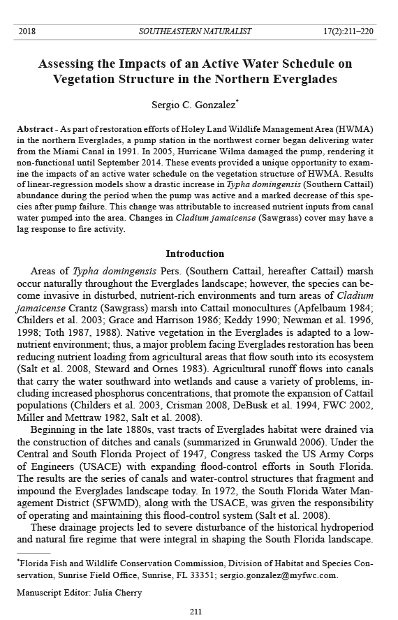
Study Area
Holey Land Wildlife Management Area (HWMA), encompassing 14,306 ha
(35,350 ac), is part of the Everglades Complex of Wildlife Management Areas
(ECWMA) and has been managed by the Florida Fish and Wildlife Conservation
Commission (FWC) (formerly the Game and Fresh Water Fish Commission) since
1968. The area comprises one of the northern extents of the Everglades Sawgrass
marsh ecosystem north of Water Conservation Area 3 and south of the Everglades
Agricultural Area, which extends to Lake Okeechobee (Fig. 1). The area is completely
impounded by canals, levees, and ditches used to control water-flow. The
western and southern boundaries of HWMA follow the L-23 (Miami Canal) and
the L-5 levees, respectively, which separate the area from its associated canals. The
northern and eastern boundaries are bordered by a levee along which is a seepage
canal that helps move water from the northwest corner to the southeast corner. Water
management is coordinated with the SFWMD (FWC 2002).
Southeastern Naturalist
213
S.C. Gonzalez
2018 Vol. 17, No. 2
As part of the hydrological restoration of HWMA, a pump station (G200A) was
constructed in the northwest corner of the area in 1991 to deliver water from the Miami
Canal. The initial operating plan specified that water stages in HWMA should
vary between 3.50 m (11.5 ft) MSL on 16 May and 4.11 m (13.5 ft) on 1 November
each year. In order to meet these objectives, the plan called for water to be pumped in
when rainfall was insufficient. However, since the onset of hydrological restoration,
Cattail has expanded to cover significant portions of the area, forming large monocultures,
and has become a major management concern (FWC 2002, FDEP 2004).
Concern over the effects of the new hydrology and water quality prompted
Cattail monitoring activities. Once Cattail coverage exceeded 809 ha (2000 ac),
managers placed flashboards in the 3 outflow culverts located on the southern border
of HWMA, which helped retain rainwater and reduce the amount of untreated
water that needed to be pumped into the area from the Miami Canal. A revision of
elevation in the area prompted the original schedule to be lowered by 1.27 cm (0.5
in) in 1993. Due to explosive expansion of Cattail and yearly high-water stress on
the deer herd, a water schedule of 3.2–3.81 m (10.5–12.5 ft) MSL was adopted as
of 1995 (FWC 2002).
The hydroperiod of the area was managed in this way until 2005, when Hurricane
Wilma damaged the G200A pump and rendered it mostly non-functional and
Figure 1. Map of Holey Land Wildlife Management Area.
Southeastern Naturalist
S.C. Gonzalez
2018 Vol. 17, No. 2
214
the area’s hydrology was primarily rainfall-driven. Managers repaired the pump in
September 2014, and the station began operating again in October 2014.
Methods
Aerial vegetation surveys have been conducted in HWMA since 1992 to track
changes in Cattail coverage. These surveys consist of point transects that cover
the entire area and are flown as east–west transects by helicopter with 2 biologists
recording the vegetation type at each point. A total of 372 points form a grid over
the area with longitudinal distances of 625 m and a latitudinal distance of 700 m between
transects (totaling 17 transects). Between 1992 and 2003, surveyors recorded
only Cattail presence at each point. In 2004, they incorporated other vegetation
types into the surveys, including Sawgrass, Morella cerifera L. (Wax Myrtle), Salix
carolinensis Berry (Carolina Willow), and Acer rubrum L. (Red Maple). I compiled
data from aerial surveys, as well as records of all known prescribed and wildfire
events in the area. I extracted stage level (water-table level above MSL) and waterquality
data from the SFWMD DBHYDRO online database.
I performed a 2-sample t-test to evaluate whether average monthly phosphate
concentrations in the water were significantly different before and after the pump
failure. To identify factors influencing Cattail coverage, I conducted a multilinearregression
analysis in R (R ver. 3.1.1; www.r-project.org). Model parameters that
I explored included area burned in the 12 months preceding the surveys, mean
annual stage-level, minimum and maximum monthly average stage-levels, and annual
mean of total-phosphate levels (mg/L) measured on the outflow side (HWMA
side) of the G200A. I used stepwise regression procedures to generate 6 optimized
models to predict percent Cattail cover, yearly change in percent Cattail cover, and
percent Sawgrass cover. Model selection was based on the variable combination
that resulted in the lowest Akaike information criterion values.
I further explored the effects of fire by generating and incorporating fire variables
that might reflect a lag in vegetation response to wildfire (12-month total area
burned 4 y prior to the survey, total area burned over the 3 y prior to the survey,
and total area burned over 5 y prior to the survey). I then replaced the total area
burned in the preceding 12 months with each new variable and re-ran the analysis
each time.
Results
The yearly Cattail cover estimates since 1990 show a parabolic trend that
drops off after the failure of the pump station and is also synchronous with a drop
in total phosphate concentrations (Fig. 2). Cattail percent cover estimated by aerial
surveys was less than 5% in 1992 and peaked at 31.7% in 2000. There was a data gap
from 2001–2003, during which no surveys were conducted. The data from 2005
onward shows a decline in Cattail cover for each subsequent year with the lowest
coverage of 10.4% in 2010. The 2014 vegetation survey estimated Cattail coverage
to be 21.1%.
Southeastern Naturalist
215
S.C. Gonzalez
2018 Vol. 17, No. 2
Yearly average total phosphate concentrations varied from 11 ppb in 2008 to
69 ppb in 2005, with a mean of over 40 ppb for the entire data set. The maximum
phosphate concentration measured was 118 ppb in December 2004. Overall, average
monthly phosphate concentrations exceeded 45 ppb. During the period when
the G200A pump was operational, monthly phosphate concentrations averaged 51
ppb. That value dropped to a monthly average of 23 ppb for the period after the
pump station broke down. The two-sample t-test demonstrated a significant difference
between the two means (t = 7.14, df = 92, P < 0.001).
The stepwise regression produced a model to predict Cattail cover that only
included minimum monthly average stage-level and annual mean total phosphate
concentrations (Table 1). Both factors were significant predictors of percent Cattail
Figure 2. Percent Cattail cover, yearly average dissolved phosphate concentration, and
monthly average stage-level over the study period.
Table 1. Results of multi-linear regression analysis. An asterisk (*) indicates that the model includes
a time-lag effect of fire.
Response Predictive variables β SE P-value R2
Percent Cattail cover
Minimum monthly stage-level -0.077 0.022 0.003 0.52
Mean annual P-concentration 2.307 0.647 0.002
Yearly change in percent Cattail cover
Minimum monthly stage-level -0.061 0.025 0.026 0.38
Mean annual stage level 0.105 0.035 0.001
Percent Sawgrass cover
Mean annual stage-level -0.273 0.066 0.004 0.76
Maximum monthly stage-level -0.113 0.091 0.256
Area burned in last 12 months 4.24E-06 2.70E-06 0.160
Percent Sawgrass cover*
Mean annual stage-level 0.146 4.40E-06 0.011 0.80
12-month area burned 4 y prior 4.70E-06 2.08E-06 0.054
Southeastern Naturalist
S.C. Gonzalez
2018 Vol. 17, No. 2
216
cover. Increases in minimum monthly average stage-level were associated with
a decrease in percent Cattail cover. Total phosphate concentrations had a strong
positive effect on percent Cattail cover. Yearly change in percent Cattail was best
predicted by minimum monthly average stage-level and mean monthly average
stage-level (Table 1).
The optimized model for percent Sawgrass cover included maximum and mean
monthly average stage-level and 12-month total area burned. Only the mean annual
stage-level was a significant predictor of Sawgrass cover (T able 1).
When replacing the 12-month total area burned with any one of the 3 time-lag
variables, each of these new fire variables had significant effects on the abundance
of Sawgrass (P < 0.1 in all cases). The model that best fit the data included the
12-month total area burned 4 y prior as a predictor and mean annual stage level
(Table 1). Further exploration of the intricacies of the relationship between fire and
Sawgrass were beyond the scope of this analysis; however, I surmise that the full
effects of fire (direct and indirect) on Sawgrass are likely additive and fully realized
over the course of several years.
Discussion
This assessment quantitatively demonstrates some of the measurable effects
of restoration efforts in this northern Everglades marsh community on the macroscale
vegetation structure. The operation of the G200A pump resulted in dramatic
changes in HWMA’s vegetation composition. Not only was hydroperiod affected,
but the results of this study suggest that the inflow of nutrient-contaminated water
promoted the rapid expansion of Cattail in the area. This finding supports my
hypothesis and is consistent with the findings of David (1996) and Childers et al.
(2003) that also suggest that phosphorus-enriched water has encouraged Cattail
encroachment in other parts of the Everglades.
Total-phosphate levels most accurately predicted percent Cattail cover overall,
while hydrological parameters most closely predicted annual change in Cattail cover.
The slight negative relationship between Cattail cover and minimum monthly
average stage-level was surprising and appears to suggest that a drier dry period has
a less-negative effect on Cattail abundance than less-extreme dry period condition.
However, this situation could result from several factors. Monthly phosphate concentrations
are somewhat cyclical in the data, with lower phosphate concentrations
generally seen in the drier half of the year, when less water is available to be moved
into the system; this pattern would account for an overall negative coefficient for
a “dryness” parameter. Secondly, dry-downs can enhance Cattail seed germination
(consistent with “lower minimum water = less-negative effect”; Johnson et
al. 2007, Sojda and Solberg 1993). Alternatively, this relationship might reflect
an indirect correlation between Cattail and other effects of drought, such as more
frequent or larger fires.
Yearly change in percent Cattail cover was significantly affected by hydrological
parameters, but not by total phosphate concentrations. Superficially, this outcome
seems at odds with the results of the model predicting total Cattail cover in the area.
Southeastern Naturalist
217
S.C. Gonzalez
2018 Vol. 17, No. 2
However, when considering differences in how the variables in the model affect the
response variable (yearly change in Cattail cover) throughout the data set, it is clear
that hydrological variables would be better predictive variables than total dissolved
phosphate concentrations in the water. Although phosphate concentrations were
not direct predictors of yearly change in percent Cattail cover, maintaining higher
mean stage-levels requires more water to be pumped in, thereby increasing the total
phosphate flowing into HWMA. Conditions in the area after the 2005 pump failure
were consistently much drier, thus both reduced phosphorus inputs and drier conditions
likely worked synergistically to reduce Cattail cover in the area. Further, after
2005, without artificially high nutrient inputs into the system, rainfall-driven wet
and dry conditions would most directly affect the annual rate of retreat of Cattail.
Percent Sawgrass cover was driven by both hydrology and fire, and it should
be noted that the effects of maximum stage-level and area burned in the 12 months
prior to a survey were in opposite directions. Thus, the results suggest that extreme
wet seasons may negatively affect Sawgrass abundance and that fire is positively
correlated with Sawgrass abundance. Considering that the results show that yearly
change in Cattail cover is predicted by hydrological variables, it is likely that the
negative effect of extreme high water on relative Sawgrass coverage is both direct
and indirect (i.e., via concurrent increases in Cattail).
In similar Sawgrass marsh communities, fire can promote the spread of Cattail
because its greater phosphorus-uptake capacity allows it to grow more rapidly after
a fire-associated nutrient release (Lorenzen et al. 2001, Miao et al. 2010, Newman
1998, Wu et al. 2012). Although a phosphate release by fire may cause a localized
increase in Cattail abundance in a nutrient-restricted system, this result is not apparent
in this dataset. Any such effect in this area is overshadowed by the much
Figure 3. Changes in vegetation structure since 2004 plotted with acreage burned in the
preceding 12 months.
Southeastern Naturalist
S.C. Gonzalez
2018 Vol. 17, No. 2
218
stronger effect of high nutrient loadings in water that has been pumped into the area.
Recent fire before the survey may similarly make surviving overstory species, such
as Carolina Willow and Wax Myrtle, less detectable to observers on aerial surveys
because it takes longer for these species to resprout than Sawgrass in the understory
(S.C. Gonzalez, pers. observ.). By this mechanism, data could suggest spikes
in Sawgrass and decreases in woody species that might hide a relative increase in
Cattail that was attributable to fire (such as in 2007; Fig. 3).
Newman et al. (1998) concluded that because they could find no phosphate
limitations between Sawgrass and Cattail stands in HWMA, either an increase
in water depth or duration of flooding stimulated Cattail growth in combination
with some effect of fire. In an environment with no nutrient limitations (specifically
phosphorus), the remaining spatial niche differentiator between Cattail and
Sawgrass is hydroperiod. Thus, in a temporally static survey in such an environment
(i.e., HWMA in 1998), one would expect water depth to best predict the
occurrence of Cattail or Sawgrass at a site. Although Cattail cover would have
undoubtedly increased in some areas with the implementation of a longer hydroperiod,
this study demonstrates that there was indeed a release from nutrient
limitation in HWMA which drove the explosive increase in Cattail abundance that
began in the early 1990s.
The return to functioning status of the G200A will most certainly have noticeable
effects on the vegetation communities and, by extension, wildlife communities
in HWMA. An increase in Cattail abundance will likely be noticeable within the
next 2 y as a consequence of higher water levels and increased nutrient inputs.
Fortunately, water pumped into HWMA will now have first been treated through
the adjacent stormwater treatment areas (STAs) instead of being pumped directly
from the Miami Canal. The STAs were designed and constructed to reduce nutrient
loading via vegetation uptake and sedimentary filtration of water flowing from the
Everglades Agricultural Area before continuing into the Everglades natural areas.
Any negative impacts of poor water-quality that were observed previously should
be less severe because they are expected to be closer to the 10-ppb limit that the
state adopted for the areas south of HWMA in 2005 (FDEP 2004).
Acknowledgments
I thank M. Anderson, T. Doonan, E. Stevenson, and M. Ward with the Florida Fish and
Wildlife Conservation Commission for reviews and logistical support; and Dr. V.S. Briggs-
Gonzalez at the University of Florida for comments and logistical support.
Literature Cited
Apfelbaum, S.I. 1984. Cattail (Typha spp.) management. Natural Areas Journal 5(3):9–17.
Childers, D.L., R.F. Doren, R. Jones, G.B. Noe, M. Rugge, and L.J. Scinto. 2003. Decadal
change in vegetation and soil-phosphorus pattern across the Everglades landscape. Journal
of Environmental Quality 32:344–362.
Crisman, T.L. 2008. Everglades ecology. Pp. 34–43, In M. Doyle and C.A. Drew (Eds.).
Large-scale Ecosystem Restoration. Island Press, Washington, DC. 340 pp.
Southeastern Naturalist
219
S.C. Gonzalez
2018 Vol. 17, No. 2
David, P.G. 1996. Changes in plant communities relative to hydrologic conditions in the
Florida Everglades. Wetlands 16(1):15–23.
DeBusk, W.F., K.R. Reddy, M.S. Koch, and Y. Wang. 1994. Spatial distribution of soil
nutrients in a northern Everglades marsh: Water conservation area 2A. Soil Science
Society of America Journal 58:543–552.
Florida Department of Environmental Protection (FDEP). 2004. Water-quality standards
for phosphorus within the Everglades Protection Area. Appendix 2C-1 in 2004 Everglades
Consolidated Report. Tallahassee, FL.
Florida Fish and Wildlife Conservation Commission (FWC). 2002. Conceptual management
plan for the Everglades complex of wildlife management areas. Internal report.
Tallahassee, FL.
Grace, J.B., and J.S. Harrison. 1986. The biology of Canadian weeds: 73. Typha latifolia
L., Typha angustifolia L., and Typha glauca Godr. Canadian Journal of Plant Science
66:361–379.
Grunwald, M. 2006. The Swamp. Simon and Schuster Paperback, New York, NY. 480 pp.
Johnson, K.G., M.S. Allen, and K.E. Havens. 2007. A review of littoral vegetation, fisheries,
and wildlife responses to hydrologic variations at Lake Okeechobee. Wetlands
27(1):110–126.
Keddy, P.A. 1990. Competitive hierarchies and centrifugal organization in plant communities.
Pp. 265–290, In J.B. Grace and D. Tilman (Eds.). Perspectives on Plant Competition.
Academic Press, New York, NY. 484 pp.
Lorenzen, B., H. Brix, I.A. Mendelssohn, K.L. McKee, and S.L. Miao. 2001. Growth, biomass
allocation, and nutrient-use efficiency in Cladium jamaicense and Typha domingensis
as affected by phosphorus and oxygen availability. Aquatic Botany 70:117–133.
Miao, S.L, C. Edelstein, S. Carsternn, and B. Gu. 2010. Immediate ecological impacts of a
prescribed fire on a cattail-dominated wetland in Florida Everglades. Fundamental and
Applied Limnology 176(1):29–41.
Miller, R.A., and H.C. Mattraw Jr. 1982. Storm-water runoff quality from 3 land-use areas
in South Florida. Water Resource Bulletin 18:513–519.
Newman, S., J.B. Grace, and J.W. Koebel. 1996. Effects of nutrients on hydroperiod on
Typha, Cladium, and Eleocharis: Implications for Everglades restoration. Ecological
Applications 6:774–783.
Newman, S., J. Schuette, J.B. Grace, K. Rutchey, T. Fontaine, K.R. Reddy, and M. Pietrucha.
1998. Factors influencing cattail abundance in the northern Everglades. Aquatic
Biology 60:265–280.
Salt, T., S. Langton, and M. Doyle. 2008. The challenges of restoring the everglades ecosystem.
Pp. 5–33 in M. Doyle and C.A. Drew (Eds.). Large-scale Ecosystem Restoration.
Island Press, Washington, DC. 340 pp.
Sojda, R.S., and K.L. Solberg. 1993. Waterfowl management handbook 33: Management and
control of cattails. US Fish and Wildlife Service leaflet 13.4.13. 33. Washington, DC.
Steward, K.K., and H. Ornes. 1983. Mineral nutrition of Sawgrass (Cladium jamaicense
Crantz) in relation to nutrient supply. Aquatic Botany 16:349–359.
Toth, L.A. 1987. Effects of hydrologic regimes on lifetime production and nutrient dynamics
of Sawgrass. Technical Publication 87-6. South Florida Water Management District,
West Palm Beach, FL.
Toth, L.A. 1988. Effects of hydrologic regimes on lifetime productions and nutrient dynamics
of cattail. Technical Publication 88-6. South Florida Water Management District,
West Palm Beach, FL.
Southeastern Naturalist
S.C. Gonzalez
2018 Vol. 17, No. 2
220
US Congress. 2000. Water Resources Development Act of 2000. Title VI - Comprehensive
Everglades Restoration. Washington, DC.
Wu, Y., K. Rutchey, S. Newman, S. Miao, N. Wang, F.H. Sklar, and W.H. Orem. 2012.
Impacts of fire and phosphate on Sawgrass and cattails in an altered landscape of the
Florida Everglades. Ecological Processes 1(8).


 The Southeastern Naturalist is a peer-reviewed journal that covers all aspects of natural history within the southeastern United States. We welcome research articles, summary review papers, and observational notes.