Viking Age Fences and Early Settlement Dynamics in Iceland
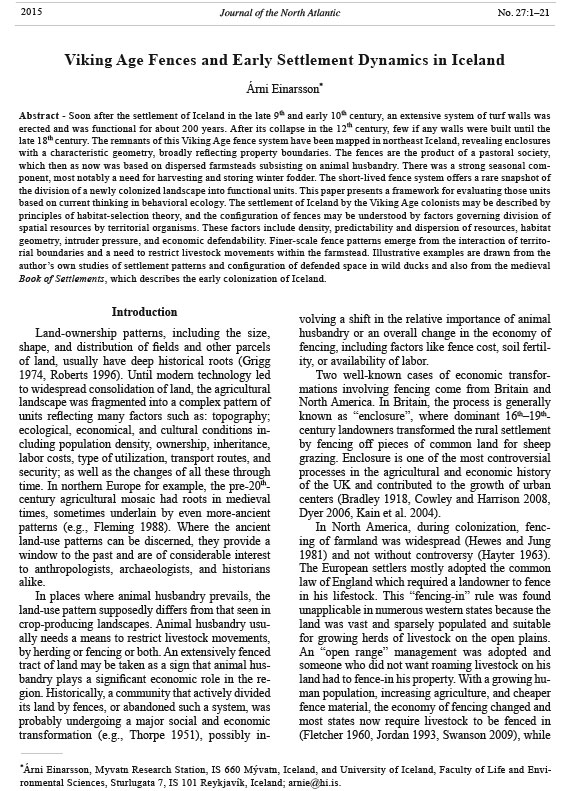
Árni Einarsson*
Abstract - Soon after the settlement of Iceland in the late 9th and early 10th century, an extensive system of turf walls was
erected and was functional for about 200 years. After its collapse in the 12th century, few if any walls were built until the
late 18th century. The remnants of this Viking Age fence system have been mapped in northeast Iceland, revealing enclosures
with a characteristic geometry, broadly reflecting property boundaries. The fences are the product of a pastoral society,
which then as now was based on dispersed farmsteads subsisting on animal husbandry. There was a strong seasonal component,
most notably a need for harvesting and storing winter fodder. The short-lived fence system offers a rare snapshot of
the division of a newly colonized landscape into functional units. This paper presents a framework for evaluating those units
based on current thinking in behavioral ecology. The settlement of Iceland by the Viking Age colonists may be described by
principles of habitat-selection theory, and the configuration of fences may be understood by factors governing division of
spatial resources by territorial organisms. These factors include density, predictability and dispersion of resources, habitat
geometry, intruder pressure, and economic defendability. Finer-scale fence patterns emerge from the interaction of territorial
boundaries and a need to restrict livestock movements within the farmstead. Illustrative examples are drawn from the
author’s own studies of settlement patterns and configuration of defended space in wild ducks and also from the medieval
Book of Settlements, which describes the early colonization of Iceland.
*Árni Einarsson, Myvatn Research Station, IS 660 Mývatn, Iceland, and University of Iceland, Faculty of Life and Environmental
Sciences, Sturlugata 7, IS 101 Reykjavík, Iceland; arnie@hi.is.
Introduction
Land-ownership patterns, including the size,
shape, and distribution of fields and other parcels
of land, usually have deep historical roots (Grigg
1974, Roberts 1996). Until modern technology led
to widespread consolidation of land, the agricultural
landscape was fragmented into a complex pattern of
units reflecting many factors such as: topography;
ecological, economical, and cultural conditions including
population density, ownership, inheritance,
labor costs, type of utilization, transport routes, and
security; as well as the changes of all these through
time. In northern Europe for example, the pre-20thcentury
agricultural mosaic had roots in medieval
times, sometimes underlain by even more-ancient
patterns (e.g., Fleming 1988). Where the ancient
land-use patterns can be discerned, they provide a
window to the past and are of considerable interest
to anthropologists, archaeologists, and historians
alike.
In places where animal husbandry prevails, the
land-use pattern supposedly differs from that seen in
crop-producing landscapes. Animal husbandry usually
needs a means to restrict livestock movements,
by herding or fencing or both. An extensively fenced
tract of land may be taken as a sign that animal husbandry
plays a significant economic role in the region.
Historically, a community that actively divided
its land by fences, or abandoned such a system, was
probably undergoing a major social and economic
transformation (e.g., Thorpe 1951), possibly involving
a shift in the relative importance of animal
husbandry or an overall change in the economy of
fencing, including factors like fence cost, soil fertility,
or availability of labor.
Two well-known cases of economic transformations
involving fencing come from Britain and
North America. In Britain, the process is generally
known as “enclosure”, where dominant 16th–19thcentury
landowners transformed the rural settlement
by fencing off pieces of common land for sheep
grazing. Enclosure is one of the most controversial
processes in the agricultural and economic history
of the UK and contributed to the growth of urban
centers (Bradley 1918, Cowley and Harrison 2008,
Dyer 2006, Kain et al. 2004).
In North America, during colonization, fencing
of farmland was widespread (Hewes and Jung
1981) and not without controversy (Hayter 1963).
The European settlers mostly adopted the common
law of England which required a landowner to fence
in his lifestock. This “fencing-in” rule was found
unapplicable in numerous western states because the
land was vast and sparsely populated and suitable
for growing herds of livestock on the open plains.
An “open range” management was adopted and
someone who did not want roaming livestock on his
land had to fence-in his property. With a growing human
population, increasing agriculture, and cheaper
fence material, the economy of fencing changed and
most states now require livestock to be fenced in
(Fletcher 1960, Jordan 1993, Swanson 2009), while
2015 Journal of the North Atlantic No. 27:1–21
2015 Journal of the North Atlantic No. 27
Á. Einarsson
2
open-range management still exists in certain areas
of most western states (Andes 2000). As in Britain,
this develoment was not peaceful. In late-19th-century
Texas, a series of disputes, the “Fence-Cutting
War” broke out when established cattle breeders
began to fence off their larger tracts of land with
barbed wire in order to protect them from farmers’
claims. The farmers saw this as a closing of the open
range, and began to cut fences in order to reclaim
lands in the public domain (Gard 1947).
In the early 10th century, an extensive system of
turf walls was built in northeast Iceland (Einarsson
et al. 2002, unpubl data). The walls were in use over
a relatively short period (10th–12th century), but their
remains have been traced archaeologically to reveal
a complex network of enclosures extending from
the coast to the lower highlands (Fig. 1; Einarsson
and Aldred 2011, Einarsson et al. 2002). In Iceland,
human settlement started relatively late. Literary
tradition, supported by archaeological, palaeoecological,
linguistic, and genetic evidence, indicates
that colonization of the hitherto virgin island took
place by a wave of immigration in the period A.D.
870–930, principally from Norway but also from Viking
colonies in the northern part of the British Isles
(e.g., Hallsdóttir and Caseldine 2005, Helgason et al.
2000, Krzewińska et al. 2015, Smith 1995, Vésteinsson
and McGovern 2012). The settlers cleared the
birch scrubland and established a dispersed farming
society subsisting to a large degree on animal
husbandry. Each farming unit consisted of one or
more households with a group of workers and slaves
(Vésteinsson 1998). This period of settlement set the
stage for social development that was to influence
the future course of events in Iceland.
A short-lived network of fences, like the Viking
one associated with the settlement in Iceland, offers
a rare glimpse of land partitioning in a society in
its infancy and probably little obscured by previous
land use and later developments. The large-scale
abandonment of the fences may also signify a major
social transformation.
But what do the fencing walls tell us? The situations
leading to the construction and abandonment
of this fence system are still unknown, but the geometry
of the fence patterns must contain information
that we may use to make inferences about the Viking
Age farming system and its resources. This information
cannot be extracted without some theoretical
framework. We need to know which environmental,
economic, and behavioral variables are most important
and what kind of dynamics shape the fence
pattern.
The fences can be viewed on 3 different scales.
The largest scale is the overall distribution of
habitable land. Another scale is the division of
the habitable land among the farmsteads, and the
third and smallest scale is the division of individual
farmsteads into units of management. The division
of habitable land among farmsteads, such as that
occurring in historical times in Iceland, can be
characterized as a territorial system (Bolender et
al. 2008, Cashdan 1983, Dyson-Hudson and Smith
1978, Maurer 1852) with well-defined property
boundaries. Such systems have been most thoroughly
described in the field of behavioral ecology and
occur where the cost of defending the resources is
less than that of sharing or foraging elsewhere. The
boundaries in territorial systems are dynamically
shaped by variables such as intrusion pressure, resource
density, and predictability (Maher and Lott
2000). The ancient wall system must partly reflect
such territory boundaries, but there should also be
intra-farmstead fences reflecting the need to confine
and separate groups of livestock and to respond to
seasonal changes in resources.
The aim of this paper is to illustrate the basic
factors shaping the layout of fenced areas, in order
to aid the interpretation of spatial patterns of archaeological
boundaries in general and the Icelandic
Viking Age walls in particular. The paper reviews
theoretical work on how settlement and boundary
patterns are generated by competition for space.
Ecologists have developed a suite of models to explore
how land is divided among settlers, all of them
revealing the dynamic nature of land division. The
results from a field study of space division in the real
world (by a territorial duck) will be presented in my
discussions here. In another section, I will assess
how realistically the medieval Book of Settlements
describes the Viking Age settling process of Iceland.
In two final sections, I examine how the geometry of
fenced areas should depend on competitive interaction,
landscape dimensionality, slope, fence costs,
and the needs of local stock and crop management.
Finally, I speculate on the rise and fall of the Viking
Age fence system.
The Viking Age Fences
The landscape
The Viking Age walls have been studied in a
3000-km2 area in the counties of Suður- and Norður
Þingeyjarsýsla in northeastern Iceland (Fig. 1). The
area can conveniently be divided into 4 main geographical
units (Einarsson and Aldred 2011). Two
of them (Kelduhverfi and Mývatn area) are characterized
by a flat landscape with extensive postglacial
(postdating the end of the Ice Age) lava fields,
interrupted by ridges of hyaloclastite (consolidated,
Journal of the North Atlantic
3
2015 No. 27
Á. Einarsson
sandstone-like tephra from glacial periods). A third
landscape unit are the glacier-carved valleys between
Lake Mývatn and the coast. This area is outside the
zone of present-day volcanic activity, although big
prehistoric lava streams cover the bottom of 2 of the
valleys. The bedrock here is moraine-covered basalt
with a rather thin layer of organic soil. The shallow
valleys provide the focus for most of the present-day
farming. They are separated by oval ridges of moorland
that extend from the highland plateau of Iceland
towards the coast. The fourth landscape unit is the
west coast of the Tjörnes peninsula. This area has a
Figure 1. A map of the study area in northeastern Iceland showing the extent of the medieval wall system (red). Green colors
indicate vegetated land.
2015 Journal of the North Atlantic No. 27
Á. Einarsson
4
low rocky coastline with small streams at regular intervals
and basaltic bedrock covered by thick banks
of raised marine sediments.
The whole habitable area of northeast Iceland
was apparently covered with birch (Betula pubescens)
scrubland at the time of first settlement
(Lawson et al. 2007). Today it is largely devoid of
woodland. The vegetation on the moorland and lava
areas, and in some of the uninhabited parts of the
valleys, is mostly heath-like, dominated by dwarf
birch (B. nana) and crowberry (Empetrum nigrum).
The inhabited parts of the study area have much
more grassland. Hay for winter fodder is the only
substantial crop produced on the hayfields around
the farms. Bogs and other wetlands are scattered
throughout the area except in the largest lava fields.
Extensive blanket and string bogs are characteristic
of the southernmost moorlands. The soil cover is
mostly continuous but is locally eroded in many
exposed and steep places.
The study area has been inhabited from the very
beginning of settlement (McGovern et al. 2007) and,
like elsewhere in Iceland, was based on dispersed
farms with a livestock of cattle, sheep, horses, pigs,
and goats feeding on grass from hayfields, meadows,
and pastures and also browsing of birch leaves and
twigs in the woodlands. The inhabitants also used
wildlife resources such as salmonid fish in the lakes
and rivers, abundant sea fish and sea birds (including
eggs), and rock ptarmigan (Lagopus muta). Some of
the coastal wildlife harvest was brought inland for
processing or consumption (McGovern et al. 2006).
The walls
The ancient turf walls are the most prominent
feature of the archaeological landscape of northeast
Iceland (Fig. 2). They run long distances (over 600
km have been mapped to date), criss-crossing the
moorlands and heaths (Aldred 2008, Einarsson et
al. 2002). The walls have collapsed, and most now
can only be seen as low earthworks in the landscape.
They seem roughly contemporaneous though there
are indications of multiple phases of construction in
some areas. For the most part, a basic pattern can be
discerned, modified by only minor repairs, rebuilds,
and additions, and it appears that the walls went
out of use a few generations after they were built.
Tephrochronological dating places the majority
Figure 2. Viking age turf walls in the study area. (a) Oblique aerial view of a complex of wall and farm ruins. (b) A cross
section of a wall, the stacked turf is revealed by a repeated sequence of dark volcanic tephra layers. (c) and (d) Remains of
two walls on the ground. Photographs © Árni Einarsson.
Journal of the North Atlantic
5
2015 No. 27
Á. Einarsson
in the 10th–11th centuries. Their maintenance was
discontinued sometime before the 13th century, and
almost all the dated walls had collapsed long before
a characteristic tephra layer from A.D. 1477 was
deposited (e.g., Hreidarsdóttir and Ólafsson 2012,
unpubl. data).
The walls form a basic pattern of enclosures
(Fig. 3), each one corresponding to an individual
farm but also internally subdivided, evidently for
more-local management of grazing, stock manipulation,
and protection of growing crops (mostly grass).
In the valley and coastal landscapes, the enclosures
tend to be square-shaped. Walls run uphill on what
seems likely to be property boundaries between
farms. A horizontal wall (a head wall) on the hillside
divides the rangeland above the farm into a near and
far section. These walls, enclosing the farm on 3
sides (a river or seashore typically closes the boundary
on the downhill side), often look like they have
been built as a single entity. The head-wall usually
joins similar ones on the neighboring farms, creating
a continuous structure that integrates multiple farm
properties and fences entire valleys from the surrounding
hills (Einarsson and Aldred 2011). In flat
landscape, such as some heathlands at the southern
border of the study area and in the lava fields, round
enclosures tend to be more prominent than square
ones, which are more typical for the valley and
coastal habitats.
Behavioral Ecology of Territoriality and
Settlement Patterns
The Viking Age walls are fences for livestock
management. Many of them are likely to trace property
boundaries, and most of those were probably
established by behavioral interactions during the
settlement period where competition for space must
have been a major factor. If we want to understand
this process and its outcome, it is necessary to look
Figure 3. A part of the turf wall system in northeastern Iceland.
2015 Journal of the North Atlantic No. 27
Á. Einarsson
6
at factors determining the shape and configuration of
territorial boundaries in general.This section gives a
brief overview of current ideas in ecology regarding
how space is divided and settlement patterns emerge
in mobile organisms. The emphasis is on organisms
competing for space, leading to the formation of territories,
defined as any defended spaces with a fixed
location (see Adams 2001). The basic idea is that territory
boundaries, created by excluding others from
local resources that are in demand, will be molded
by opposing pressures of intrusion and repulsion.
The focus here will be on territorial behavior of individuals
or families, not larger groups such as tribes
or larger social units.
Division of land through territorial behavior is
frequently observed in the animal world, giving rise
to interesting spatial patterns resulting from the repulsive
behavior. Ecologists have developed models
to describe how space is divided and how it is influenced
by resource density, resource dispersion and
predictability, intrusion pressure, and cost of defense
(e.g., Adams 2001). These models have been useful
for interpreting territoriality and sociality in such
diverse groups as fish, birds, reptiles, and mammals.
They have shed light on differences in space use
when a species occupies habitats of different quality,
and have also been used to analyze the dynamic
situation that arises when migratory birds settle in
their breeding habitat in spring. The models are not
species-specific and have a high degree of generality
which makes them useful also for insight into settlement
patterns and land tenure in human societies
(Baker 2003, Cashdan 1983, Chabot-Hanowell and
Smith 2013, Dyson-Hudson and Smith 1978, Field
2005, VanValkenburgh and Osborne 2013). I will
give a short review of such models here because they
shed light on the dynamics of the situation. It should
be emphasized that animal behavior is not used here
as an analogy for human behavior. Rather I make use
of models that describe how antagonistic behavior
of mobile organisms creates and shapes settlement
patterns. It just happens that most of the models have
been developed by animal ecologists.
In this section, numerous references are made to
“patches” and “habitats”. Patches refer to a division
of land roughly corresponding to the home range of
an individual. In human settlement terms, a patch
would mean an inhabitable spot. Habitat refers to a
larger area; here it is used as a set of patches of similar
type or quality. On a human scale, lowland and
upland areas would be 2 different habitats, so would
south-facing vs. north-facing slopes, grasslands vs.
woodlands, and landlocked vs. shore-based areas
to name a few examples. Usually habitats can be
contrasted, one being more suitable than the other.
However, as we will see, the quality of habitat is not
a fixed value but depends on the density of competitors.
Farm property boundaries, defined by fences
or formal agreement, and boundaries in a system of
contagious non-overlapping animal territories (often
defined by visual threat displays) will be discussed
as “territory boundaries”. In most animal models,
the agent responsible for territory defense is a male
or a pair, but sometimes a family or a more complex
kin group is involved. In the case of Viking Age
farmers in the settlement period, the entire household
was probably engaged in boundary patrol and
maintenance, aided by pressure exerted by grazing
livestock (and later by social contracts, such as law).
Settlement patterns
The earliest model of animal settlement was presented
by Brown (1964) and is still useful in its simplicity
(see also Brown 1969). When animals settle
into a habitat on a seasonal basis, their settling patterns
are expected to reflect their preference for rich
food supplies. The first settlers ought to settle in the
best feeding patches (given that nest sites are available).
The best habitat will be filled up and become
saturated. Further settlement will then take place in
the second best habitat (e.g., Kluijver and Tinbergen
1953). When this habitat becomes saturated, further
settlement may have to take place in a habitat which
is unsuitable for breeding, resulting in “floaters”
which postpone breeding or wait for an opportunity
to fill a vacancy when an animal in a better
habitat dies. The progress of settlement described by
Brown’s model has been observed in a large number
of animal populations. The model seems to describe
both the seasonal settlement of migratory birds and
also the situation when an animal population is expanding.
As the population gets larger, more habitats
are used (e.g., Newton 1998). This phenomenon is
called the buffer effect. Brown’s model, although
developed for birds, makes intuitive sense also in the
human context: infilling of gradually less-productive
and more-marginal habitats as colonization progresses,
then a creation of a class of landless people
with delayed marriage and household formation,
some acting as subordinate individuals within the
household or vagabonding.
The next stepping stone of settlement theory
was a paper published by two mathematicians,
Fretwell and Lucas (1969). They realized that
habitat saturation was not a fixed dimension but a
dynamic process involving the number of contenders
and the relative quality of the habitats. As a null
model, they presented the ideal free distribution
Journal of the North Atlantic
7
2015 No. 27
Á. Einarsson
(IFD), a model which is still at the core of discussion.
The name stems from the assumption they
made of birds that are ideal in the sense of maximizing
their fitness, having perfect knowledge of
the environment and freedom to move from one
place to another. According to the ideal free model,
just as that of Brown (1964), the first birds to arrive
in an area will settle in the most suitable habitat.
With more birds settling, the suitability of the habitat
is reduced because of competition with those
already there. At some point, newcomers may find
it advantageous to settle in habitats with less food
and a lower density of competitors (Fretwell 1972,
Lack 1966, Sutherland 1996). From this moment,
both habitats will be settled in simultaneously, but
at different densities. The difference between the
predictions of the two models is that the “ideal
free” model predicts simultaneous settlement of
the two habitats after a certain density has been
reached, whereas Brown’s model assumes that the
better habitat becomes saturated before the inferior
habitat begins to be colonized. Both models predict
that settlement will begin later in the inferior
habitat. Field studies have not quite been able to
differentiate between the models, mostly because
the models are based on oversimplifications. Habitats
are not all that discrete, some degree of overlap
in intrinsic quality can be expected, and there is
a fair degree of unpredictability in the environment.
Some birds that settle in an inferior habitat
may be successful and will tend to go for the same
place the following breeding season (site tenacity)
and the offspring tend to do the same (philopatry,
silver-spoon effect). Despite these shortcomings
(e.g., Hugie and Grand 1998, Tregenza and Thompson
1998), the models make a useful framework
for thinking about settlement processes, and the
IFD model has been employed to analyze archaeological
records of the prehistoric establishment and
expansion of human settlements on the Northern
Channel Islands of southern California (Winterhalder
et al. 2010; see also Kennett et al. 2006 for
settlements in Oceania).
One assumption of the “ideal free” model that
definately does not hold is that birds are free to
move. In the actual world, a dominance hierarchy
(peck order) will restrict their movements, especially
the site-specific dominance called territoriality.
In many bird species, for example, territories
are exclusive, and the movements of new birds are
more or less restricted to areas not taken by earlier
settlers. In these cases, the first settlers occupy the
best patches. The ensuing process then is what
Fretwell and Lucas (1969) called the ideal despotic
distribution. The ideal despotic model assumes that
an individual that has settled in a habitat defends the
patch that it has settled in and monopolizes it. The
first one to arrive will select the best patch, and the
subsequent settlers will be forced to settle in progressively
less suitable patches. These later settlers
might compensate by keeping larger territories, but
the density of resources is lower and more effort is
needed to utilize them. Eventually, the only suitable
patches available in the richer habitat are similar to,
or poorer than the best patches in the poorer habitat.
The overall settlement pattern will be similar in
both the free and despotic models. Nicholson, one
of the eminent figures of ecological theory, termed
these two modes of resource utilization “scramble”
and “contest” competition respectively (Nicholson
1958). In scramble competition the game is to eat
faster than the others, in contest competition others
are kept away from the resources, which only works
if the benefits of such behavior outweight the costs.
Saturated habitats, polygamy, and natal dispersal
Behavioral ecology has produced theories about
what happens when habitats become saturated.
When habitats get crowded, individuals may opt for
settling inside already occupied territories in a good
area rather than moving to a poor habitat with little
reproductive potential. This theory would explain
the frequently observed behavior when animals
help others to raise their offspring (Brown 1987).
The parent gains from the helping, the helper gains
from experience and from being able to stay inside
the habitat while waiting for a vacancy (a “pay to
stay” strategy; Kokko et al. 2002). When habitats approach
saturation, young animals tend to stay home
longer, which often leads to “territory budding”
where the youngster eventually wins a part of the
parent territory and a slice of the neighboring one for
himself (Komdeur and Edelaar 2001). Orians (1969)
developed a similar idea, the polygyny threshold
model, to predict when certain bird species switched
from monogamy to polygamy. In this model, males
claim territories, which differ in quality, and then
start to attract mates. An unpaired female may
choose between being the only mate in an inferior
territory or to become the second mate in a good
territory. This tactic may be advantageous in spite of
a higher number of inhabitants on the good territory
and having to share a mate with another female. In
human terms, as habitats get saturated, the frequency
of co-residence should increase. The results include
cheap labor, tenancy, and joint and extended families
(see Benedictow 1993). Generally speaking, when
habitats are filled, theory predicts more sociality.
2015 Journal of the North Atlantic No. 27
Á. Einarsson
8
early settlers would tend to keep a large distance
from each other, but still short enough to prevent a
new territory to squeeze in between. The result of
sequential colonization should be that (1) territories
would tend to be larger than minimum, and (2) the
earliest territories would tend to be clustered together.
Evidence of such attraction was reviewed and
tested experimentally by Stamps (1988). The model
was further developed by Getty (1981), Stamps
(1988), and Stamps and Krishnan (1990).
Territory shape
Territory shapes tend towards certain geometric
configurations that reflect the 2 opposing forces of
intruder density and repulsion by the owner. An
ideal territory would be circular, but pressure from
neighbors will generate a near-hexagonal shape and
will tend to equalize territory sizes within a habitat
(Fig. 4; e.g., Barlow 1974, Hasegawa and Tanemura
1976). It should be noted that utilization of spacedout
resources by non-territorial organisms dispersed
from their homes also leads to near-hexagonal patterns
of activity (cf. central place foraging in ecology
[Orians and Pearson 1979] and catchment analysis
in archaeology [Vita Finzi and Higgs 1970]). Not
all habitats are spacious enough to allow a near-hexagonal
pattern to develop. Many habitats are linear,
e.g., river banks, forest edges, narrow valleys, and
seashores, and computer simulations and even tests
with interacting robots have shown that territories in
such habitats tend to become square-shaped (Fig. 5;
Votel et al. 2000). The ducks discussed below show
exactly this feature (see also Currie et al. 2000 for
another example).
A case study: Wild duck territories
This section gives a brief overview of a case study
by Einarsson (1990) of a territorial animal where the
filling-in of different habitats at the beginning of the
breeding season was followed in detail. The study
was on the Barrow’s goldeneye duck (Bucephala
islandica; Fig. 6) and offers a useful illustration of
the organizing forces that shape settlement patterns.
In spring, duck pairs established territories on open
water (Fig. 7). The territories were easily mapped by
observing the behavior of the tame birds. The males
defended square-shaped territories on the water
along the shore of the lake and also on the effluent
river. The territory boundaries, which appeared to
follow invisible lines on the water surface, were well
defined and maintained by direct-threat displays and
attacks. Defended areas were restricted to the water
surface and did not include the nest sites, which were
in the surrounding landscape. The pair spent over
90% of its activity within the territory, only leaving
Territory size in relation to habitat richness
So far we have described rather simple theories
about the sequential filling of habitats without worrying
too much about the behavioral mechanisms.
Such mechanisms may be important if they result in
a thinning out of the population. If a habitat contains
a certain density of individuals and territorial behavior
simply works to space them out, the territory
owner gains access to the habitat and lower travel
costs while foraging. In this case, the territorial behavior
alone has no effect on the population dynamics.
If, however, the repulsive effect of territorial
behavior leads to a lower density than might occur
otherwise, then more individuals will be forced into
inferior habitats with lower reproductive potential,
leading to a stronger density-dependent effect that
will affect final population size. Which of the scenarios
is more common is an issue that has not been
resolved and will not be discussed here. There are,
however, observations on territorial behavior and
territory size that deserve attention in the human
context of this paper.
The first, and a very common observation is a
negative correlation between resource density and
territory size (among the earliest ones being reported
by Cody and Cody 1972, Gill and Wolf 1975,
Kodric-Brown and Brown 1978, Simon 1975). Rich
habitats have small territories, poor habitats tend to
have large territories, but the variation in territory
size is usually high. It might seem obvious that animals
will not defend larger territories than needed
and that in a poor habitat a larger area is needed for
subsistence. Theoretical and experimental work with
animals, however, has shown that this is an oversimplification,
and several authors have developed
models that emphasize that territory size is a payoff
between the gain of keeping a large territory and the
costs incurred by defending a larger area. The territory
size should be adjusted so that the gain is maximized
or at least not outweighed by the cost (Hixon
1980, Lima 1984, Schoener 1983). This model
implies that territory sizes vary according to both
resource levels and intrusion pressure (e.g., Eberhard
and Ewald 1994). Intrusion pressure increases
with relative resource level, i.e., attractiveness of
the land, and population size. In the context of the
present paper, intrusion pressure is not only exerted
by fellow humans but also by their grazing animals.
There are other factors to consider. John Maynard
Smith (1974) presented a model to illustrate
the possible consequences of sequential versus
simultaneous establishment of territories. Animals
arriving simultaneously would tend to squeeze into
the available habitat, compressing the territories
to a minimum size. In sequential colonization, the
Journal of the North Atlantic
9
2015 No. 27
Á. Einarsson
divisions between contrasting subhabitats can be
made: (1) between the lake and the river, the latter
being far more productive; (2) between the upper
and lower parts of the river, the former being more
productive; and (3) between inshore and offshore
parts of the lake, with similar resources in both parts
but with lower defensibility offshore due to more
for visiting nest-sites and if insects emerging from
the lake offered a temporally superabundant food
source. The ducks fed on small invertebrate animals
on the lake and river bottom.
The duck habitat can be divided into subhabitats
with different resource density (food abundance)
that allow comparison of settlement patterns. Three
Figure 4. A regular settlement pattern is automatically generated if imagined settlers avoid each other. Left: Voronoi polygons
drawn around randomly distributed points (settlers). Right: A spaced out equilibrium situation after the settlers have
been allowed repeatedly to move to the centroids of the polygons. A system of near-hexagonal territories has been formed.
Redrawn from Hasegawa and Tanemura (1976).
Figure 5. The effect of changing the dimensionality of a
habitat on the shape of territories. Linear and two-dimensional
habitats tend to have square and polygonal territories
respectively. The rules of behavior of the “settlers” is
the same as in Figure 4. The diagrams show equilibrium
configurations for 3 “settlers” (dots). Stable equilibria to
the left, unstable equilibria to the right. h = height, w =
width of the rectangle. Redrawn from Votel et al. (2000).
Figure 6. A male Barrow’s goldeneye. Photograph © Yann
Kolbeinsson.
2015 Journal of the North Atlantic No. 27
Á. Einarsson
10
spring before poorer subhabitats were saturated,
so that the number of territorial pairs in the richer
subhabitat rose to a peak and then decreased again
while the numbers were still rising in the poorer
subhabitat. Many territories in the poorer subhabitat
were eventually abandoned, but it is not known if
they moved to a still poorer habitat farther away or
skipped breeding.
The inshore/offshore subhabitat division was
also illustrative (Fig. 7). Despite a similar resource
density, the inshore area was colonized first and the
offshore habitat was colonized only after the inshore
exposed boundaries (Einarsson 1990).
The study showed that the richer subhabitat
(river) was colonized faster and reached higher bird
densities (and consequently smaller territories) than
the poorer one (lake). Neighbor distances ranged
between 20 and 150 m (mode around 50 m) in the
rich habitat, but were between 20 and 320 m (mode
around 90 m) in the poorer habitat (Fig. 8). A buffer
effect was observed, in that the richer habitat
became saturated, and further settlement took place
only in the inferior habitat (Fig. 8.). The richer
subhabitats became temporarily overcrowded in the
Figure 7. Barrow’s goldeneye territories
in a small bay at Lake Mývatn on three
successive dates. (A) Increasing density,
most territories along the shoreline. First
offshore territories beginning to form. A
flock of non-territorial birds in the outer
bay; (B) Maximum density and oversaturation,
a number of offshore territories
present; (C) Final density. The flock of
nonterritorial birds has disappeared. Each
dot indicates a resident duck pair. Modified
from Einarsson (1990).
Figure 8. (A) The buffer effect
displayed by territorial
Barrow’s goldeneye ducks on
the river Laxá at Mývatn in
Iceland. The river has been
divided into an upper (richer)
and a lower (poorer) part. The
ducks settle first on the richer
part, then both parts are colonized
at a similar rate until the
rich part has become saturated.
After that, all further increase
is confined to the poorer part.
(B) Pairs on small territories
need to spend more time feeding
than pairs on larger territories
in the same bay, despite
similar food resource densities.
This fact probably reflects the
more stressful situation in territories
that have more of their
boundaries exposed to intrusion
(C). Modified from Einarsson
(1990). (D) Frequency distributions
of distances between
territorial neighbors in two
adjoining habitats where one
habitat is 10–20 times richer
than the other. From Einarsson
(1985).
Journal of the North Atlantic
11
2015 No. 27
Á. Einarsson
of Iceland, Grágás, which has extensive regulations
on how to build walls on property boundaries (Dennis
et al. 2000, Karlsson et al. 1992). The law presented
in the book were contemporaneous with the
walls and defined what constituted a lawful property
boundary wall, as well as how, when, and by whom
it should be constructed (Table 1).
The other documentary source is the Book of
Settlements (BoS, Icel. Landnámabók; Benediktsson
1968, Pálsson and Edwards 2007), a unique piece of
medieval literature, and the one on which we shall
focus here. It is a register of the main characters
who allegedly moved to Iceland in the “Settlement
Period”, A.D. 870–930. The compilation was carried
out some 200–300 years later, which limits the accuracy
of its information (Friðriksson and Vésteinsson
2003, Rafnsson 1974), and furthermore, some of the
text is augmented by material of a mythological character.
Despite this, its information has not yet been
contradicted by current archaeological knowledge,
and the book was a product of a society with a rich
oral tradition, with much awareness of geography
and history and where tracing of genealogy played
a major part (Pálsson and Edwards 2007). The BoS
gives a picture of the early settlement process. It
says who settled where, often with some details of
the circumstances, including territory boundaries.
There is a pattern in the settlement process according
to BoS that suggests that the course of events
may be described in similar terms as those behind
current ideas of habitat selection and territoriality.
In the animal world, territories are aquired
by various means. A newcomer may settle in an
unoccupied patch or he may fight for a patch in
an occupied area, displacing an earlier settler. In
areas had reached maximum density. The offshore
territories were smaller (the density was higher)
because intruders could enter from all sides resulting
in higher cost of defense (see Stamps et al. 1987
for theoretical aspects). Also, more of the intruders
were strangers, leading to more elaborate and costly
displays. The result for the holders of offshore territories
was that they needed more time to feed and
had less time for resting. All offshore territories
were eventually abandoned and so were some of the
inshore territories. The study suggests that the birds
have a limited amount of time they can spend in
defense and they will compensate for high defense
costs by keeping a smaller territory. This strategy
will compromise their feeding efficiency and may
in the long run force them to abort the settling attempt.
Inshore birds tried to minimize the exposed
boundary of their territories and reduced intrusion
by placing the territories against concave shorelines
(small bays).
The overall result of this balance between defense
costs and intrusion pressure in the Barrow’s
goldeneye is that richer habitats have a higher population
density than poorer areas.
The Book of Settlements
The Viking Age walls reflect a settlement pattern
and territorial boundaries that had stabilized after a
colonization process, presumably with much social
interaction where the ever increasing number of
competitors and their drive to settle in the favored
habitat must have been important features. Two ancient
documentary sources provide insight into this
process. One of them is the oldest medieval lawbook
Table 1. Legal walls (standardized property boundary walls) in Iceland according to the Grágás lawcode (Dennis et al. 2000:109–111,
115–116, 138–139, 301, 303; Karlsson et al. 1992:31 1–314, 321–322, 342–343).
Feature Regulation according to the Grágás law code
Time of year and
effort
A call for wall building means that the landowner and his neighbor have to spend two months per year in the
following three years in construction. During the two months (May and June) the construction work should
be given priority over other work except driving livestock home and collecting firewood. A third month (September)
was allocated for private wall work.
Dimensions Five feet thick at ground level, three feet at top. Shoulder height of an average person (about 1.50 m, but a
trench, created by digging the building material on one or both sides, adds to the effective height).
Material Material should be available so close that it needs not be transported by animals or cart.
Workers The farmer should not need to spend more labor than is normally available at his household.
Gates When a wall crosses a public way there should be a hinged gate, a fathom and an ell wide, so that if a man
wishes he may open and close it from horseback.
Cost Half and half with neighbor. If the adjacent land is owned by many (communal pasture), half of the cost will
be divided among them.
Legal aspects A farmer can only sue his neighbor for grazing on his land if there is a legal wall in place.
Shortcuts Shortcuts are encouraged across bends in the boundaries. The wall shall run as straight as possible through
meadowland. Walls should run around very valuable land such as nesting colonies, hayfields, and woodland.
2015 Journal of the North Atlantic No. 27
Á. Einarsson
12
The BoS mentions about 430 settlers over the
period of 60 years and gives useful information on
384 of them (Table 2). In the majority, or 267 cases,
the BoS simply states that they settled in (Icelandic
nam, 265 cases) or claimed (Icel. eignaði sér,
2 cases) a certain area, and more often than not the
territory boundaries are specified. In 30 more cases,
the settler was said to have made his or her home or
established a farm in a place (Icel. byggði, bjó, gerði
bú, átti) without defining the piece of land or how it
was aquired. In 19 more cases, a place was settled at
someone’s advice, and in one case by someone’s permission.
In 44 cases, the territory was received as a
gift from an earlier settler, in 18 (41%) of those cases
it was from a close relative. A total of 17 territories
were said to have been bought, only one of them from
a close relative and only because she insisted on paying
for the piece of land. When a territory was bought
or received as a gift, it was carved out of a larger territory.
In one case, the entire territory was sold and the
former owner left. There were 23 records of hostile
takeover (duels, threats, or forced selling). Another 4
movements were associated with matrimonial issues.
Twenty-two settlers spent one or more winters with
earlier established relatives before settling in a place.
Two people were said to have moved their settlement
in search for better land. For 147 settlers, a territory
boundary was said to have been formed by a river, and
9 of those were also said to have a boundary formed
by a mountain, lake, or a glacier.
Most if not all the named settlers claimed more
land than could be utilized by a single farmstead.
Some of the early settlers claimed large tracts of
land, sometimes a whole fjord with adjacent valleys,
that were later subdivided, and according to BoS
this behavior created a stir among later settlers and
the matter was resolved by the Norwegian king, who
proposed rules to constrain maximum territory size
(Benediktsson 1968:337).
either case, he may eventually have to fend off
later settlers. In the human context, purchase of
land can be seen as a peaceful way to settle a potential
territorial dispute. Final boundaries will be
set by mutual respect of the territorial neighbors,
who will avoid direct confrontations. Ecological
theory also expects animals to move between
habitats while searching for the best one. In summary,
an ecologist would expect to see in BoS
some evidence of exploration, habitat selection,
competition, aggression, boundary conflicts, and
displacement. To a certain degree, the best habitat
should be colonized first and then sequential filling
of habitats by productivity is expected, taking
into account that suitability of a habitat changes
with the number of settlers already there. Early
territories should be large and then contract as
population size and intrusion pressure rises, a process
that has been reported not only in ducks (Fig.
7) but also a number of other species (e.g., Kendeigh
1941, Blank and Ash 1956, Ickes and Ficken
1970, Zimmerman 1971). Territories in regionally
poorer habitat should be larger than those in rich
habitats, mainly because of low intrusion pressure.
Territory owners may move due to improved
knowledge of resources, pairing, or because they
were displaced. Conflicts should occur and may
increase in the next generation as the population
grows and as the natural environment changes in
response to exploitation. A final adjustment is expected
as settlers become more familiar with the
landscape, some may expand their territories while
others abandon theirs. Boundaries are expected to
follow natural landmarks, such as rivers, that enhance
the defensibility of the territories (Eason et
al. 1999, Reid and Weatherhead 1988).
The BoS does not yield information on all those
factors, and contains little information that allows
an evaluation of the sequential filling of habitat by
productivity. There are indications though that the
writers expected such a relationship. One comment
is that some of the earliest colonizers settled near
the mountains, having noticed that livestock was
attracted to the good grazing in the mountains. This
observation is followed by a comment in one of the
manuscripts that also in Norway the early human
settlement had followed the productivity of the land
(Benediktsson 1968:337). Another comment illustrates
the significance of travel costs: the south coast
was the last piece of land to be fully settled because
of paucity of landing sites (Benediktsson 1968:337).
And shortly later, in a different manuscript, it is
stated that the south of Iceland is the most productive
part of the island (Benediktsson 1968:338).
Table 2. Circumstances of aquiring a territory in the medieval
Book of Settlements. The figures refer to the number of cases
mentioned in the book.
Circumstance Number of cases
Direct settling (circumstances not given) 297
Settling by advice 19
Settling by permission 1
A gift (41% from relatives) 44
Buying (6% from relatives) 17
Movement by matrimonial issue 4
Moving to better location 5
Forced displacement:
Killed 4
Threatened 12
Bought away 4
Carved a piece out of another’s land 3
Journal of the North Atlantic
13
2015 No. 27
Á. Einarsson
One characteristic of the settlement process is
the indication that the earlier settlers were controlling
the later settlements through social interactions
(selling, giving away, granting permission, giving
advice) and there was a strong nepotic element.
While the social mediation may have strengthened
long-term social bonds and hierarchies, there is
nothing to suggest that the resulting settlement
pattern would have been different without it (for
an alternative view see Vésteinsson 1998, 2006;
Vésteinsson et al. 2002). The large territories were
indefendable anyway, and giving away or selling
a piece of it can be seen as a means to manage the
retreat and avoid aggressive encounters.
Archaeological evidence, supported by written
sources (The Book of Icelanders Íslendingabók and
BoS), indicates that the colonization of Iceland was
a rapid process (Benediktsson 1968:5, Vésteinsson
and McGovern 2012). One study in particular, in
Skagafjörður in central North Iceland, has focused
on the relative timing within a group of adjacent territories
(Bolender 2008, Bolender et al. 2008). The
first farmsteads were established in the Settlement
Period (A.D. 870–930). By the second half of the
10th century, productive lands were under the control
of specific households as lawfully recognized
farmstead properties (Bolender et al. 2008:221).
After that, new farmsteads were established by dividing
an existing farmstead property. A final stage
was reached at the end of the 11th century when cottage
farms (Icel. hjáleiga) were established within
the previous properties (Bolender et al. 2008).
The progressive stages of farmstead establishment
are perhaps most simply explained by population
growth (immigration having ceased in the late 10th
century according to the sagas mentioned above),
but it is also possible that the last stage, the cottagers,
had their origin in the large-scale abandonment
in the 11th–12th centuries of marginal farmsteads,
which were probably experiencing intensive habitat
degradation (see later). The emergence of cottage
farmers may be viewed with behavioral ideas similar
to those behind the polygyny threshold model of
Orians (1969); people may fare better by establishing
a household inside someone elses territory and
pay for it in the form of rent or labor service, than by
occupying a territory of their own in marginal areas.
A Theoretical Outline of Fencing
What do ancient fences tell us? The fact that
they were made indicates that animal husbandry was
a significant part of the livelihood, the community
could afford the investment, and the long-term benefit
was believed to exceed the cost. But a wealth
of additional information is contained in the geometry
of the fence network that could be extracted
if there was a theoretical outline for how fences fit
into the rural landscape and how fenced boundaries
are shaped by landscape characteristics, population
density, and land use. To the degree that fences coincide
with territory boundaries the animal-dispersion
models will be useful. But some fences are for internal
management only and are not expected to follow
such boundaries. Before proceeding with a fence
theory, some terminology needs to be clarified.
Most farmland fences are for restraining livestock
movements, yet the motives differ. They may
be: (1) to protect growing crops such as hayfields;
(2) for zonation by distance from farmhouse, e.g.,
to keep certain animals within reach; (3) to prevent
mutual trespassing across territorial boundaries;
(4) to seperate the sexes; (5) to separate milking
animals and their offspring; (6) for zonation by land
quality, e.g., to keep non-breeding animals away
from the best pastures; (7) to allow rotation of pastures
through the summer (cattle; cf., Halldórsson
1780:102); and (8) to create structures for herding
(pens or corridors).
Old Icelandic texts, medieval and later, mention
various types of fencing walls, e.g., “pasture walls”
(hagagarður), “meadow walls” (engjagarður),
“hayfield walls” (túngarður, vallargirðing), “herding
walls” (vörslugarður), “hay-storage walls”
(heygarður), “property boundary walls” (landamerkjagarður,
merkjagarður), and “small infield
enclosures” (geilagarður). This terminology has
limited use because purposes may overlap so that a
particular fence may serve more than one function.
Two adjacent patches of different resources may be
divided by a single wall and its functional name will
depend on which resource is the focus of discussion.
As an example, a wall separating a pasture and
a hayfield is a “hayfield wall” when seen from the
hayfield perspective and a “pasture wall” when seen
from the other side. Its primary function is to protect
the grass, and it surrounds that resource although it
is designed to keep the livestock in the surrounding
pastures and away from the hayfield.
Basic models
In order to illustrate the main factors that promote
fencing and influence the geometry of the
fenced areas, we may start with an oversimplified
situation and gradually work towards a more realistic
one. I begin with a situation where the farming
activites are neither constrained by neigbors
nor landscape. Those living there have 3 problems.
2015 Journal of the North Atlantic No. 27
Á. Einarsson
14
They need a fixed location for shelter and storage
of food, and a means to keep livestock within reach
but away from the growing crop of winter fodder.
One solution would be to build 2 concentric,
circular fences around the house, the outer fence
to keep the animals home, wide enough to provide
good grazing throughout the summer, the inner to
protect the hayfield. The shape is circular because
that minimizes the length of fence. The circles are
concentric because the center is the best location
for management, and keeping the hayfield at close
range minimizes travel. The outer fence should
not be too large because of time constraints—the
investment is not effective until the construction is
finished and the circle has been closed. The next step
is to add a neighor. He may establish an identical
system, but more likely he will push his territory up
against yours. One reason is the mutual benefit of
cooperation (this is called the Allee effect after W.C.
Allee, an early American ecologist), another is that
there is pressure from other settlers and unclaimed
spaces will be created if the circles are not pressed
against each other. The 2 circles will meet, and a
part of the boundary will turn into a straight line, a
territory boundary. The fence built on this boundary
will surely work as a marker of the territory but its
primary function would be to keep your livestock
home and your neighbor’s livestock away.
With more neighbors moving in and pressing
against your territory, its curved outline will turn
into a polygon. The tendency should be towards hexagonal
shapes. A fully settled plain of equally strong
farmers should then be divided into near-hexagonal
plots of land, fenced by walls to prevent movements
of livestock across the property boundaries. Inside
the hexagons, circular hayfields should be predominant.
The farmer may want to subdivide his homerange
further for other management purposes.
Three factors may lead to different patterns: (1) A
need for defense may lead to more clustered arrangements
or fortification, (2) farmers are not equal, so
territory sizes may differ, and (3) the landscape is
not flat and homogeneous, leading to other types of
geometry than circular or near-hexagonal.
Much of the inhabited land in Iceland is either
inside valleys or along shores, which means that
the farms tend to be arranged in a single row. This
linearity is generally carried over into the geometry
of fields and fences, and instead of inherent nearhexagonal
shapes, territories become square as a
consequence of the tendency to minimize mutual
boundary lengths (see Sveinbjarnardóttir et al. 2008
for an example).
The landscape is usually not flat; most often it
is tilted towards a valley bottom or seashore. This
should lead to zonation with height. Nutrients are
washed downslope and temperature is highest at
the bottom, hence the highest fertility is expected
at the lower end. Hayfields and craving animals
(like cows) should be located there (e.g., Halldórsson
1780), with non-breeding animals at higher elevation.
The resulting pattern for linear landscapes
should be square territories and a zonation parallel
to the river or shore.
The landscape is clearly a predominant factor
governing the shape of the territory, and thus the
geometry of the outermost fences of a property. The
subdivision of the territory is also determined by the
landscape, with fences running either parallel with
or perpendicular to the slope. There should also be
zonation by distance from the dwelling place. The
main factors influencing size and shape of fenced
areas are summarized in Figure 9.
Although the settling pattern we have discussed
is best understood as a territorial system where farmers
have spaced themselves out by pushing or avoiding
each other, it does not exclude their interaction in
other situations. There are obvious benefits of such
interactions (exchange of goods, mating, mutual
defense, helping) which then occur at other levels of
the social network.
Head walls and communal pasture
The scale and configuration of the Viking Age
walls suggests that their main function was to
fence off adjoining farms. They also seem to have
served herding and grazing management within
each property. For example, the walls separated the
Figure 9. A summary of the main factors affecting the size
and shape of fenced areas. See text for discussion.
Journal of the North Atlantic
15
2015 No. 27
Á. Einarsson
farmland from the mostly uninhabited upland areas
(Figs. 1, 10). A wall between adjacent farms is easily
explained by the mutal benefit of keeping the livestocks
separate. The head wall, bordering the upland,
however, had a different purpose. One purpose was
probably a “shoestring” function: just as an untied
shoestring does not do its job, two boundary walls,
one on each side, are of little use if they are not connected
at the top (Fig. 10). There are other purposes
too. The head wall constrains animal movement
between the lowland and upland, allowing different
management in each. Lawbook texts (Grágás, see
Dennis et al. 2000:318, Karlsson et al. 1992:340),
indicate that the upland was used for open-range
grazing by non-breeding livestock, while the richer
pastures close to the farms were mostly reserved for
milking animals (see Guðmundsson 1981). The head
wall would then have the dual role of keeping the
milking livestock within reach in the rich pastures
and keeping out the non-breeding, less-demanding
animals, thus reducing competition.
Whether the head walls were also property
boundaries is not clear. In the medieval period,
upland pastures could be either of multiple ownership
(Icel.: afrétt, translated as communal pasture
by Dennis et al. [2000]) or a more remote common
(Icel.: almenningur) with different rules for each
(Grágás; Karlsson et al. 1992:330 and 369, respectively)
(see Guðmundsson 1981). Elaborate rules determined
the number of animals each landowner put
into the communal pastures to guarantee that they
were fully utilized yet not overexploited (Grágás;
Dennis et al. 2000:132, 315–319; Karlsson et al.
1992:310, 335–342). It is not known if the afrétt
was a mosaic of well-defined patches of ownership
under joint open-range grazing management or if the
ownership of the land was totally shared with no person
claiming ownership of particular pieces. Both
interpretations seem plausible. The afrétt as a whole
was automatically fenced off by the combined head
walls of adjacent farms, which formed a boundary
between a fenced-in homerange of private use and
the upland pastures used jointly by (mostly) local
landowners for open-range grazing.
It is interesting that the uplands were not divided
by fences. Even if it might seem beneficial to keep
one’s animals private and at a relatively close range,
it would be impractical because the uplands were
not defensible due to high fencing cost and the low
marginal utility of the relatively poor upland reaches
(Eggertsson 1992). The head walls were a relatively
cheap way of enclosing the homerange of the farm,
allowing the landowner to fence in his livestock and
keep upland free-ranging animals from invading the
more fertile pastures in a valley. For a landowner, it
would seem to be an option to expand the homerange
and move the head wall into the communal pasture,
but the final position of the head wall was probably
governed primarily by cost–benefit considerations.
According to Grágás (Dennis et al. 2000:138,
Karlsson et al. 1992:342), a legal duty was imposed
on all owners of an afrétt to build half of the walls
bordering on private land (Table 1). This rule should
have stimulated a farmer to build his head wall on
Figure 10. Forces shaping the farm enclosure. Property boundary walls have a fixed location, but the head wall should be
flexible as it may not be at property boundaries. Its position (elevation) may be flexible within a zone of net benefit (benefit
of expansion outweighing the cost of wall building and longer herding distances) but also dependent upon suitable terrain
to build the wall. Distance between farms is approximately 1–1.5 km. See text for discussion.
2015 Journal of the North Atlantic No. 27
Á. Einarsson
16
the borderline of his private land, in order to avoid
having to build it all by himself.
Rich farmland close to home is defensible (and
practical to fence), whereas the poorer and more remote
uplands are not (Figs. 10, 11). In the uplands,
instead of fencing, a strictly controlled open-range
grazing system was organized and bound in legislation.
The head walls were an essential part of this
division. The private interests driving the territorial
system of fences had a regionwide consequence for
land management because it caused entire valleys
to be fenced off from the uplands. The overall fence
pattern will have sharpened and regionalized the division
between fence-in and fence-out management,
a major physical division of pasture land. When, for
some reason, the walls went out of use, the whole
countryside became an open range for grazing, only
managed by shepherding. With the loss of fences,
the original definition of afrétt became unclear,
possibly leading to the age-long controversies over
their historical significance and associated rights
(Guðmundsson 1981).
Rise and Fall of the Wall System
A grazing system based on local and stable resources
will tend to become fenced. The pressure to
erect fences is related to the density of people and
Figure 11. Hypothetical grazing management of a valley landscape in northern Iceland by A.D. 1000. Main walls in red,
minor walls in black. Milking livestock at valley bottom, non-breeding livestock in upland part of enclosure, non-breeding
sheep and possibly some cattle in communal pasture (Icel. afrétt), which was of multiple ownership. Zonation is parallel to
the river. Hayfield enclosures close to farmhouse. Other small enclosures such as for meadows, arable plots, newborn animals,
hay, and pigs not shown. Summer dairy production stations (shielings) not shown either, but according to the Grágás
lawbook they were not allowed in communal pasture.
Journal of the North Atlantic
17
2015 No. 27
Á. Einarsson
their roaming animals and also on the size and shape
of the surrounding landscape that the animals may
escape to. The critical issue is whether the investment
is affordable. This depends on the manpower
available and their wages and on the availability and
cost of suitable fencing material. The elaborate ancient
legislation on fencing in Iceland suggests that
it was seen by the ruling class as a good long-term
investment and that the start capital was available.
The rise of the fence system is not precisely dated
because the turf walls may have been preceded by
wooden fences while the woodland was still widespread
(turf walls could hardly be built in forested
land anyway). A long tradition of roundpole fences
(Norwegian: skigård) prevails in Scandinavia, and
such constructions would have been relatively easy
in early Iceland. In the middle western prairie in
North America, the first fences were mostly zig-zag
rail fences that were easy to construct when wood
was nearby. Some of these were later replaced by
turf and ditch fences (turf embankments with ditches
alongside; Hewes and Jung 1981).
The fall of the wall system should be viewed in
the cost–benefit context of territoriality. It is noteworthy
that the wall system collapses at the time
of other large-scale changes in the environment
in the 12th–13th century, manifested in widespread
abandonment of marginal settlements (e.g., Sveinbjarnardóttir
1992), thinning of the lowland farms
(Lárusdóttir 2007), and a rapid increase in cottage
farming and changed species proportions of livestock
(Vésteinsson et al. 2002). A poorer economy
may have prevented large-scale rebuilding of walls
when needed. The walls may also have been judged
by the ruling class as a failed experiment, not to be
repeated after the walls were due for major repairs
and rebuilding. Perhaps the demise of the walls
reflects a depopulation, workers becoming too few
and expensive. Maybe fenced-in grazing was becoming
less feasible with fewer animals and radical
changes in settlement or animal-husbandry patterns.
These changes could be due to the abandonment
of marginal settlements that allowed more upland
grazing. Perhaps a fenced-in economy was based
on a high proportion of cattle. The environmental
degradation following the woodland clearance may
also have been crucial (Dugmore et al. 2000, 2005;
Lawson et al. 2007; Hallsdóttir and Caseldine 2005).
All these wide-ranging changes in Iceland may have
been a prelude to the late-medieval agrarian crisis on
mainland Europe which has long been a key research
problem for European historians and involved significant
and lasting changes in the size of agrarian
populations, farm prices, and the number of deserted
farms during the period between 1300 and 1450
(Abel 1980). The many possible variables call for a
modelling approach, perhaps involving regime-shift
theory, which includes changes to ecological and
economic systems that are difficult and impractical
to reverse (Figueiredo and Pereira 2011, Scheffer
2008).
In this paper, the discussion has been limited to
the earliest and most basic territory and dispersion
models. Models that go beyond the simple territorial
division of space have also been developed.
For example, in a model of a red grouse (Lagopus
lagopus) population, the effect of territory sharing
between neighboring relatives has been taken into
account (Matthiopoulos et al. 2000). It may also be
worth considering if some of the models concerned
with helping and territory budding may be useful
for studies on tenancy as a strategy to get access to
territories in a saturated environment (see Bolender
et al. 2008). Also, there is interesting work on the
European badger (Meles meles) that examines the
effect of den-site availability on group size, sociality,
and territoriality, which clearly has a bearing
on similar aspects in human societies (Woodroffe
and Macdonald 1993). There is a growing literature
that uses game theory to deal with questions about
territoriality (see Adams 2001, Morrell and Kokko
2005). Game theory describes the flexible strategies
adopted by individuals in response to the actions of
others (Maynard Smith 1982).
The landscape and competitive interactions of
settlers are key factors in shaping the geometry of
boundaries, and the colonization of Iceland or the
territorial division of any other piece of land, including
fencing, will not be understood without reference
to such factors. The landscape determines the
dispersion of resources, their density, seasonality,
patchiness, and defensibility, which in turn dictate
how they are most effectively utilized and managed
(Roberts 1996). Long-term historical factors such as
changes in the natural environment, population size,
landholding strategies or marketing, and interactions
of those, will mold and obscure the original settlement
patterns (e.g., Roy et al. 2002). The walls of the
Viking Age provide the oldest and the most comprehensible
empirical evidence for an early settlement
pattern and land division in Iceland. The significance
of the walls has not yet been studied in detail, but
the present paper may hopefully be a useful point of
departure for such an analysis.
Acknowledgments
This paper is the result of a long-standing discussion
on the significance of the Viking Age walls in Iceland. My
thanks are due to the numerous researchers participating in
2015 Journal of the North Atlantic No. 27
Á. Einarsson
18
the wall research, most notably Orri Vésteinsson, Thomas
McGovern, Sophia Perdikaris, Christian Keller, Oscar Aldred,
Birna Lárusdóttir, Elín Hreiðarsdóttir, Stefán Ólafsson,
and Oddgeir Isaksen.
Literature Cited
Abel, W. 1980. Agricultural Fluctuations in Europe: From
the Thirteenth to the Twentieth Centuries. London,
1980. Originally published in German: Agrarkrisen
und Agrarkonjunktur, Hamburg, Berlin, 1966.
Adams, E.S. 2001. Approaches to the study of territory
size and shape. Annual Review of Ecology and Systematics
32:277–303.
Aldred, O. 2008. Unfamiliar landscapes: Infields, outfields,
boundaries, and landscapes in Iceland. Pp.
299–321, In A.M. Chadwick (Ed.). Recent Approaches
to the Archaeology of Land Allotment. BAR International
Series 1875, Archaeopress, Oxford UK.
Andes, R.H. 2000. Open-range law in the American West.
Pp. 72–80, In G.M. Bakken (Ed.). Law in the Western
United States. University of Oklahoma Press, Tulsa,
OK, USA.
Baker, M.J. 2003. An equilibrium conflict model of land
tenure in hunter–gatherer societies. Journal of Political
Economy 111:124–173.
Barlow, G.W. 1974. Hexagonal territories. Animal Behaviour
22:876–878.
Benedictow, O.J. 1993. The Medieval Demographic
System of the Nordic Countries. Middelalderforlaget,
Oslo, Norway. 229 pp.
Benediktsson, J. (Ed.). 1968. Íslensk Fornrit I. Íslendingabók
- Landnámabók. (Book of Icelanders and Book
of Settlements). Hið íslenzka fornritafélag. Reykjavík,
Iceland.
Blank, T.H., and J.S. Ash. 1956. The concept of territory
in the partridge, Perdix p. perdix. Ibis 98:379–389.
Bolender, D. 2008. Dividing land and creating class: The
development of a landlord-tenant political economy
in medieval Iceland. Pp. 65–83, In E.P. Durrenberger
(Ed.). The Anthropological Study of Class and Consciousness.
University Press of Colorado, Boulder,
CO, USA.
Bolender, D.J., J.M. Steinberg, and E.P. Durrenberger.
2008. Unsettled landscapes: Settlement patterns and
the development of social inequality in northern Iceland.
Pp. 217–238, In L. Cliggett and C.A. Pool (Eds.).
Economies and the Transformation of Landscape.
Monographs in Economic Anthropology. Society for
Economic Anthropology. Altamira Press, Lanham,
MD, USA.
Bradley, H. 1918. The Enclosures in England: An Economic
Reconstruction. Columbia University, New
York, NY, USA.
Brown, J.L. 1964. The evolution of diversity in avian territorial
systems. Wilson Bulletin 76:160–169.
Brown, J.L. 1969. Territorial behavior and population
regulation in birds. Wilson Bulletin 81:293–329.
Brown, J.L. 1987. Helping and Communal Breeding in
Birds: Ecology and Evolution. Princeton University
Press, Princeton, NJ, USA.
Cashdan, E. 1983. Territoriality among human foragers:
Ecological models and an application to four bushman
groups. Current Anthropology 24:47–66.
Chabot-Hanowell, B., and E.A. Smith. 2013. Territorial
and nonterritorial routes to power: Reconciling
evolutionary ecological, social agency, and historicist
approaches. In J.F. Osborne and P. VanValkenburgh
(Eds.). Territoriality in Archaeology. Archaeological
Papers of the American Anthropological Association
22:72–86.
Cody, M.L., and C.B.J. Cody. 1972. Territory size,
clutch size, and food in populations of wrens. Condor
74:473–477.
Cowley, D.C., and J.G. Harrison. 2008. “Well sheltered
and watered”. Menstrie Glen, a farming landscape
near Stirling. Royal Commission on the Ancient and
Historical Monuments of Scotland, Edinburgh, UK.
71 pp.
Currie, D., D.B.A. Thompson, and T. Burke. 2000. Patterns
of territory settlement and consequences for
breeding success in the Northern wheatear, Oenanthe
oenanthe. Ibis 142:389–398.
Dennis, A., P. Foote, and R. Perkins. (Transl. and Eds.)
2000. Laws of Early Iceland, Grágás II. University of
Manitoba Press, Winnipeg, MB, Canada.
Dugmore, A.J., A.J. Newton, G. Larsen, and G.T. Cook.
2000. Tephrochronology, environmental change, and
the Norse settlement of Iceland. Environmental Archaeology
5:21–34.
Dugmore, A.J., M.J. Church, P.C. Buckland, K.J. Edwards,
I.T. Lawson, T.H. McGovern, E. Panagiotakopulu,
I.A. Simpson, P. Skidmore, and G. Sveinbjarnardóttir.
2005. The Norse landnám on the North Atlantic
islands: An environmental impact assessment. Polar
Record 4:21–37.
Dyer, C. 2006. Conflict in the landscape: The enclosure
movement in England, 1220–1349. Landscape History
28:21–33.
Dyson-Hudson, R., and E.A. Smith. 1978. Human territoriality:
An ecological reassessment. American
Anthropologist 80:21–41.
Eason, P.K., G.A. Cobbs, and K.G. Trinca. 1999. The use
of landmarks to define territorial boundaries. Animal
Behaviour 58:85–91.
Eberhard, J.R., and P.W. Ewald. 1994. Food availability,
intrusion pressure, and territory size: An experimental
study of Anna’s hummingbirds (Calypte anna). Behavioral
Ecology and Sociobiology 34:11–18.
Eggertsson, Th. 1992. Analyzing institutional successes
and failures: A millennium of common mountain
pastures in Iceland. International Review of Law and
Economics 12:423–437.
Einarsson, Á. 1985. Use of space in relation to food in
Icelandic Barrow´s goldeneyes (Bucephala islandica).
Ph.D. Thesis. University of Aberdeen, Scotland.
244 pp.
Einarsson, Á. 1990. Settlement into breeding habitats by
Barrow´s goldeneyes, Bucephala islandica: Evidence
for temporary oversaturation of preferred habitat. Ornis
Scandinavica 21:7–16.
Journal of the North Atlantic
19
2015 No. 27
Á. Einarsson
Einarsson, Á., and O. Aldred. 2011. The archaeological
landscape of northeast Iceland: A ghost of a Viking
Age society. Pp. 243–258, In D.C. Cowley (Ed.).
Remote Sensing for Archaeological Heritage Management.
EAC (Europae Archaeologiae Consilium)
Publications. EAC Occasional Paper 5.
Einarsson, Á., O. Hansson, and O. Vésteinsson. 2002. An
extensive system of medieval earthworks in northeast
Iceland. Archaeologia Islandica 2:61–73.
Field, J.S. 2005. Land tenure, competition, and ecology in
Fijian prehistory. Antiquity 79:586–600.
Figueiredo, J., and H.M. Pereira. 2011. Regime shifts in
a socio-ecological model of farmland abandonment.
Landscape Ecology 26:737–749.
Fletcher, R.H. 1960. Free Grass to Fences: The Montana
Cattle Range Story. University Publishers, New York,
NY, USA.
Fleming, A. 1988. The Dartmoor Reaves. Investigating
Prehistoric Land Divisions. Windgather Press, Oxbow
Books, Oxford, UK.
Fretwell, S.D. 1972. Populations in a Seasonal Environment.
Monographs in Population Biology 5. Princeton
University Press, Princeton, NJ, USA.
Fretwell, S.D., and M.L. Lucas. 1969. On territorial
behaviour and other factors influencing habitat distribution
in birds. I. Theoretical considerations. Acta
Biotheoretica 19:16–36.
Friðriksson, A., and O. Vésteinsson. 2003. Creating a
past: A historiography of the settlement of Iceland.
Pp. 139–161, In J. Barrett (Ed.). Contact, Continuity
and Collapse: The Norse Colonization of the North
Atlantic. Studies in the Early Middle Ages 5. Brepols,
Turnhout, Belgium.
Gard, W. 1947. The fence-cutters. Southwestern Historical
Quarterly 51:1–15.
Getty, T. 1981. Competitive collusion: The preemption of
competition during the sequential establishment of territories.
American Naturalist 118:426–431.
Gill, F.B., and L.L. Wolf. 1975. Economics of feeding
territoriality in the golden-winged sunbird. Ecology
56:333–345.
Grigg, D.B. 1974. The Agricultural Systems of the World.
An Evolutionary Approach. Cambridge University
Press, Cambridge, UK.
Guðmundsson, G.F. 1981. Eignarhald á afréttum og
almenningum. Sögulegt yfirlit. Sagnfræðistofnun
Háskóla Íslands. Reykjavík, Iceland. (Ownership of
communal pastures and commons: An historical overview.
In Icelandic).
Halldórsson, B. 1780. Atli. Reprinted in 1948 by the Agricultural
Society of Iceland, Reykjavík, Iceland.
Hallsdóttir, M., and C.J. Caseldine. 2005. The Holocene
vegetation history of Iceland, state-of-the-art and future
research. Pp. 320–334, In C.J. Caseldine, A. Russel,
J. Harðardóttir, and Ó. Knudsen (Eds.). Iceland:
Modern Processes and Past Environments 5. Elsevier,
Amsterdam, The Netherlands.
Hasegawa, M., and M. Tanemura. 1976. On the pattern of
space division by territories. Annals of the Institute of
Statistical Mathematics 28, part B:509–519.
Hayter, E.W. 1963. Livestock-fencing conflicts in rural
America. Agricultural History 37:10–20.
Helgason, A., S. Sigurðardóttir, J. Nicholson, B. Sykes,
E.W. Hill, D.G. Bradley, V. Bosnes, J.R. Gulcher, R.
Ward, and K. Stefánsson. 2000. Estimating Scandinavian
and Gaelic ancestry in the male settlers of Iceland.
American Journal of Human Genetics 67:697–717.
Hewes, L., and C.L. Jung. 1981. Early fencing on the
middle western prairie. Annals of the American Association
of Geographers 71:177–201.
Hixon, M.A. 1980. Food production and competitor
density as the determinants of feeding territory size.
American Naturalist 115:510–530.
Hreidarsdóttir, E.Ó., and S. Ólafsson. 2012. Fornir garðar
í Kelduhverfi. Árbók Thingeyinga 2011:66–83. (Ancient
walls in Kelduhverfi. In Icelandic).
Hugie, D.M., and T.C. Grand. 1998. Movement between
patches, unequal competitors, and the ideal free distribution.
Evolutionary Ecology 12:1–19.
Ickes, R.A., and M.S. Ficken. 1970. An investigation of
territorial behavior in the American redstart utilizing
recorded song. Wilson Bulletin 82:167–176.
Jordan, T.G. 1993. North American Cattle-Ranching Frontiers:
Origins, Diffusion, and Differentiation. University
of New Mexico Press, Albuquerque, NM, USA.
Kain, R.J.P., J. Chapman, and R.R. Oliver. 2004. The
Enclosure Maps of England and Wales, 1595–1918.
Cambridge University Press, Cambridge, UK.
Karlsson, G., K. Sveinsson, and M. Árnason. (Eds.) 1992.
Grágás. Lagasafn íslenska þjóðveldisins. Mál og menning,
Reykjavík, Iceland. 567 pp. (Grágás, the Law of
the Icelandic Commonwealth, in Icelandic.)
Kendeigh, S.C. 1941. Territorial and mating behavior of
the house wren. Illinois Biological Monograph 18(3).
University of Illinois Press, Urbana, IL, USA.
Kennett, D.J., A. Anderson, and B. Winterhalder. 2006.
The ideal free distribution, food production, and the
colonization of Oceania. Pp. 265–288, In D.J. Kennett,
B. Winterhalder (Eds.). Behavioral Ecology and
the Transition to Agriculture, University of California
Press, Berkeley, CA, USA.
Kluijver, H.N., and L. Tinbergen. 1953. Territory and
regulation of density in titmice. Archives Néerlandaises
de Zoologie 10:265–287.
Kodric-Brown, A., and J.H. Brown. 1978. Influence of
economics, interspecific competition, and sexual
dimorphism on territoriality of migrant rufous hummingbirds.
Ecology 59:285–296.
Kokko, H., R.A. Johnstone, and J. Wright. 2002. The
evolution of parental and alloparental effort in cooperatively
breeding groups: when should helpers pay to
stay? Behavioural Ecology 13:291–300.
Komdeur, J., and P. Edelaar. 2001. Male Seychelles warblers
use territory budding to maximize lifetime fitness
in a saturated environment. Behavioural Ecology
12:706–715.
Krzewińska, M., G. Bjørnstad, P. Skoglund, P.I. Olason,
J. Bill, A. Götherström, and E. Hagelberg. 2015. Mitochondrial
DNA variation in the Viking age population
of Norway. Philosophical Transactions of the Royal
Society B 370: 20130384. Available online at http://
dx.doi.org/10.1098/rstb.2013.0384.
2015 Journal of the North Atlantic No. 27
Á. Einarsson
20
Lack, D. 1966. Population Studies of Birds. Oxford University
Press, London, UK. 341 pp.
Lárusdóttir, B. 2007. Settlement organization and farm
abandonment: The curious landscape of Reykjahverfi,
North-East Iceland. Pp. 45–63, In W. Davies, G. Halsall,
and A. Reynolds (Eds.). People and Space in the
Middle Ages, 300–1300 (Studies in the Early Middle
Ages 15). Brepols, Turnhout, Belgium.
Lawson, I.T., F.J. Gathorne-Hardy, M.J. Church, A.J.
Newton, K.J. Edwards, A.J. Dugmore, and Á. Einarsson.
2007. Environmental impacts of the Norse settlement:
Palaeoenvironmental data from Mývatnssveit,
northern Iceland. Boreas 36:1–19.
Lima, S.L. 1984. Territoriality in variable environments:
A simple model. American Naturalist 124:641–655.
Maher, C.R., and D.F. Lott. 2000. A review of ecological
determinants of territoriality within vertebrate species.
American Midland Naturalist 143:1–29.
Matthiopoulos. J., R. Moss, and X. Lambin. 2000. The
kin-facilitation hypothesis for red grouse population
cycles: territory sharing between relatives. Ecological
Modelling 127:53–63.
Maurer, K. von 1852. Die Entstehung des isländischen
Staats und seiner Verfassung. Buchhandlung von Cristian
Kaiser, München, Germany.
Maynard Smith, J. 1974. Models in Ecology. Cambridge
University Press, Cambridge, UK.
Maynard Smith, J. 1982. Evolution and the Theory of
Games. Cambridge University Press, Cambridge, UK.
McGovern, T.H., S. Perdikaris, Á. Einarsson, and J.
Sidell. 2006. Coastal connections, local fishing, and
sustainable egg harvesting: Patterns of Viking Age
inland wild resource use in Mývatn district, Northern
Iceland. Environmental Archaeology 11:187–205.
McGovern, T.H., O. Vésteinsson, A. Fridriksson, M.J.
Church, I.T. Lawson, I.A. Simpson, Á. Einarsson,
A.J. Dugmore, G. Cook, S. Perdikaris, K.J. Edwards,
A.M. Thomson, W.P. Adderley, A.J. Newton, G. Lucas,
R. Edvardsson, O. Aldred, and E. Dunbar. 2007.
Landscapes of settlement in northern Iceland: Historical
ecology of human impact and climate fluctuation
on the millennial scale. American Anthropologist
109:27–51.
Morrell, L., and H. Kokko. 2005. Bridging the gap between
mechanistic and adaptive explanations of territory
formation. Behavioral Ecology and Sociobiology
57:381–390.
Newton, I. 1998. Population Limitation in Birds. Academic
Press, San Diego, CA, USA.
Nicholson, A.J. 1958. Dynamics of insect populations.
Annual Review of Entomology 3:107–136.
Orians, G.H. 1969. On the evolution of mating systems
in birds and mammals. The American Naturalist
103:589–603.
Orians, G.H., and N.E. Pearson 1979. On the theory of
central place foraging. Pp. 154–177, In D. Horn, R.D.
Mitchell, and G.R. Stairs (Eds.). Analysis of Ecological
Systems. State University Press, Columbus, OH,
USA.
Pálsson, H., and P. Edwards (Transl.). 2007. The Book of
Settlements. Landnámabók. University of Manitoba
Press, Winnipeg, MB, Canada.
Rafnsson, S. 1974. Studier i Landnámabók. Kritiska bidrag
til den isländska fristatstidens historia. Gleerup,
Lund, Sweden. 256 pp.
Reid, M.L., and P.J. Weatherhead. 1988. Topographical
constraints on competition for territories. Oikos
51:115–117.
Roberts, B.K. 1996. Landscapes of Settlement. Prehistory
to the Present. Routledge, London, UK. 181 pp.
Roy, L., G. Domon, and S. Paquette. 2002. Settlement
pattern, environmental factors, and ethnic background
on a southwestern Quebec frontier (1795–1842). Canadian
Geographer 46:144–159.
Scheffer, M. 2008. Critical Transitions in Nature and Society.
Princeton University Press, Princeton, NJ, USA.
Schoener, T.W. 1983. Simple models of optimal territory
size: A reconciliation. American Naturalist
121:608–629.
Simon, C.A. 1975. The influence of food abundance on
territory size in the iguanid lizard Sceloporus jarrovi.
Ecology 56:993–998.
Smith, K. 1995. Landnam: The settlement of Iceland in
archaeological and historical perspective. World Archaeology
26:319–347.
Stamps, J.A. 1988. Conspecific attraction and aggregation
in territorial species. American Naturalist
131:329–347.
Stamps, J.A. 1994. Territorial behavior: Testing the
assumptions. Advances in the Study of Behavior
23:173–232.
Stamps, J.A., and V.V. Krishnan. 1990. The effect of
settlement tactics on territory sizes. American Naturalist
135:527–546.
Stamps, J.A., M. Buechner, and V.V. Krishnan. 1987.
The effects of habitat geometry on territorial defense
costs: Intruder pressure in bounded habitats. American
Zoologist 27:307–325.
Sutherland, W.J. 1996. From Individual Behaviour to
Population Ecology. Oxford Series in Ecology and
Evolution. Oxford University Press, Oxford, UK.
Sveinbjarnardóttir, G. 1992. Farm Abandonment in Medieval
and Post-Medieval Iceland: An Interdisciplinary
Study. Oxbow (Monograph 17), Oxford, UK.
Sveinbjarnardóttir, G., I.A. Simpson, and A. Thomson.
2008. Land in Landscapes circum landnám: An integrated
study of settlements in Reykholtsdalur, Iceland.
Journal of the North Atlantic 2008:1–15.
Swanson, D.A. 2009. Fighting over fencing: Agricultural
reform and antebellum efforts to close the Virginia
open range.Virginia Magazine of History and Biography
117:103–139.
Thorpe, H. 1951. The influence of inclosure on the form
and pattern of rural settlement in Denmark. Transactions
and Papers of the Institute of British Geographers
17:113–129.
Tregenza, T., and D.J. Thompson. 1998. Unequal competitor
ideal free distribution in fish? Evolutionary Ecology
12:655–666.
VanValkenburgh, P., and J.F. Osborne. 2013. Home turf:
Archaeology, territoriality, and politics. In J.F. Osborne
and P. VanValkenburgh (Eds.). Territoriality in
Archaeology. Archaeological Papers of the American
Anthropological Association 22:3–27.
Journal of the North Atlantic
21
2015 No. 27
Á. Einarsson
Vésteinsson, O. 1998. Patterns of settlement in Iceland. A
study in prehistory. Saga-Book of the Viking Society
25:1–29.
Vésteinsson, O. 2006. Communities of dispersed settlements:
Social organization at the ground level in
tenth- to thirteenth-century Iceland. Pp. 87–113, In W.
Davies, G. Halsall, and A. Reynolds (Eds.). People and
Space in the Middle Ages, 300–1300. Brepols Publishers,
Turnhout, Belgium.
Vésteinsson, O., and T.H McGovern. 2012. The peopling
of Iceland. Norwegian Archaeological Review
45:206–218.
Vésteinsson, O., T.H. McGovern, and C. Keller. 2002.
Enduring impacts: Social and environmental aspects
of Viking Age settlement in Iceland and Greenland.
Archaeologia Islandica 2:98–136.
Vita-Finzi, C., and E.S. Higgs.1970. Prehistoric economy
in the Mount Carmel area of Palestine: Site-catchment
analysis. Proceedings of the Prehistoric Society
36:1–37.
Votel, R., D.A.W. Barton, T. Gotou, T. Hatanaka, M.
Fujita, and J. Moehlis. 2000. Equilibrium configurations
for a territorial model. SIAM Journal on Applied
Dynamical Systems 8:1234–1260.
Winterhalder, B., D.J. Kennett, M.N. Grote, and J.
Bartruff. 2010. Ideal free settlement of California’s
Northern Channel Islands. Journal of Anthropological
Archaeology 29:469–490.
Woodroffe, R., and D.W. Macdonald. 1993. Badger sociality:
Models of spatial grouping. Symposia of the
Zoological Society of London 65:145–169.
Zimmerman, J.L. 1971. The territory and its density dependent
effect in Spiza americana. Auk 88:591–612.